Atlantic Hurricane Season 2016
We Bid Farewell to a Historic Hurricane Season
Updated November 30, 2016 @ 10:11 pm EST
We have reached that date where about 99% of people living along the Atlantic coastlines breathe a sigh of relief; November 30, the end of the Atlantic Hurricane Season. For the rare 1% (mostly consisted of meteorologists and adrenaline junkies) we are sad to see the end of this dangerous season. To have this season end means that I shift my forecasting focus to other ocean basins and other forms of severe weather and natural disasters happening around the world. Nothing wrong with this, we all need a break, especially after this wild year, but for those who understand my work and my research you all know how special hurricanes are to me and why I am sad to see this season end.
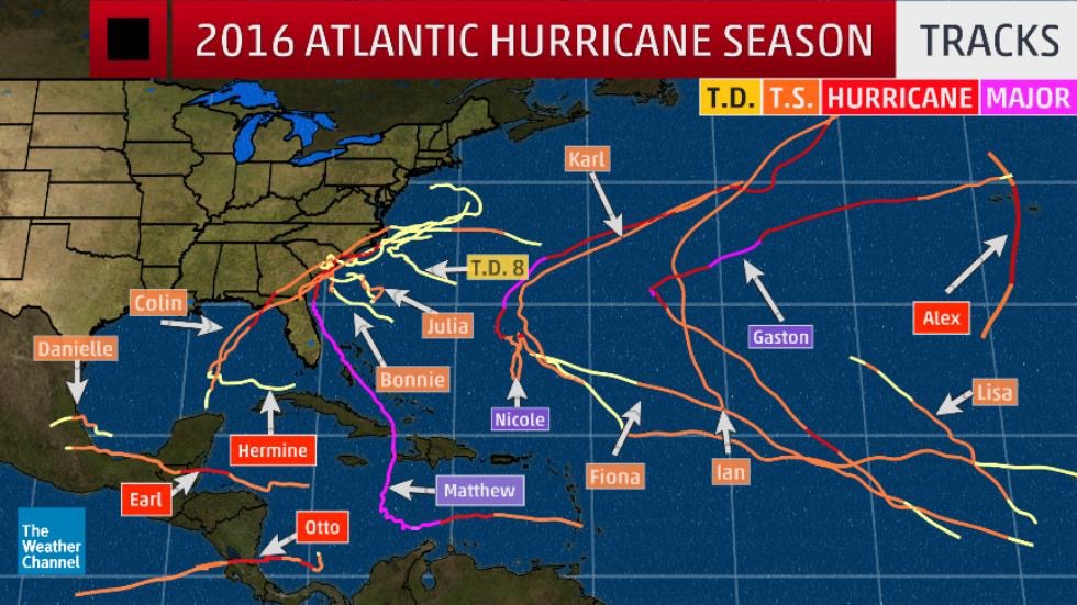
Lineup of Tropical Cyclones that Formed in the 2016 Atlantic Hurricane Season
Statistically speaking Hurricane Season runs from June 1 and runs through November 30 each year in the North Atlantic. This is not to say that we will not see anymore hurricanes until June, 2017 though. It happens occasionally that hurricanes form outside the official hurricane season time range. However, the Atlantic becomes prime for tropical storm formation during these particular 6 months due to sea surface temperatures rising (thank the summer temperatures) and the high wind shear values dying across most of the Atlantic.
The 2016 Atlantic Hurricane Season smashed many records and reminded us that these storms need to be respected. The 2015 Hurricane Season was quiet, too quiet, thanks to the large El Niño event that was taking shape in the Pacific Ocean. While the Pacific saw its 2nd most active hurricane season (1992 was ranked 1st), the Atlantic was experiencing a slightly below average season. However, the tables turned as the El Niño event weakened and switched to a La Niña which created cooler waters in the Pacific hindering tropical storm development. The Atlantic on the other hand saw an increase in sea surface temperatures and therefore the frequency of hurricane development began to increase.
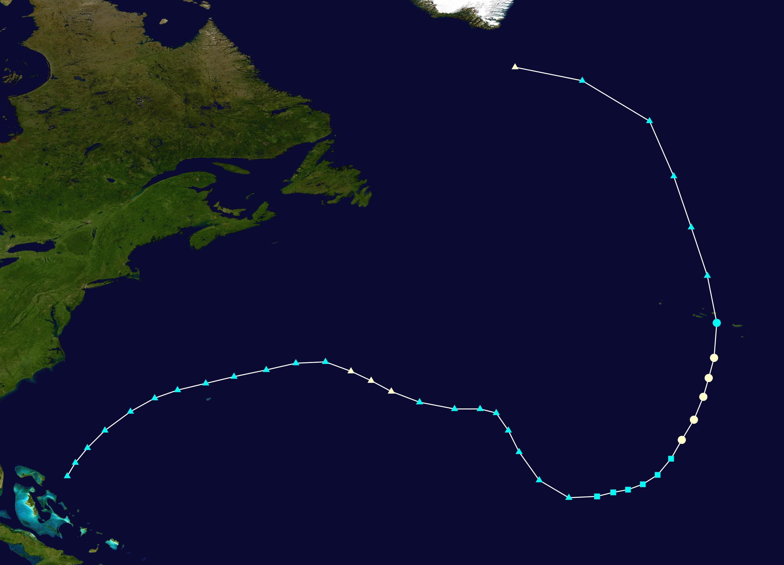
To start we were introduced to Hurricane Alex, which developed almost 6 months ahead of the official start of hurricane season, in early January:
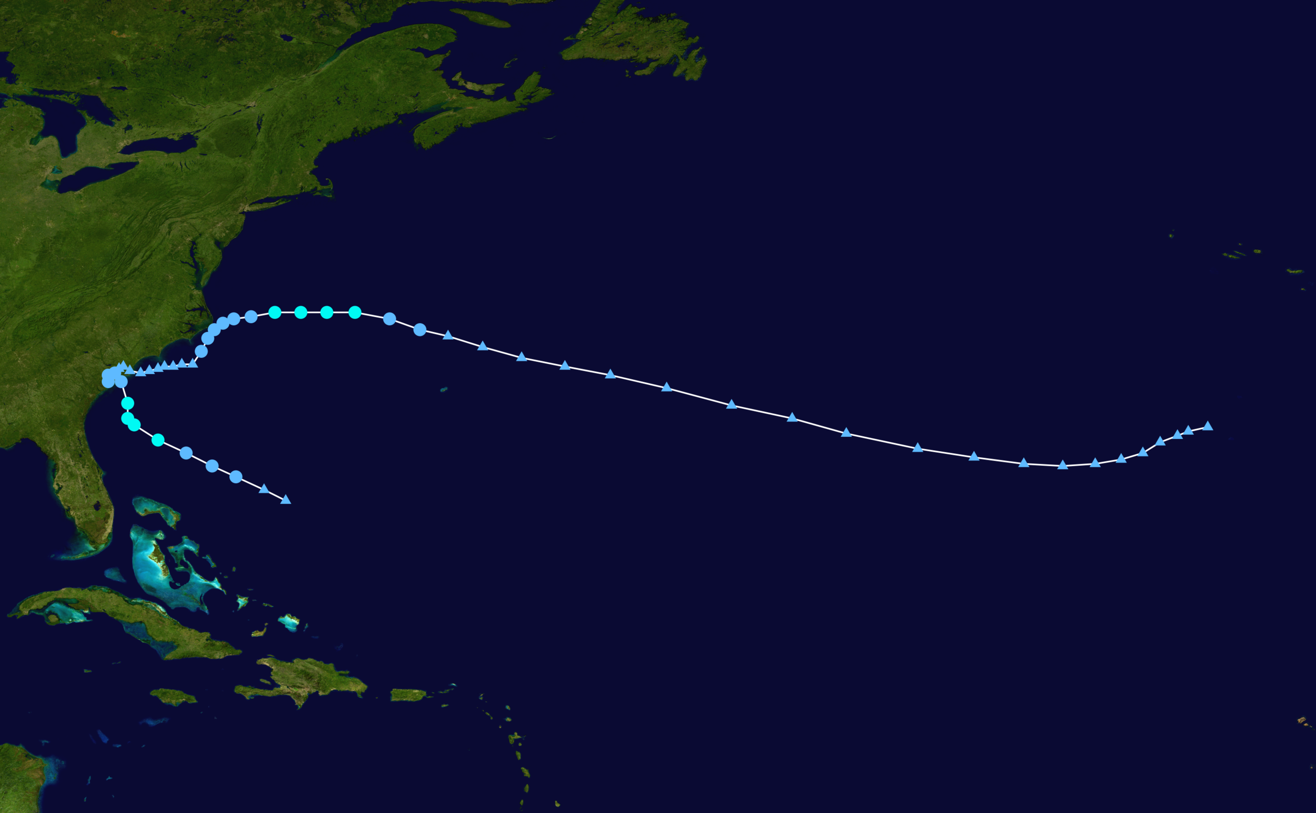
Track of Hurricane Alex
Nothing like starting off the new (and wild) year of 2016: with a very early hurricane. Alex was first a low pressure area spinning to the east of the Bahamas and traveling northeastward across the Atlantic. This track may seem the opposite of a typical hurricane path which usually runs from east to west and the curved northward as it approaches the east coast of the United States. This “typical path” usually only occurs from June to September. By October upper level winds shift thanks to the Earth tilting in preparation for the winter season. Therefore in October we start to see weather systems over the Atlantic move generally west to east, away from the North American continent.
As Alex moved across the Atlantic it entered into a favorable area close to Africa where there was very little wind shear (rare for this time of the year) and a patch of warm sea surface temperatures. This allowed Alex to undergo a reverse transition. Originally Alex was a regular non-tropical low pressure system which is a typical sight during the winter time in the Northern Hemisphere. These low pressures bring heavy snow to the north and rain in the south as they sweep over the north american continent and then exit into the Atlantic. Alex, however, was a very southern low pressure area and stayed relatively south of where these systems usually travel (usually found in midlatitudes). On January 10, Alex had the classic features of a non-tropical low pressure system (or extratropical cyclone):

A front was associated with this large area and Alex began to travel eastward. However, convection began to take place close to the center of circulation a few days later. This convection created high top clouds which surrounded the center of low pressure, creating an eye. This process in turn transformed the storm from an extratropical cyclone (very large, no tropical characteristics, front attached), to a subtropical cyclone (some tropical characteristics, eye becoming more defined, front beginning to dissipate), to a full fledged category 1 hurricane on January 14:
The meteorological community was just stunned to see this happen in the dead of winter and we were all impressed that this system happened to find the one area in the whole Atlantic Ocean that was not covered in immense wind shear values and that the sea surface temperatures were warm enough for development. The last hurricane that formed in the month of January was Hurricane Alice in 1955. In addition Alex had one more trick up his sleeve: he made a rare direct hit on the Azores Islands crossing over Terceira Island as a Tropical Storm before transitioning back into an extratropical cyclone. Luckily no direct deaths were blamed on this “winter hurricane”.
Winter passed and we were greeted with another early storm – Tropical Storm Bonnie. Bonnie formed on May 24, a few days before the official start of the Atlantic Hurricane Season.
Bonnie was a slow moving storm and lingered off the Carolinas dumping heavy rains and causing some flooding but it was a usual start to a typical hurricane season. Usually we see these first few storms early the hurricane season reach low level strengths (tropical storm and category 1).
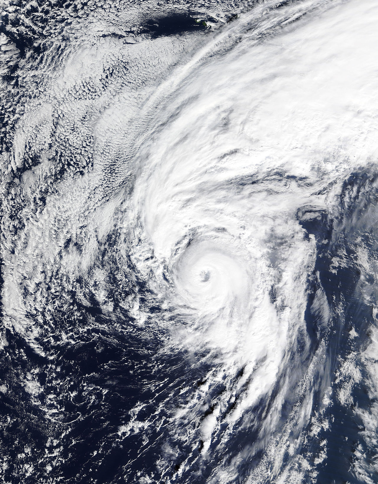
As the summer went one we saw more tropical storms form and quickly die off. We saw our first major hurricane of the season, Hurricane Gaston.
Gaston kept its distance and stayed offshore in the mid-Atlantic growing to Category 3 status before turning north-northwestward and headed over towards Europe. Then along came the first big storm to rattle our nerves and make the government jump for joy and start pressing the alarm buttons: Hurricane Hermine.
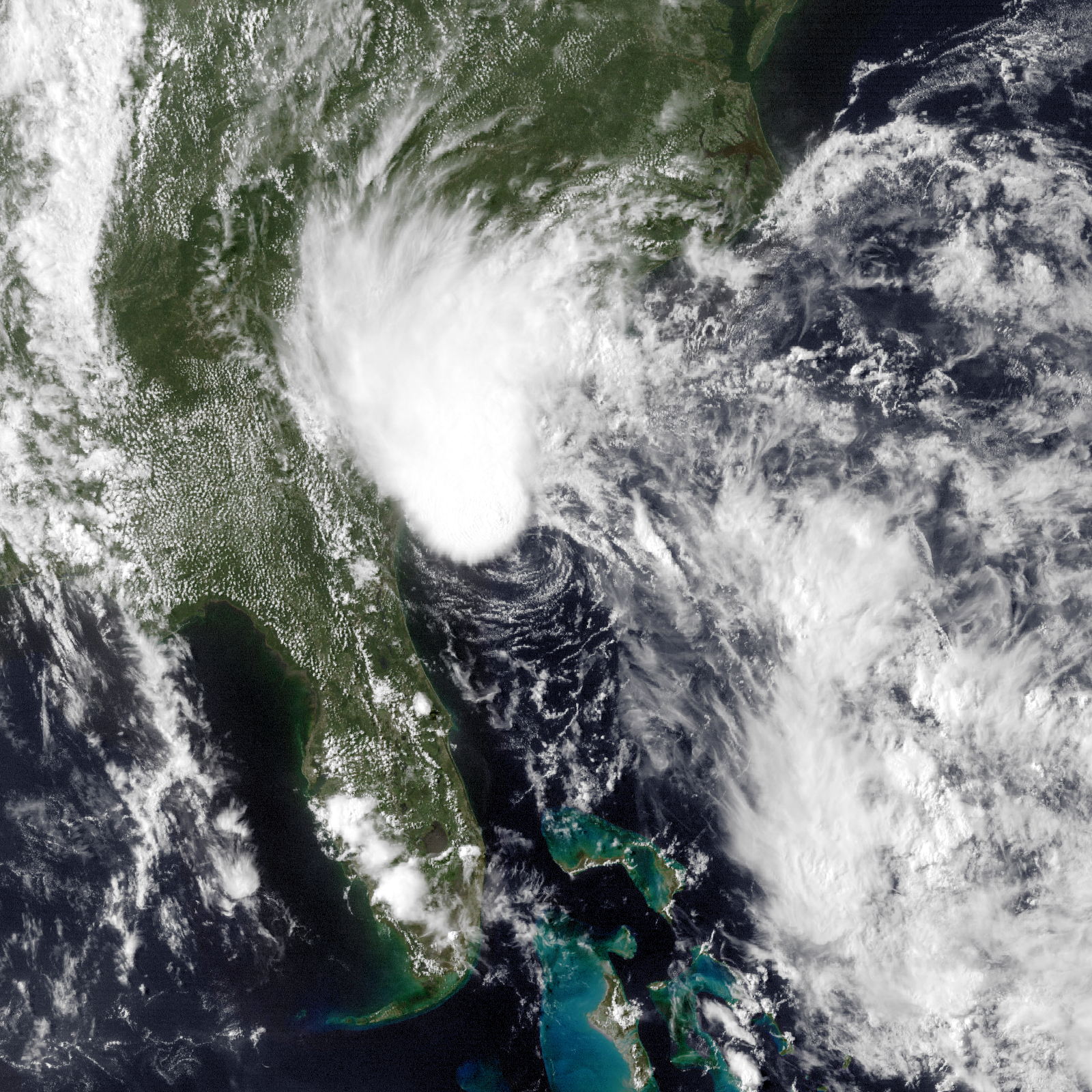
Herman began her journey to the south of the Florida keys and managed to stay perfectly in the “Florida Straights” where very warm waters helped convection to take place and cause a low pressure to form resulting in the formation of Hermine. Forecasters were pretty confident that Hermine was going to form once it entered into the Gulf of Mexico and that it would turn eastward impacting Florida, the question was: where in Florida and how strong will she be?
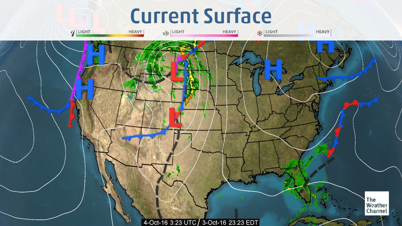
The cone of uncertainty was large and covered Florida for many days with very little indication on if the panhandle would get the brunt of the storm, or if it would stay south an impact the more densely populated areas like Tampa. It also did not help that meteorological models were fighting with each other on how severe this storm would be:
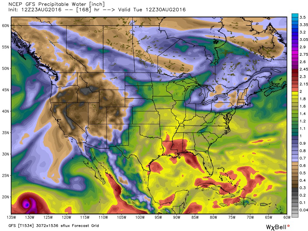
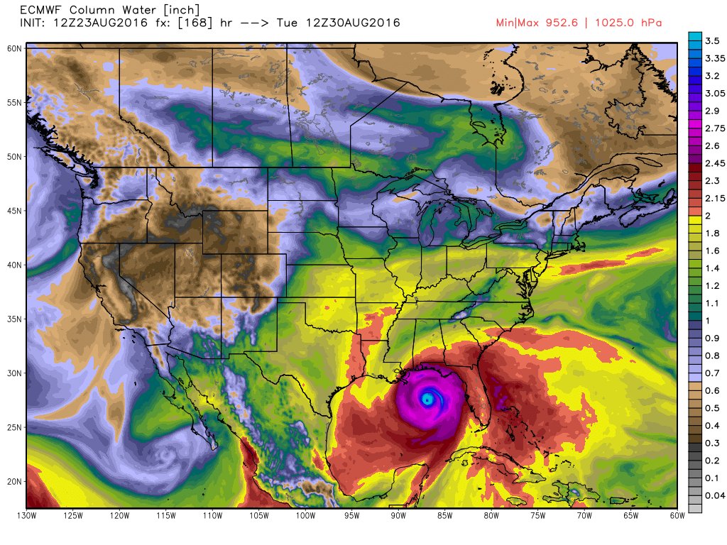
The first model shown is the GFS model (also known as the American model) the second is the ECMWF (European model). very big difference. One depicting no storm, the other showing the “apocalypse” scenario. This isn’t the first time the models have disagreed with each other. In fact, they do this what seems like 99% of the time. Almost immediately the Florida government started pressing the alarm buttons warning residents to evacuate and be prepared. What did Florida do? Well, pretty much ignore it all together. The past decade has been good to the state of Florida. Every now and then a tropical cyclone would hit the state or brush against it but the truth was that Florida had no seen a hurricane make landfall in over 10 years. A whole decade without one hit. The last time Florida was hit was in 2005 from Hurricane Wilma (Category 3). That is very rare and bizarre considering most people think of Florida and immediately relate it to hurricanes (or Disney World). Time has a way to heal and make us become complacent though. Residents laughed at hurricanes and ignored those that could potentially threaten them, and Hermine was one of those storms. Although evacuations were ordered only a few heeded the warnings. Most opted to stay and ride out the storm.
On September 1st, a day before landfall, Hermine was upgraded to a Category 1 hurricane and was closing in on northwestern Florida. Once the storm was upgraded to hurricane status people did start taking the storm a little more seriously, but once again the typical Florida mentality kicks in: Category 1 hurricane = Hurricane Party. Throughout Florida this was the case. I even went out to celebrate in the festivities in Saint Augustine, Florida while Hermine’s rains were coming down. It’s a normal day really for Florida, heavy rain, some wind, some good surf. All and all Category 1 storms don’t both us too much. This is not to say that there was no damage. Numerous trees and power lines fell from the high winds causing several injuries and even the death of one Florida man. Hermine made landfall just east of St. Marks, Florida before entering into Georgia and the Carolinas while undergoing extratropical transition. These areas experienced heavy rains and flooding due to Hermine’s extratropical transition. Hermine was not exactly the “wake up call” Florida needed to remind them how dangerous the state really is based on its geographic location. Yet, Hermine finally broke the Hurricane drought for the state. Little did we know that Hermine was a friendly reminder of what was to come.
Hurricane Season 2016 continued with more tropical storms forming around the Atlantic with a couple brushing the United States and producing some much needed rain for some drought stricken areas. Florida kept laughing as these weak systems rolled by. Then along came Matthew.
Matthew was not only Florida’s wake up call, but all of North America’s wake up call. Our time of laughing at hurricanes came to a screeching hault.
More info regarding this storm can be found in the previous blogs below.
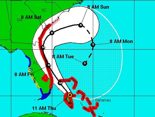
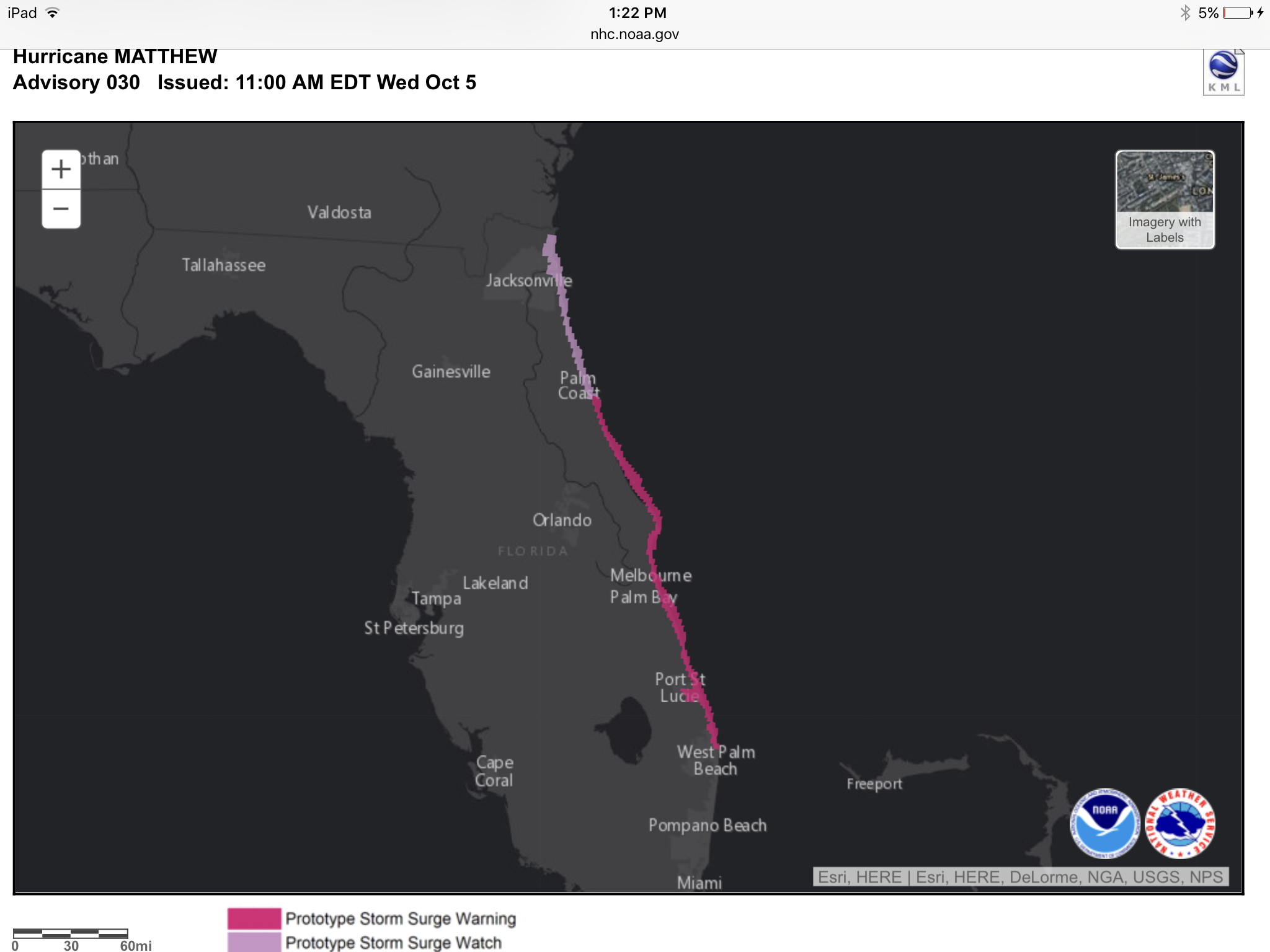
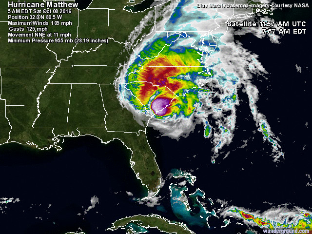
Matthew became the first Category 5 to form in the Atlantic Basin since Hurricane Felix in 2007. It also became the southern most Category 5 storm to form on record. At its peak strength Matthew was almost stationary and situated itself right in the heart of the Caribbean between South America and the Caribbean Islands feeding off of the warm waters and becoming stronger. Forecasters battles to find out the exact path Matthew would take. For certain we knew Matthew was going to head northward:

However, we did not know when the storm would pick up speed and start its journey northward and whether a stationary front over Florida would start to move eastward and throw Matthew away from land. At this point Jamaica, Haiti and Cuba were the countries that were preparing for the worst. As Matthew began to finally move northward it carved a horrible and deadly path through Haiti where death tolls are still being calculated. Estimates put the death toll around 1,600 (as of November 30, 2016).
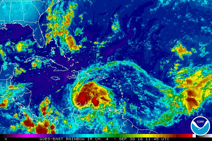
The viral satellite image of Hurricane Matthew depicted as skull began to circulate as this storm impacted southwestern Haiti on October 4 and later that day extreme eastern Cuba as a Category 4. Matthew emerged as a Category 3 and began tracking towards the Bahamas gathering strength until it regained Category 4 strength once again. At this point alarms were firing all across Florida, Georgia and the Carolinas. Forecasters were convinced this hurricane was going to impact Florida, possibly directly. A State of Emergency was declared and finally Floridians started to take this system seriously, especially seeing the destruction and death that was starting to come out of Haiti. It wasn’t just residents that started to panic. Meteorologists and State Officials were going insane over the approaching storm:
See link of this broadcast here: FOX News Hurricane Matthew
We get it. Florida hasn’t seen a major hurricane in over 10 years, but seriously, there is such a thing as raising too much panic. Regardless it seemed to work for some people and many started to pack up their family and head inland or even out of the state.
Matthew was also scaring everyone with the forecast that was being put out by the National Hurricane Center. Due to another tropical storm forming (Hurricane Nicole), Matthew was forecasted to loop back around and come back at Florida for a second round. Granted if Matthew had done this it would have been a very weak storm, but this still made Floridians shake in their flip-flops.
On October 7, 2016 Matthew impacted the Space Coast and the First Coast as a major Category 3 hurricane. The people who chose to stay (including myself) rode out the storm surge, the high winds, and the never-ending rain. Luckily for all of us, Matthew’s eye stayed offshore. If the eye came ashore without a doubt the storm surge would have been worse and the winds would have been stronger.
It was enough that my area experienced about 5-6 foot storm surge levels, anymore and the house would have been a swimming pool.

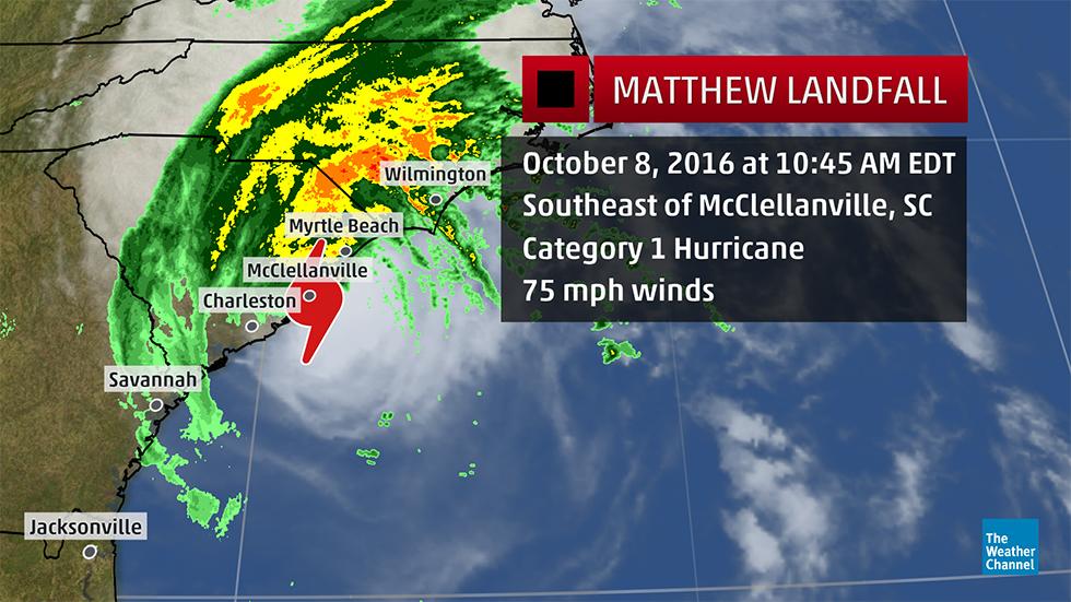
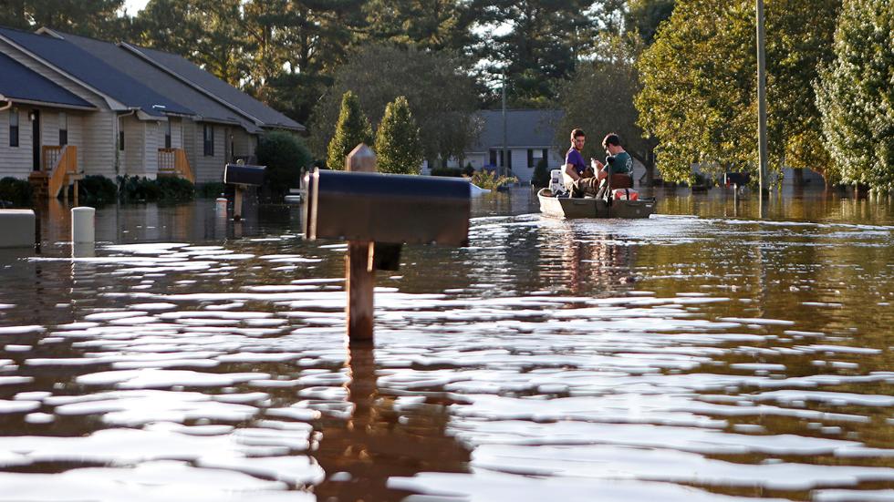
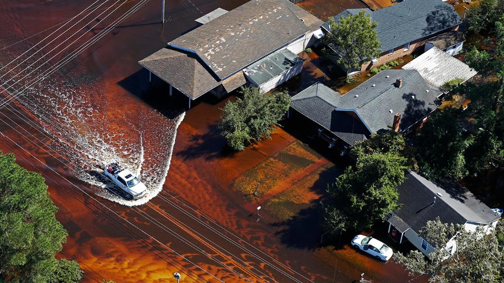
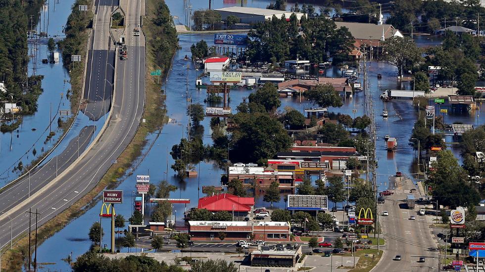
Matthew began to undergo an eyewall replacement cycle. Trying to gather and strengthen a big as the eye wall is replaced with the cloud layers behind it. Matthew slowed down considerably towards Saint Augustine and Jacksonville as it tried to strengthen. Unfortunately, the west side of the storm was over Florida causing great stress on the storm and cutting it off from its fuel: the ocean. This eyewall replacement cycle could not save the storm and Matthew began to weaken while also beginning its extratropical transition as it moved towards Georgia and the Carolinas. As a category 1 hurricane, Matthew made landfall at Cape Romain National Wildlife Refuge, near McClellanville, South Carolina the next day on October 8, 2016. While Floridians began to emerge from their houses and begin the cleanup the Carolinas were now dealing with the deadly extratropical transitioning part of Matthew: the rain. Due to Matthew expending immensely in size rain values were increased and accumulating all across the Carolinas causing historic flooding trapping people in their homes even though they were far away from the shorelines. 49 deaths were blamed on Matthew in the United States, most of these from the deadly floods in the Carolinas and Virginia.
As of November 30, 2016 Hurricane Matthew has been ranked as the 10th most expensive hurricane to impact the United States and the 2nd most expensive for Cuba according to the National Hurricane Center. Cleanup still continues for the countries that experienced this deadly hurricane. It was the wake up call that Florida and North America needed though. Florida will always have hurricanes, especially major ones like Matthew. All we can do is respect mother nature and be prepared for the next big one.

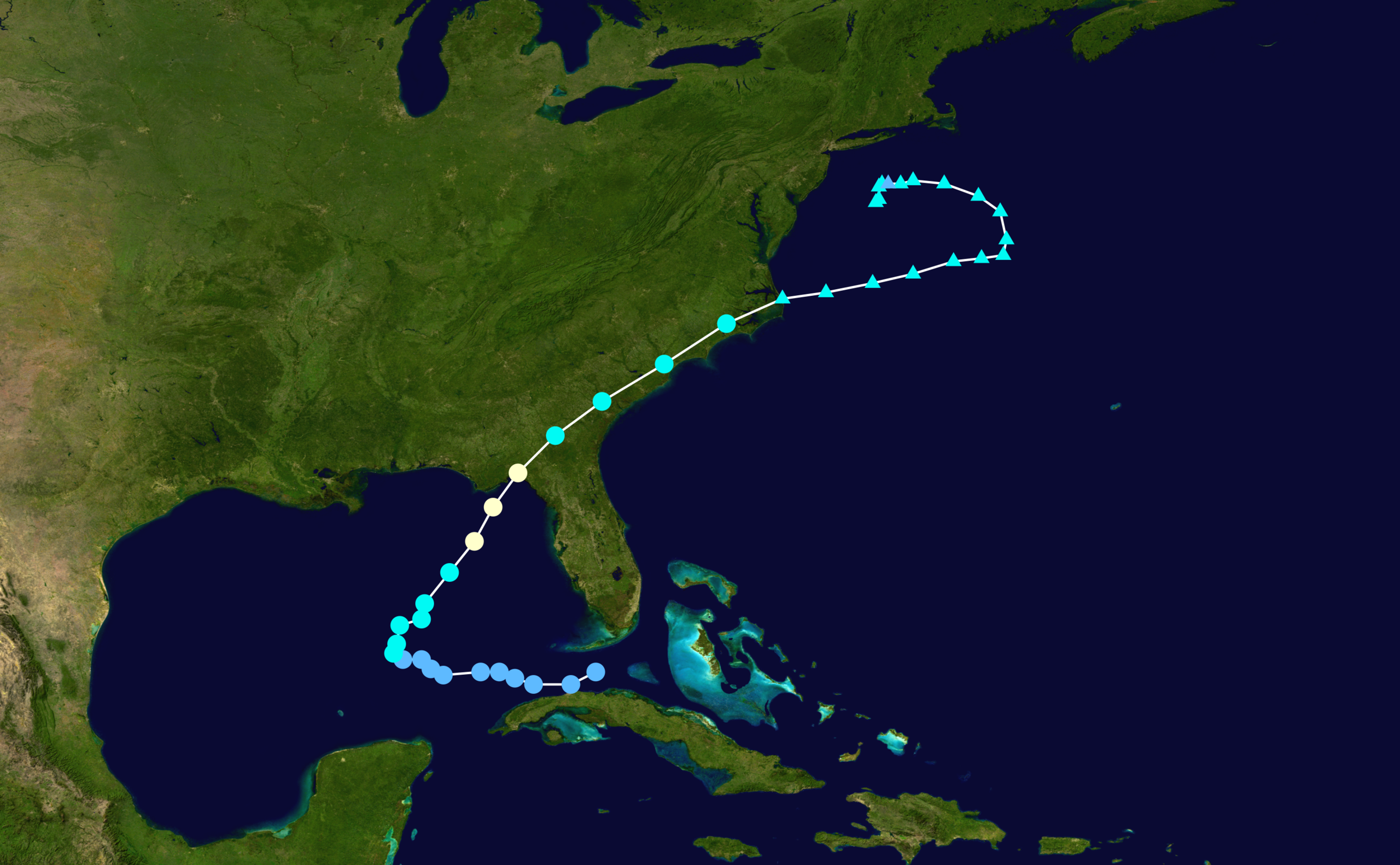
The Track and Intensity History of Hurricane Matthew
While Matthew was impacting the south east coast of the United States many forgot about another storm that was spinning in the Atlantic: Hurricane Nicole. I think of this storm as the “forgotten hurricane” mostly because everyone was focused on Matthew at the time.
Tropical Storm Nicole forms on October 4, 2016
Nicole was a unique hurricane and played a large role in Matthew’s direction. Nicole trapped Matthew and pushed him further westward into Florida, Georgia and the Carolinas and prevented him from turning back out to sea. As Matthew battered the southeast United States Nicole spent her time lingering and swaying north and southward to the east of the Bahama Islands.
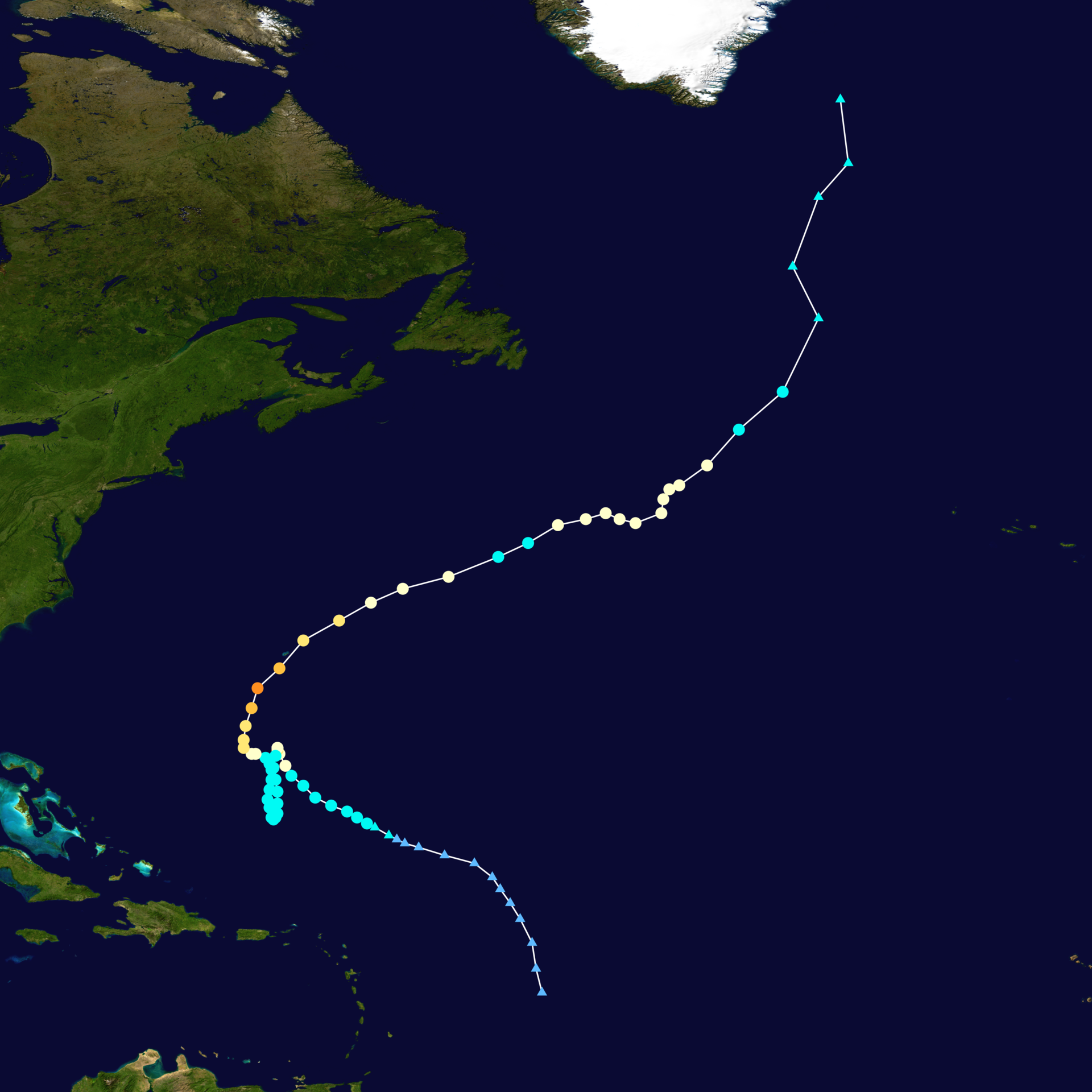
Track of Hurricane Nicole October 1, 2016 – October 18, 2016
It wasn’t until around October 10-11 that Nicole started to make a choice and move away from her lingering area. At this time she strengthened into a category 1 hurricane and began moving slowly north-northeastward. Bermuda immediately watched the storm carefully. Bermuda is no stranger to hurricanes and have been brushed by them almost every year. It is very rare for this island to receive a direct impact from a hurricane though due to the size of this small island nation. Bermuda issued Tropical Storm and Hurricane Watches as Nicole started to turn eastward. Nicole underwent rapid intensification going from a category 2 storm to a category 4 storm from October 12-13. Bermuda braced itself and shut down the island as the storm approached. Luckily Nicole lost some of its strength and passed directly over the small island on October 13 at around 3:00 pm local time as a strong Category 3 hurricane.
The Hurricane Hunters flying through the eye of Hurricane Nicole on October 13, 2016. Bermuda is seen below.
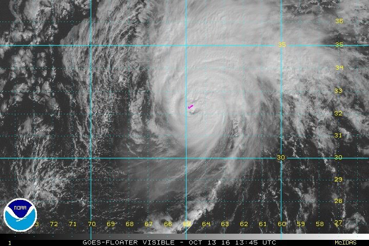
Category 3 Hurricane Nicole passing through Bermuda on October 13, 2016.
Fortunately, no fatalities were reported on Bermuda. Nicole created large swells that extended all the way to the east coast of the United States. These swells claimed one life in a boating accident. Nicole traveled away from Bermuda and headed north where it weakened to a tropical storm and the re-strengthened back to hurricane status for the final time before meeting its death to the south of Greenland.
After Nicole dissipated, the rest of October became quiet. Fitting after two major hurricanes caused destruction across the Caribbean and the United States. Lives were trying to be put back together and many did not want to be reminded that Hurricane Season still have November to worry about.
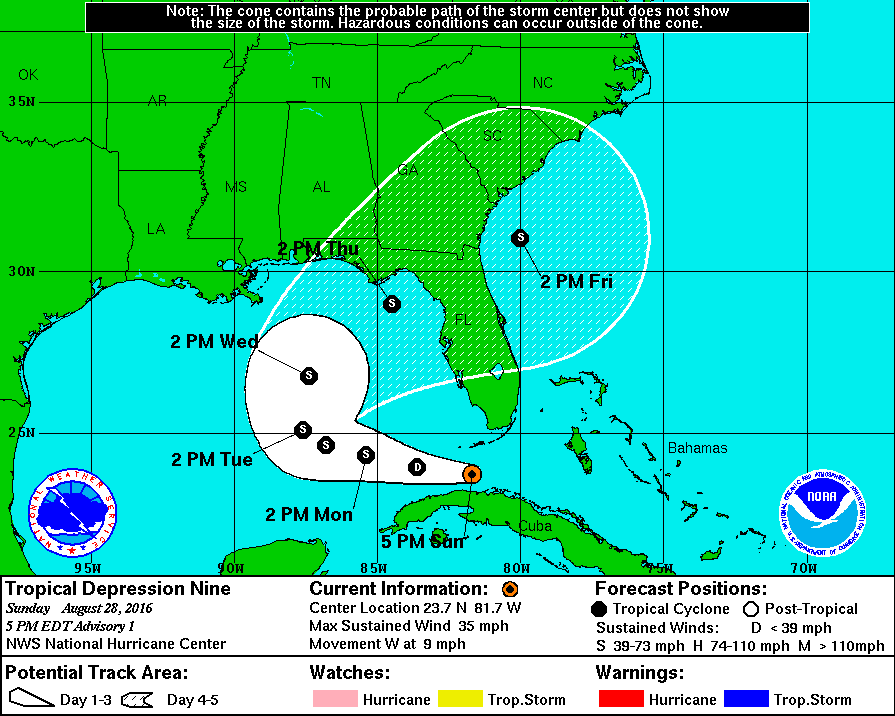
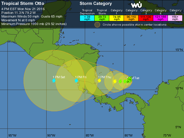
A few times tropical waves came off Africa’s west coast, and even a few areas in the Gulf of Mexico started to flare up making all eyes turn to these areas to see if Otto would form. Instead these waves dies out and Otto continued to hide. It wasn’t until November 21, 2016, 9 days before the end of the Atlantic Hurricane Season that Otto decided to show himself. An area of low pressure lingering to the south of the Yucatan Penninsula started to develop and linger just off Nicaragua and Costa Rica. This system struggled to evolve and grow due to the intense wind shear that was just to the north of the system at the time. It wasn’t until it drifted further southwards and continued to avoid this harsh wind environment that it started to develop quickly into Tropical Storm Otto.
Otto just before reaching tropical storm status on November 18, 2016.
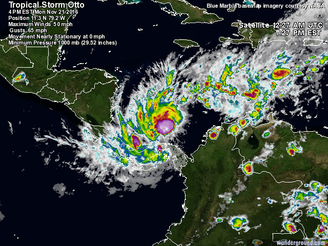
Otto reaching Tropical Storm status after becoming more organized on November 21, 2016.
What made Otto so unique and dangerous was its location at that time of the year and how slow it was moving. Otto was a very southern hurricane which is not typical of most hurricanes. Due totes Coriolis force, most hurricanes cannot form very close to the equator. Otto was rare and could even be related to Hurricane Matthew in this respect. Both of these hurricanes in the same year formed very south and closer to the equator than normal. Therefore, areas that typically do not see hurricanes (or the effects of them) were receiving some impacts. Columbia with Matthew and Nicaragua and Costa Rica with Otto.
Otto continued to strengthen rapidly as it took its time gathering up strength over the warm waters. Otto strengthened into a Category 1 hurricane on November 22 making it latest Caribbean storm in the hurricane season to reached hurricane intensity. Upon approaching land Otto had one more trick up its sleeve and strengthened rapidly into a Category 2 hurricane. That same day Otto made landfall in the evening near the Nicaragua and Costa Rica border with winds of 110 mph (175 km/h). Hurricane Otto broke a record as the southernmost hurricane to hit Central America. Otto was also the first hurricane to pass directly over the nation since records began.

Hurricane Otto Approaching Nicaragua and Costa Rica on November 22, 2016.
The National Hurricane Center is still determining the strength of Hurricane Otto as it came ashore. There is the possibility that Otto was a major hurricane (category 3) due to one observational station stating that the winds were at least 110 mph, possibly higher.
In addition, Otto became one of 18 other storms on record to survive crossing Central America and exit into the Pacific Ocean maintaining tropical storm status. Due to the harsh wind shear and cooler sea surface temperatures from the ongoing La Niña event Otto rapidly dissipated.

Track of Hurricane Otto November 21, 2016 to November 25, 2016
Hurricane Otto was the storm that wrapped up the 2016 Atlantic Hurricane Season, but just because Hurricane Season is over does not mean that another hurricane won’t form. Hurricane Alex proved this to us this year that a hurricane has the potential to form in any month. We could even see Paula (the next named storm on the 2016 list) form in the month of December.
Regardless of if we see Paula or not, the 2016 Atlantic Hurricane Season is one for the record books both on duration, storm intensity, storm location, fatalities and damage, to name a few records broken this year. Probably the most important lesson of all was that Floridians were reminded that their state is vulnerable and will continue to be. The decade-long hurricane drought is over thanks to Hurricane Hermine and especially Major Hurricane Matthew.
15 named storms formed this year, 7 became hurricanes, and 3 were major hurricanes. 2 of these major hurricanes made landfall (Matthew and Nicole). Most forecasters knew that the 2016 season would be above average due to the La Niña taking place which helps warm the Atlantic sea surface temperatures.
So now we have to look forward into 2017. What can we say so far as we await the next hurricane season. Forecasters and myself are still waiting to see how strong this La Niña event will be and how long it will last. If La Niña keeps its strength it can have an effect on the 2017 Atlantic Hurricane Season and we could see a similar year like we did this year. If it weakens we could see an average hurricane year with slightly less numbers of named storms. However, it is too early too say or forecast the 2017 season, which is 6 months away. Usually around February the National Hurricane Center releases their first outlook and revises it as we get closer to hurricane season (they will even update their outlook during the season). For now we have to take what lessons we learned from the 2016 Atlantic Hurricane Season and remember it for future seasons (I’m looking at you Florida).
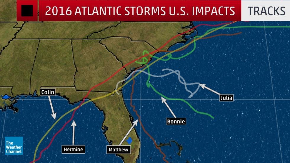
2016 Atlantic Tropical Storms and Hurricanes Impacting the Southeast United States
Blogs and forecasts will continue to be published here in case another 2016 hurricane forms. Otherwise on January 1st, 2017 this page will be moved to the archives in preparation for the 2017 Atlantic Hurricane Season. Start preparing now, because we only have 6 more months until the start of the 2017 Atlantic Hurricane Season, and that is not a long time.
It’s Not Over Yet! Tropical Storm Otto Forms.
Updated November 21, 2016 @ 8:55 pm EST
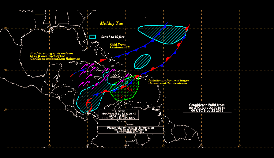
Many have been under the impression that the 2016 Atlantic Hurricane season is over, when in fact we have another 9 days until Hurricane Season (statistically speaking) comes to an end. Typically hurricanes start to become less likely to form in the Northern Atlantic basin after October due to the seasonal change taking place. The air temperature starts to drop, which in turn starts to cool to the ocean waters. In addition, wind shear becomes more common throughout the Atlantic decreasing hurricane numbers and instead increasing the frequency of midlatitude cyclones. These midlatitude cyclones then start to become the dominant storm system in the northern hemisphere during the cold winter season. However, it is still possible for tropical systems (hurricanes) to form during the month of November and now we have Tropical Storm Otto churning off the coast of Central America.
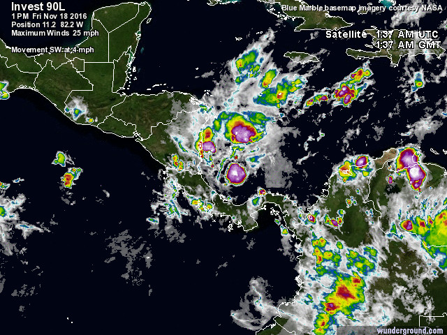
The National Hurricane Center has been keeping a very close eye on this storm for a few days as it was lingering off the east coast of Central America and slowly drifting southward. This system had a high chance of forming into Tropical Storm Otto for a few days due to the warm sea surface temperatures in this area, but also the minimal wind shear for this space. A few days ago the system was having trouble becoming organized due to the intense wind shear around the Yucatan Peninsula.
Invest 90L on Friday November 18, 2016
The satelitte image above was from Friday when the system was struggling to form. High wind shear to the north was tearing the storm apart making it hard for Otto to officially form. Luckily, the low pressure center moved further south and out of the higher wind zone. Finally, Otto formed as thunderstorm activity started to circle closer to the center of circulation.
Although Otto is now officially a tropical storm, it is weak. As of the 4pm EST advisory, barometric pressure is stable at 1000 mb and wind speeds are around 50mph (around 45 kts). So this is a very weak tropical storm. But here is where things get interesting. Otto is nearly stationary over these warm waters and plans to stay stationary for the next couple of days.
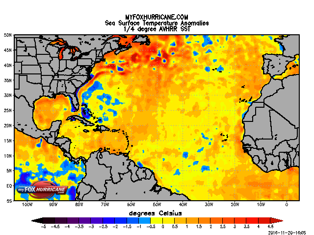
Current sea surface temperatures off the coast of Nicaragua and Costa Rica are still prime for hurricane formation (over 26.5 degrees C). Otto is over waters that are averaging around 29 degrees celcius. The past few weeks have been relatively warm over the North American continent where warmer than average temperatures were recorded as far up as Canada. There warm land temperatures helped to warm up the sea surface temperatures slightly. In addition, the Atlantic is still experiencing a warming trend due to the La Nina event taking place in the Pacific (warmer Atlantic waters, colder Pacific waters ). Therefore, when looking at sea surface temperature anomalies, we are seeing most areas in the Atlantic being 1-2 degrees warmer than average for this time of the year:
This is good news for those of us who are trying to delay winter, but bad in the respect that hurricanes thrive off of warm sea surface temperatures.
Let’s also refer back to the wind shear values in the area that Tropical Storm Otto is in. Currently the higher wind shear values continue to stay to the north of Otto and over towards the open Atlantic (to the east of Otto). Otto has managed to stay in a pocket of low wind shear:
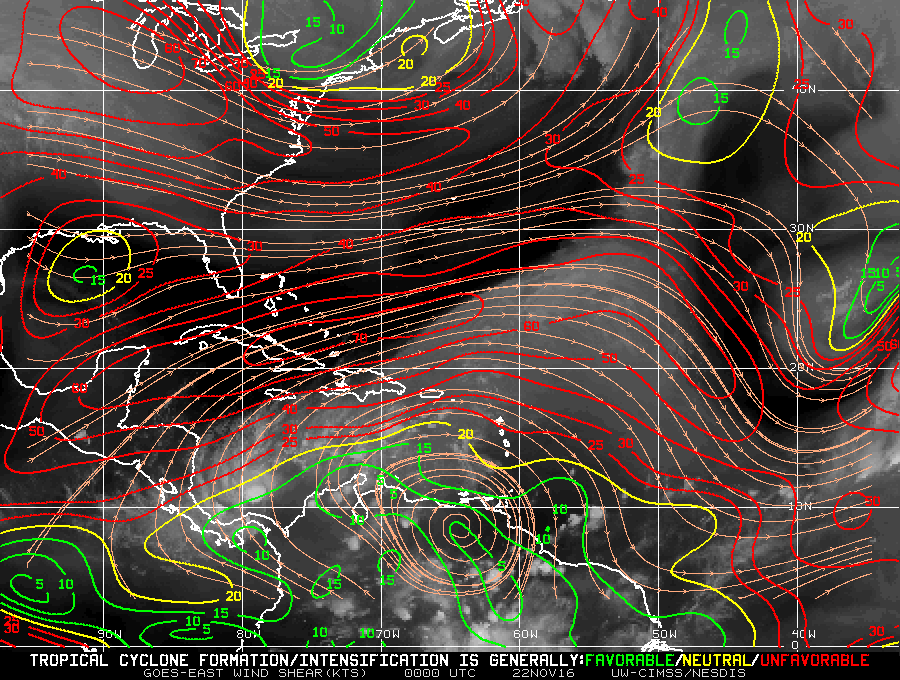
As long as Otto continues to stay in this area it will likely strengthen and become more organized before it stops being stationary and start to move again. However, because it is stationary and in this (near perfect) area, we are expecting Otto to strengthen over the next couple of days. Otto could reach category 1 hurricane strength before making landfall somewhere along the east coast of Nicaragua or Costa Rica around Thursday afternoon (November 24, 2016).
So why is Otto near stationary and how do we know that this Tropical Storm will move due westward over the next couple of days? It all has to do with two fronts that are pushing against Otto:
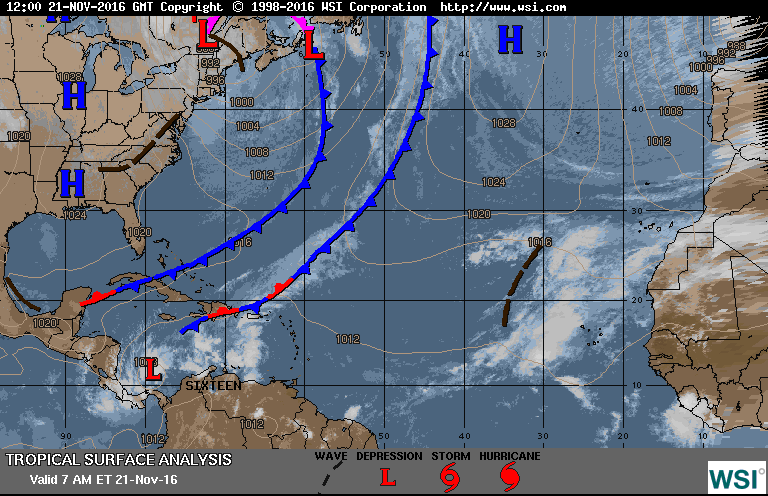
We have two low pressure systems way up north. One near Greenland, the other near Newfoundland, Canada. These low pressures both have a very long “tail”, known as a “front”. These fronts act as a whip and push other systems around thanks to their strong winds and their fast forward speed. The surface map above shows there fronts extending all the way down to where Otto is and is trapping the system in this tiny area. Otto cannot travel eastward because one of the fronts is pushing and blocking that route, and Otto cannot move northward because of the other front pushing Otto southwards. These frontal regions will continue to linger in the area (especially now that they are becoming stationary and barely moving). This will allow for Otto to stay in this favorable area and continue to strengthen before starting to move again.
What will likely happen in the next couple of days is that both frontal regions will elongate further and act like a “scissor” with Otto trapped in the center. As these two front move closer and closer to each other Otto will be squeezed and have nowhere else to go but westward, right into Central America.
Rain and high surf have already been threatening the east coast of Central America over the past few days as Otto started to form. Nicaragua, Costa Rica, San Andres and Panama are monitoring Tropical Storm Otto and starting to warn residents that this storm is likely to intensify over the next 12-24 hours into a hurricane. Heavy rains will likely be the main concern for areas impacted. Storm surge could be as high as 4-5 feet if the system grows into a Category 1 hurricane. The area that will likely see the greatest storm surge would be Nicaragua with Costa Rica also experiencing some high surge values. Flooding will be a major concern for low-lying areas and mountanous terrain, where flash floods and mudslides could occur.
Due to the geography of Central America it is possible that Otto will survive the crossing and exit out into the Pacific Ocean. This does occur sometimes when an Atlantic storm crosses over into the Pacific. Usually it is very difficult for the storm to exit out and continue to keep its tropical characteristics. This is usually because Central America is so mountanous on the western side that many of these storms are torn apart and dissipate over land before exiting back out into the Pacific. However, because of how thin Nicaragua and Coasta Rica are we could see Otto survive this small journey and exit out into the Pacific. This will not be an easy journey though. Regardless, Otto will weaken once it interacts with land and especially as it travels over the mountanous terrain. If Otto does survive it will likely come out as a tropical depression. However, looking at the wind shear map once more:
Otto (if it survives) will exit into an area with moderate wind shear, possibly minimal shear. This is good for the storm to reorganize. The bigger problem for this storm will be the sea surface temperatures in the Pacific:
Thanks to the La Nina event in the Pacific the waters are colder than normal. If Otto does survive its journey across Central America it will likely continue to dissipate over the Pacific due to these cold waters. Wind shear values could change over the next few days with wind shear values becoming minimal, but we can easily say that these cold Pacific temperatures will stay due to the climatological La Nina event and the typical seasonal pattern (winter fast approaching).
The main concern right now would be Otto strengthening into a Category 1 hurricane and impacting Central America.
Currently, there are no watches or warnings issued for areas that will likely be impacted. A Tropical Storm Watch is expected to be in effect during the next advisory or overnight. Otto’s slow movement will likely help the system to become more organized and produce more thunderstorm activity around the central area of low pressure producing heavy rainfall from Panama down to Coasta Rica. 3-7 inches of rain in the outerbands is expected. Higher elevations near the mountains will experience higher rain values of 10-15 inches. This amount of rain can cause flash floods, landslides and mudslides for the end of the week and into the weekend.
Tropical Storm Otto will continue to be monitored as it approaches Central America. The 2016 Atlantic Hurricane Season is not over yet! Just because the cooler weather is moving in does not mean that we should let our guard down. Hurricane Matthew was a good reminder for many of us this year.
Recap on Hurricane Matthew and Hurricane Nicole – The Romantic Duo
The Experience of Going Through a Major Hurricane.
Updated October 19, 2016 @ 5:02 pm EST
Note: Videos showing the Live Coverage of Hurricane Matthew and more images can be found on the Weather Goddess Facebook Page and the Weather Goddess Twitter Page.
It has been a little over 10 days now since Hurricane Matthew sliced through Florida and my hometown in Saint Augustine, Florida. Fortunately, I have access to internet now which allows me to update the page. I had a feeling that the website would not be able to be accessed during and after Matthew and this is why I chose to direct everyone to the official Weather Goddess Facebook and Twitter pages where for days I was covering Matthew as it impacted Florida, Georgia and the Carolinas. For those that do not know the Facebook and Twitter pages are updated daily with weather information.
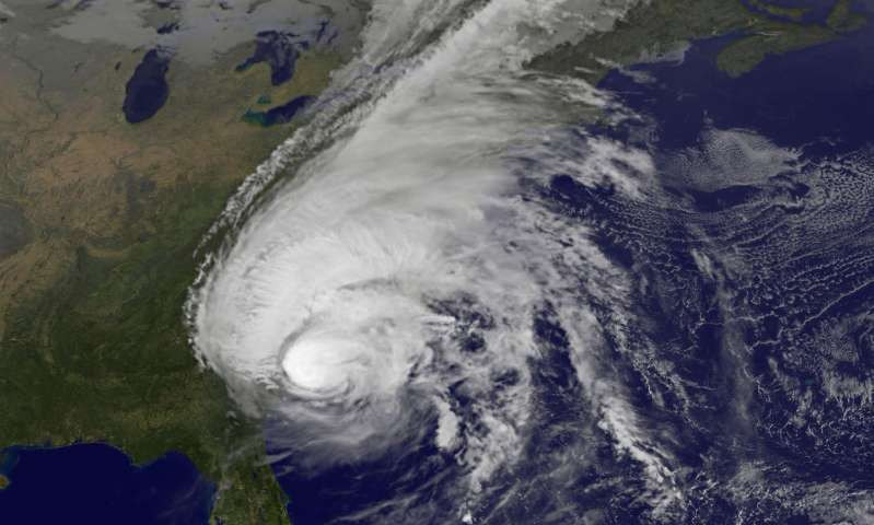
So let’s discuss Matthew and his romantic friend Nicole and review everything that happened. We last left off as Matthew was exiting eastern Cuba and approaching the Bahamas as a Category 3 storm and was quickly intensifying one last time to a Category 4 storm.

At this point meteorologists across the south and the National Hurricane Center were issuing warning after warning on Matthew. Memories of Hurricane Andrew (1992) were being surfaced and the government kept warning residents that this could be the hurricane to be matched with Hurricane Andrew. In addition the last time Florida saw a major Hurricane was Hurricane Wilma (2005) which came ashore as a Category 3 storm. The difference was that Wilma approached Florida from the southwest and impacted an area that was scarcely populated (mainly the Florida Everglades). By the time Wilma reached the Miami area it was weakened thanks to wilderness to the west. Storm Surge was also not a big threat because of Wilma’s direction. Matthew was a different type of beast. A major hurricane that was not turning away and was heading to the Atlantic side of Florida, where the majority of Floridians reside.
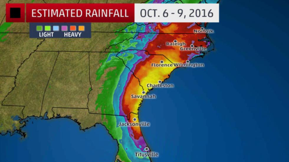
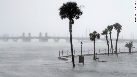
The biggest threat was the storm surge, especially for Georgia and the Carolinas. The shape of the south east coast of the US is very unique and also dangerous when it comes to hurricanes. Notice how there is a bend from north Florida to South Carolina. A hurricane that goes straight into the bend pushes water forward into the curve. The water has no place to go but forward. The water from the Atlantic would be going so fast that rivers and streams connecting to the Atlantic would fill up in a matter of minutes and spill over. This is exactly what we saw; and what was even scarier was that it was happening 24 hours before Matthew even arrived.
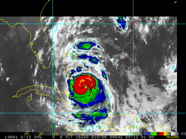
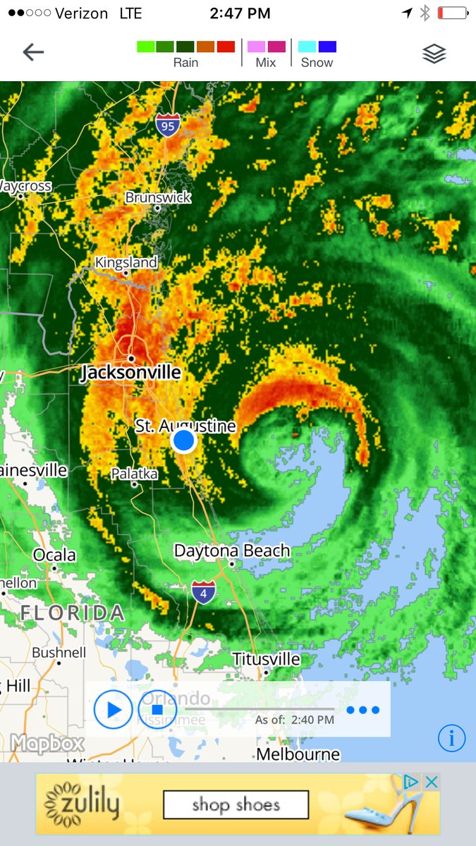
On October 6, 2016 Matthew was passing over the Bahamas and slicing through the island of Nassau while strengthening back into a Category 4 storm. At this point areas of west palm beach were starting to get some of the outer bands. Meanwhile up in north Florida we were getting these problems:
Rivers, lakes, streams were already overflowing and Matthew was a whole day away from reaching the north. In addition it did not help at all that for the past few days north Florida had a stationary front hanging right over dumping immense amounts of rain.
(Surface map from October 4, 2016. Note the black line over Florida and the rain)
North Florida was already in trouble way before Matthew’s arrival. Flooding streets and drainage systems were already full thanks to the heavy rains from the frontal system, now Matthew was coming the very next day.
It did not help that we had government agencies blaring sirens and warnings across all of east Florida especially in North Florida where some meteorological models were showing a direct hit from Matthew:

The GFS model at one point was indicating that Matthew could come ashore around the Cape Canaveral area and possibly stay over land reaching up into Jacksonville, Florida. For those that stayed behind and did not evacuate you probably were visited by emergency crew managers begging you to evacuate and threatening you with potential possibilities of your death or how you would be trapped for days or weeks in your house before help would arrive. Then there are the on-the-air meteorologists that tried to scare you by saying “you will die… and your children will die.”
See link of this broadcast here: FOX News Hurricane Matthew
Now I am not saying that this was the wrong thing to do, but I do have to say it was a bit dark. I get the fact that people use fear in order to make a person cooperate and evacuate but after a while it was sickening. At one point I turned off all the televisions in the house and refused to answer the doors. However, I should note, there are many reasons why a person may choose to not evacuate. A few people in my area were disabled, one was even secluded to his bed while his wife constantly took care of him 24/7. There is no easy way to move these people, let alone put them in a vehicle for probably 12 hours as you moved further inland. Others thought it would be best to stay with their property and protect it while they were there, especially from the rising flood waters. They could fill up sandbags as the storm raged and increase their protection knowing what was going on around them instead of leaving and hoping that they did enough to protect their house to begin with. Then there are those who stay just for the thrill of it:

(One of the flag bearers for the Jax Pack team with the Jacksonville Jaguars decided to defy Hurricane Matthew by waving an American flag and jamming out to some metal music in the midst of the storm. Photo: Screengrab via Lane Pittman).
^Although not really safe, I applaud this guy. I see a future meteorologist.
So why did I stay? I usually say “because I am a meteorologist”. It usually makes people shut up (“usually”). There was a deeper reason though, which I explained to a total of 17 CBC radio stations and 4 CTV broadcasts. “Someone needs to be here for those that stayed.” I went through Hurricane Andrew in 1992. I remember my mother and I huddled in bed all night with only a battery operated TV and radio. On the other side was Meteorologist Bryan Norcross reporting in Miami. During the storm Bryan evacuated to the back closet of the TV station for extra protection with the anchors and continued to report through on Hurricane. He encouraged people to remain clam and gave suggestions on how to survive the storm. Throughout that long night my mother and I listened to his every word.
Hurricane Andrew made me the meteorologist I am today. Currently finishing up my doctoral degree at the University of Toronto with a thesis focusing on creating a new and improved hurricane scale for the North Atlantic. I know and understand hurricanes inside and out. I have lived through hurricanes of all categories. For those that know me, you know I go insane when there is no hurricane forming in any ocean basin. As my Facebook status says: I am engaged to my thesis on hurricane -> the relationship is unhealthy and complicated.
Well, now Hurricane Matthew was approaching and someone needed to step up to the plate to help people through the storm. The best way to get the word out was via Facebook and Twitter. As long as cell phone towers stood my messages would reach anyone else that had a cellular signal and access to these social media platforms. Unlike 1992, where we had no cellular phones and no social media platforms it was easier to get information to the community. In many cases Twitter and Facebook helped save some people from the the rising waters of Matthew. I knew that internet would have been knocked out in the storm and that weathergoddess.com would be in the dark. I quickly directed everyone I could find who refused to evacuate to check out the Twitter and Facebook accounts promising to update constantly and give live reports throughout the storm. Immediately I was swarmed with messages as Matthew started to approach closer and closer to the First Coast of Florida. People asking if they should evacuate, what they should buy, where they should go. It was at this point I was charging as many extra battery packs that I could find for my phone before Matthew cut all power. Responding to everyones questions while also updating on the path and destruction of Matthew was exhausting, terrifying, exhilarating, and insane all at the same time.
The talk across all of North America was Hurricane Matthew. The National Hurricane Center for the first time issued storm surge watch and warning areas and used this as an experiment on if they could use this procedure in future storms.
As Hurricane Matthew moved closer to North Florida the storm surge warnings were extended all the way up to North Carolina.
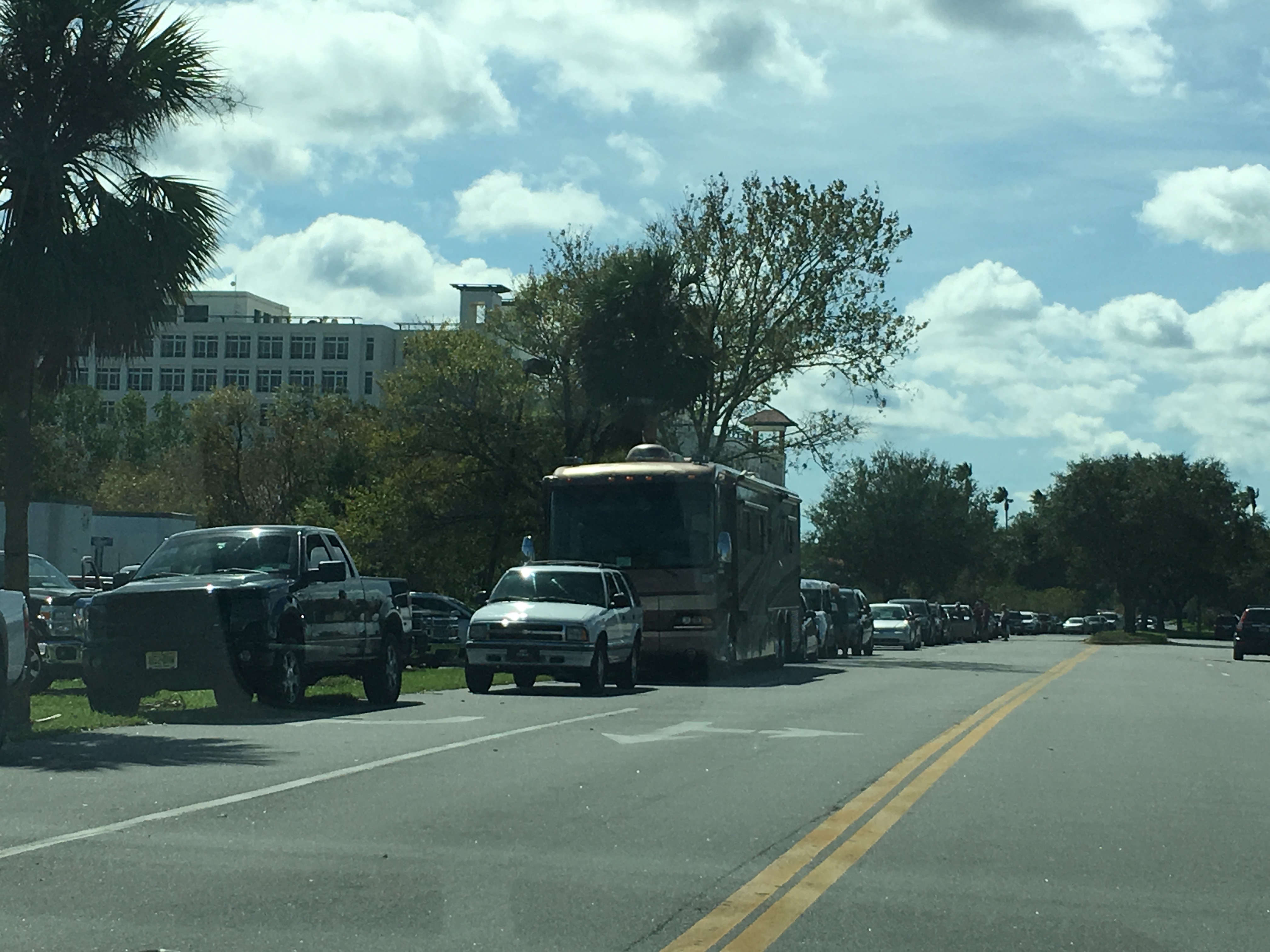
About 2 days before Hurricane Matthew arrived Jacksonville Beach, Saint Augustine Beach, Flagler Beach, Daytona Beach, all of these areas were under a mandatory evacuation. Across Saint Augustine emergency personnel said that by 6am October 6, 2016 everyone had to be gone from the beach area. The bridges would be closed, water will be cut off and you would be left alone to fend for yourself. Although I was on the mainland and not on Saint Augustine Beach I could only imagine how those people who chose to stay felt about being cut off from the mainland. Without a doubt we were all expecting the worst damage to be on Saint Augustine Beach. It would be closest to Matthew’s eye and thus see the most damage.
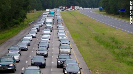
(Evacuations Taking Place Across Florida, Georgia and the Carolinas. Photo Courtesy of CNN)
Soon after the city of Saint Augustine, Florida was placed under a mandatory evacuation as well. This was when panic broke out. We do not have a recent record on the last time the whole city was ordered to evacuate. At this point, everyone who wasn’t taking Matthew seriously finally started to see how big this storm really was and the impact it was about to make.
October 6, 2016 – the last day to prepare
On this day businesses were open until around 1-3pm to accommodate any last minute shoppers that needed supplies. Target and Michaels were putting up their storm shutters and bringing in all the extra shopping carts creating long lines of these carts up and down the isles.

By the time shoppers made it to the food section this was the result:
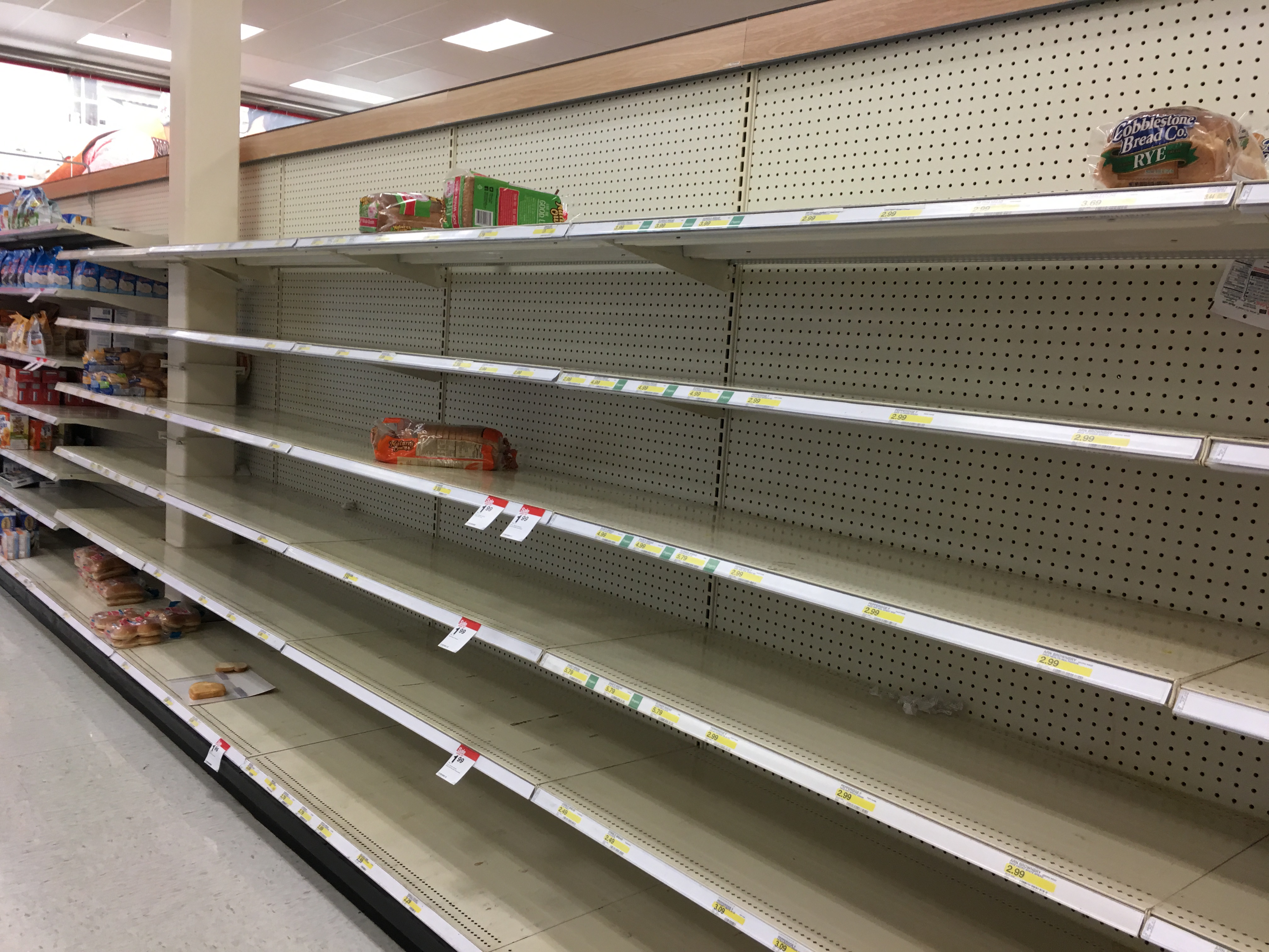
Bread and canned food was sold out. Water was also running low:
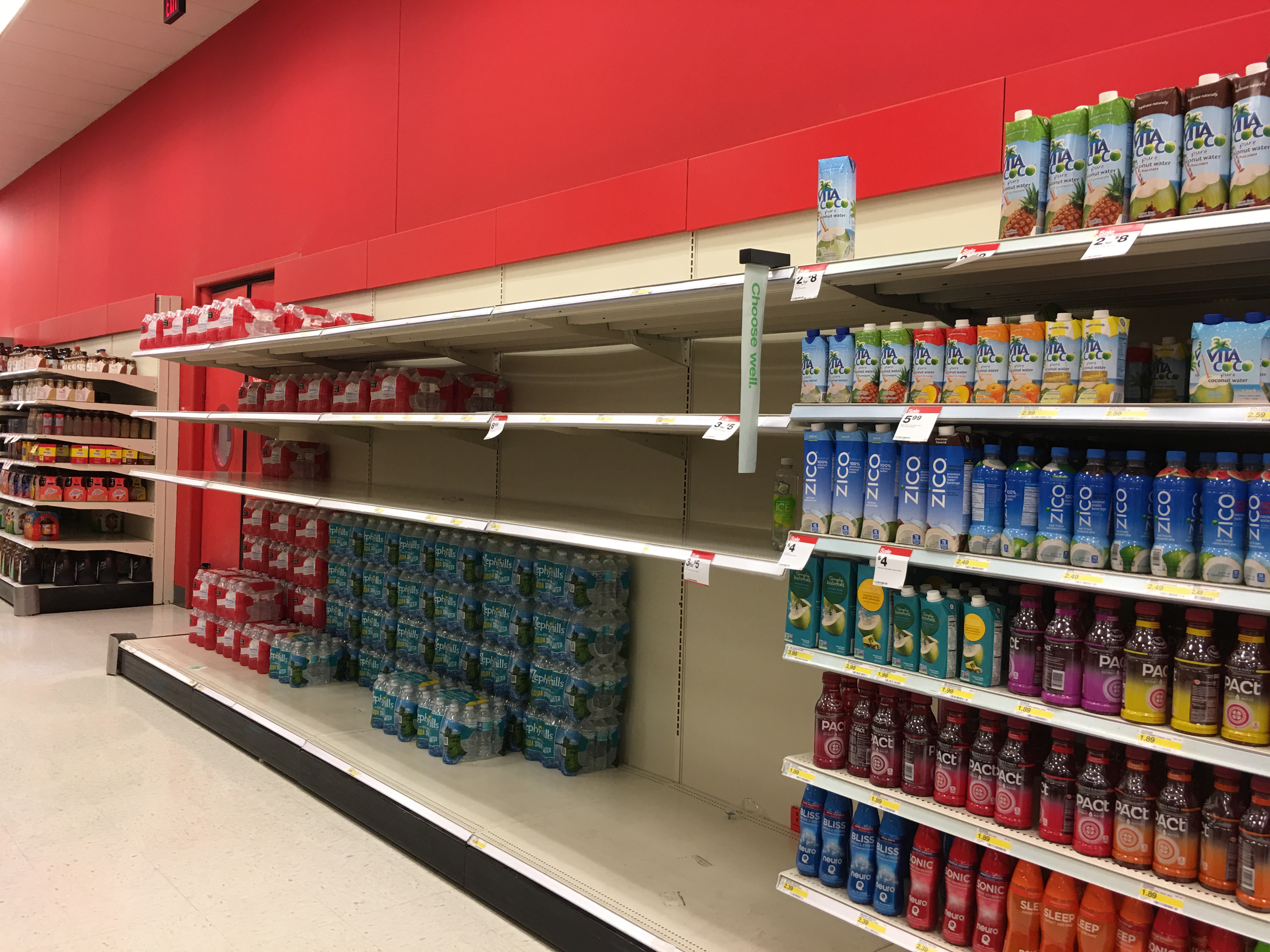
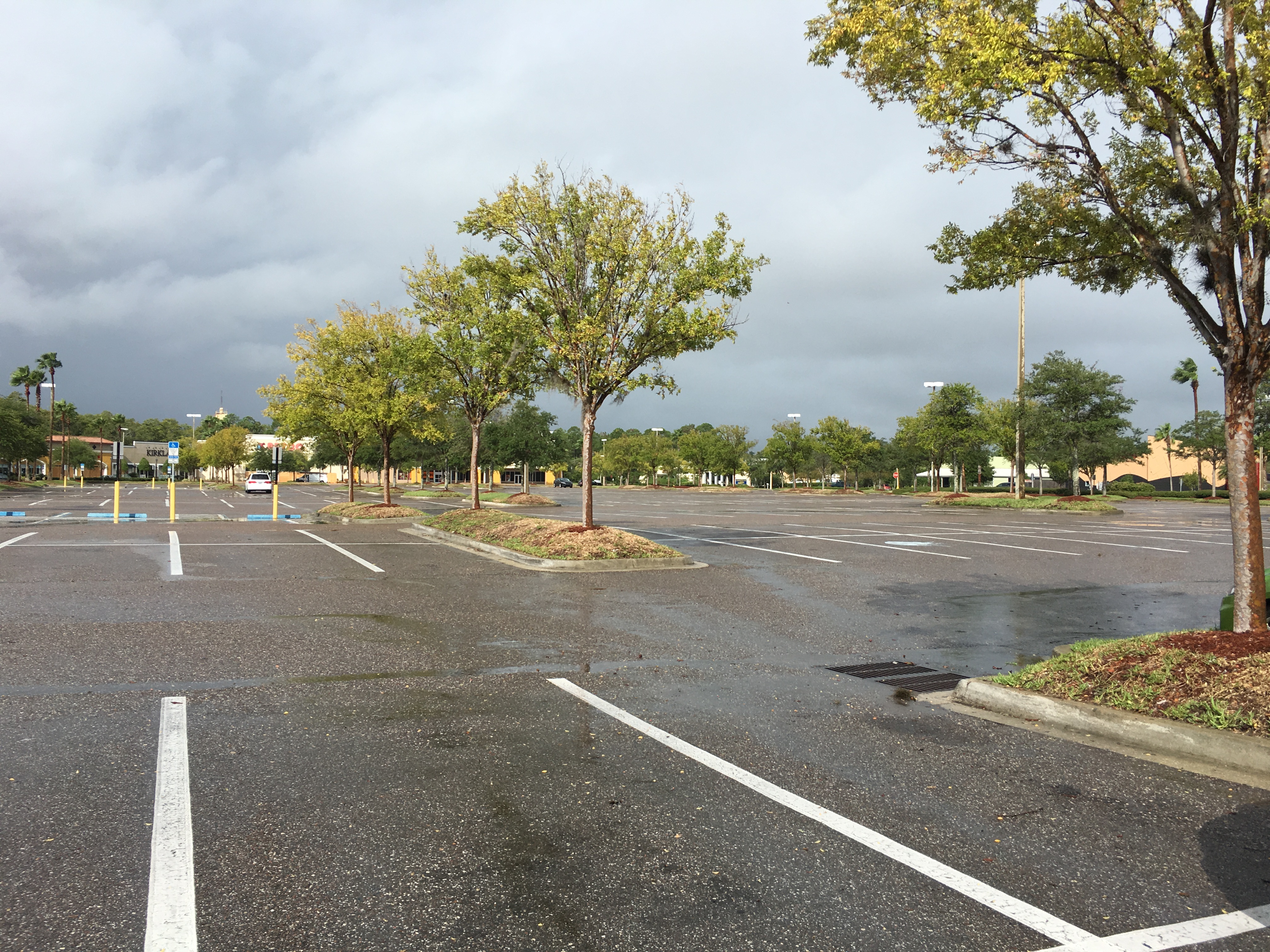
Luckily some last minute shipments of water made it to local grocery stores so that people could pick up a few extra cases. However, it is a very erie feeling to look around your neighborhood and seeing food vanish from the shelves and stores becoming enclosed behind metal and plywood. Parking lots that are usually filled to maximum were suddenly empty:
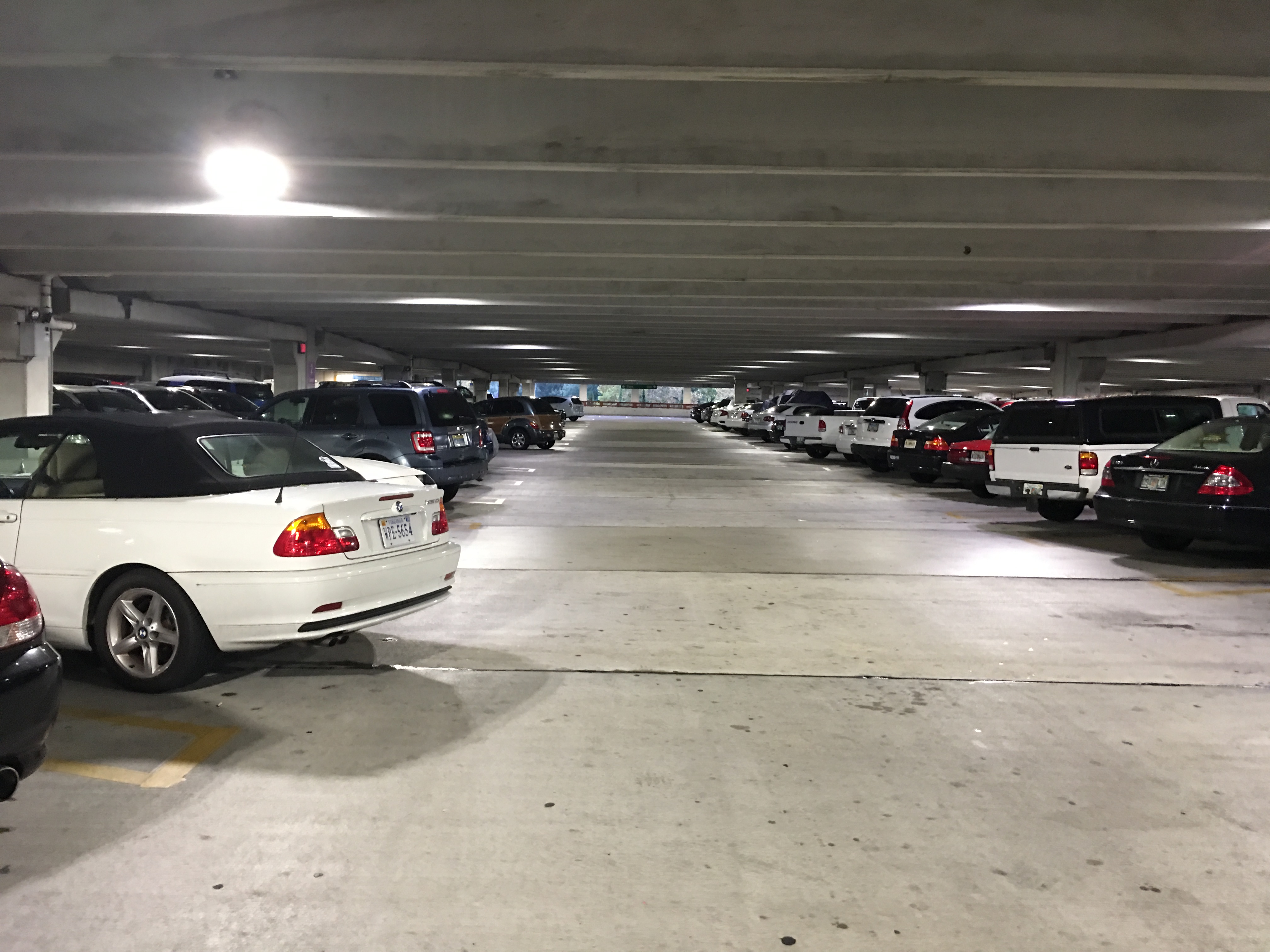
However, above-ground parking garages were filled with cars to offer any bit of protection. It is a smart move that many people in the south know well. A concrete parking lot structure will usually protect our vehicles from storm surge and wind damage. In some cases some people evacuated to these structures and spent the time sleeping in their car as Matthew moved over the area.
I was proud that Floridians took this storm seriously and were preparing for the worst, because that is really what all of us believed. We were concerned about this storm. It was the first major hurricane to impact Florida in over 10 years and it was heading into north Florida, an area that rarely receives hurricanes to begin with. This is mostly due to the easterly winds changing to westerly winds up in north Florida. Usually when a hurricane reaches north Florida it gets pushed away from the dominate westerly winds in the atmosphere back out to sea. Or in most cases hurricanes are picked up by the Bermuda High and directed away from Florida. So what happened? Why did Matthew come to this area? Two individual atmospheric components are to blame: The stationary front over Florida and Tropical Storm Nicole.
First, the stationary front that was giving north Florida grief days before Matthew arrived. This front was connected to a low pressure system that was over the northern Atlantic and traveling slowly eastward. This low pressure originally formed over the continental United States about a week before Matthew arrived and traveled across the US. As it exited into the Atlantic its “tail” (the front) stretched down to Florida and help nearly stationary for a few days dumping rain over the area. Originally meteorologists believed that this front would start to pick up speed and interact with Matthew enough to give it a push back out to sea and not affect the United States (or at least not Florida). What happened is that this stationary front continued to be stationary and acted as a barrier for Matthew. Matthew had nowhere else to go but follow along this stationary line, which was located right along the Florida Coast upon Matthew’s arrival:
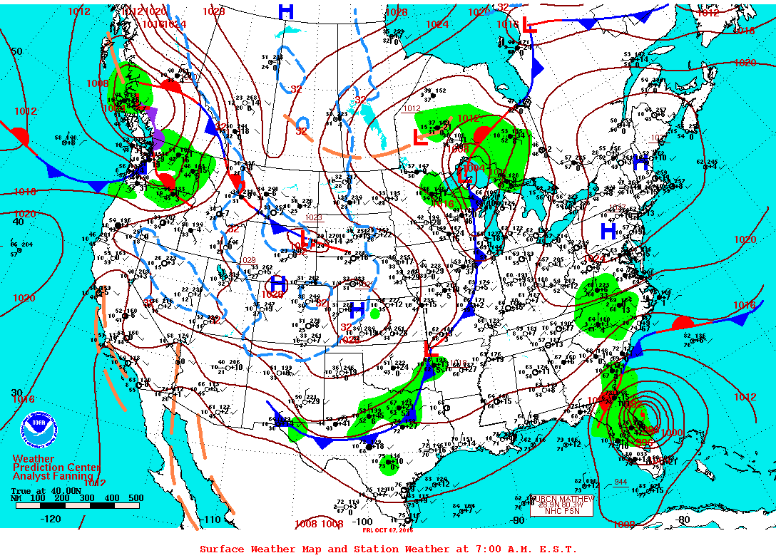
Above is a surface map which gives meteorologists information regarding temperature, pressure, conditions, etc. at specific locations. However, this map shows clearly the stationary front over Florida on October 7, 2016 and how Matthew followed this area from Florida all the way to North Carolina. This front contributed to the path that Matthew took throughout its life time.
Next we get to talk about Matthew’s brief “love affair” with Tropical Storm Nicole.

Visible image on Oct. 6 at 7:45 a.m. EDT from NOAA’s GOES-East satellite shows Hurricane Matthew to the west of a much smaller Tropical Storm Nicole. Nicole is about 400 miles south of Bermuda. (NASA, 2016 -> click)
On October 6 Nicole was hanging out to the east of Matthew growing in strength until it became a Category 1 hurricane on October 7. Now, hurricanes can interact with each other but we can think of them as bubbles. When you blow two bubbles at each other they will usually bounce off each other and push further apart. This is essentially what happened with Matthew and Nicole. Nicole for the most part was stationary and pushing Matthew away as it grew and strengthened. Because Nicole was to the east of Matthew it pushed softly on Matthew making this larger storm push further towards Florida. Some people have asked if this was a Fujiwhara effect. It was not. A Fujiwhara is very rare and only a handful of hurricanes have undergone this (mostly in the Pacific Ocean). When two hurricane “orbit” one another this is technically a correct Fujiwhara effect. Usually the stronger sucks in and absorbs the smaller/weaker hurricane. Instead what happened was just a small bounce interaction between Matthew and Nicole. However, meteorologists started to update their track on Matthew as it churned closer to Florida and everyone was shocked to say the least:
Nicole had a roll in this potential future track. The idea was that as Matthew exited back out into the Atlantic is would interact again with Nicole, bouncing off her again and being propelled back towards Florida. In addition, the Bermuda High was forecasted to be to the north of Matthew as it exited back out creating a barrier. The only option for Matthew was to bounce off Nicole (still stationary at the time) and return to the south. It was horrifying to everyone who was just preparing for Matthew’s first arrival. No one had time to consider a second approach about a week later.
Regardless, Florida, Georgia and the Carolinas knew that Matthew was coming and would be a major hurricane (Cat. 3 or higher).
On a side note I was particularly busy during October 5 and 6, 2016. Canadian CBC Radio stations and CTV were constantly trying to get ahold of me to give some insight on the storm. In total I managed to get in about 17 radio interviews and 4 TV interviews over Skype. To say that everything was insane was an understatement. At one point I had to stop taking interviews because I was not prepared myself. I was too bus getting everyone else prepared that I completely forgot to take care of my own situation. By the time night came and the winds were starting to move in. I was exhausted and needed some sleep and store up some energy for the big day when Matthew would arrive.
Morning of October 7, 2016 Matthew Arrives
Evacuation time was closing in and soon no one would be able to get out. Throughout the night I had people, even family members calling me, saying horrible things to me and my family who chose to stay with me such as “you will die”, “you will drown”, “get out now”, “think of your animals, think of your family”, “you will kill your family.” I wasn’t the only one to experience these calls. Many people across Saint Augustine received them. It drove many insane and they took to FaceBook and other social media platforms to vent and tell everyone to shut up. I can exactly see why. Many of the people that were calling in may have been generally concerned, but they were not helping at all. Many of these people that called us never experienced a hurricane and they have been constantly watching the news, which hypes up every single disaster. It was infuriating to say the least. The night that I needed the most rest possible to be strong and alert for when Matthew did arrive I had these people calling and putting these dark thoughts into my mind. I blocked everyone on my phone. No one was going to call me or my family anymore throughout the storm. No one needed any of those words the night before Matthew came. After those phone calls many people experienced the same pain that I did in the early hours of September 7. An agonizing pain in the gut. That feeling that you get when you are in danger and you have to act on it. There came a moment that I was seriously considering to evacuate, especially when I started to hear the wind pick up and tree branches snapping and being tossed into the side of the house. As I was starting to look around the room to decide what to grab the phone rang across all of Saint Augustine saying “the time for evacuation has closed, do not leave, you will be putting yourself in more danger if you leave.” Game Over. There was no running away at that point. I was trapped in my house with a bunch of spare batteries for my phone, weather charts that I printed out hours before, and a single phone that would connect me to anyone that was watching and following begging for information and advice. I look back now and I am glad the phone rang before I could act. If I left, I would have abandoned everyone that was waiting for me to start reporting and giving information. At this point I knew that no matter how experienced you are as a meteorologist there is still a human side to you and you will feel fear. Any meteorologist who says they do not fear the weather has either not experienced a major disaster or is lying. That was my main conclusion during those early morning hours.
Around 10 am power started to rapidly go out across Saint Augustine. With no power and no TV to drown out the sounds from the outside everyone heard the terrifying sounds of the winds and the heavy rain. Throughout the morning I gave live vlogs through the Weather Goddess Facebook page showing the conditions and how they were deteriorating. At this point Matthew’s eye was still a few hours away from reaching the Saint Augustine area.
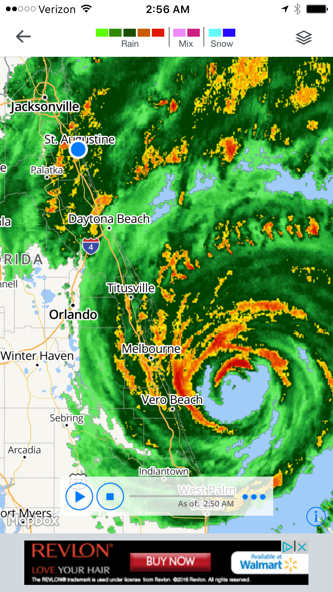
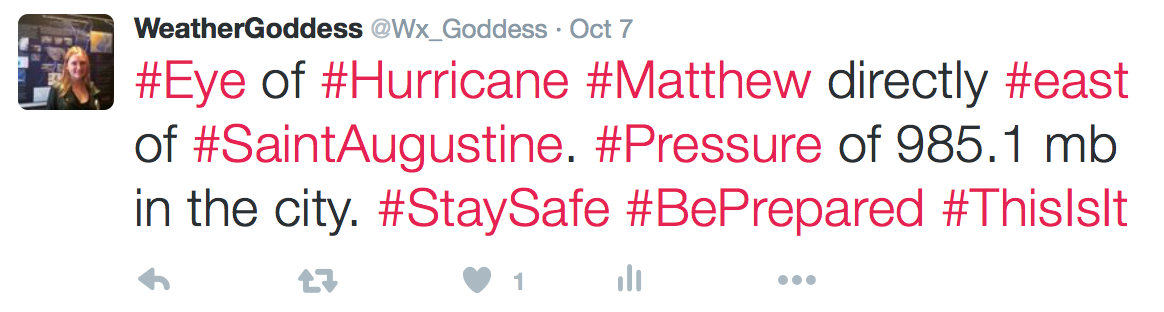
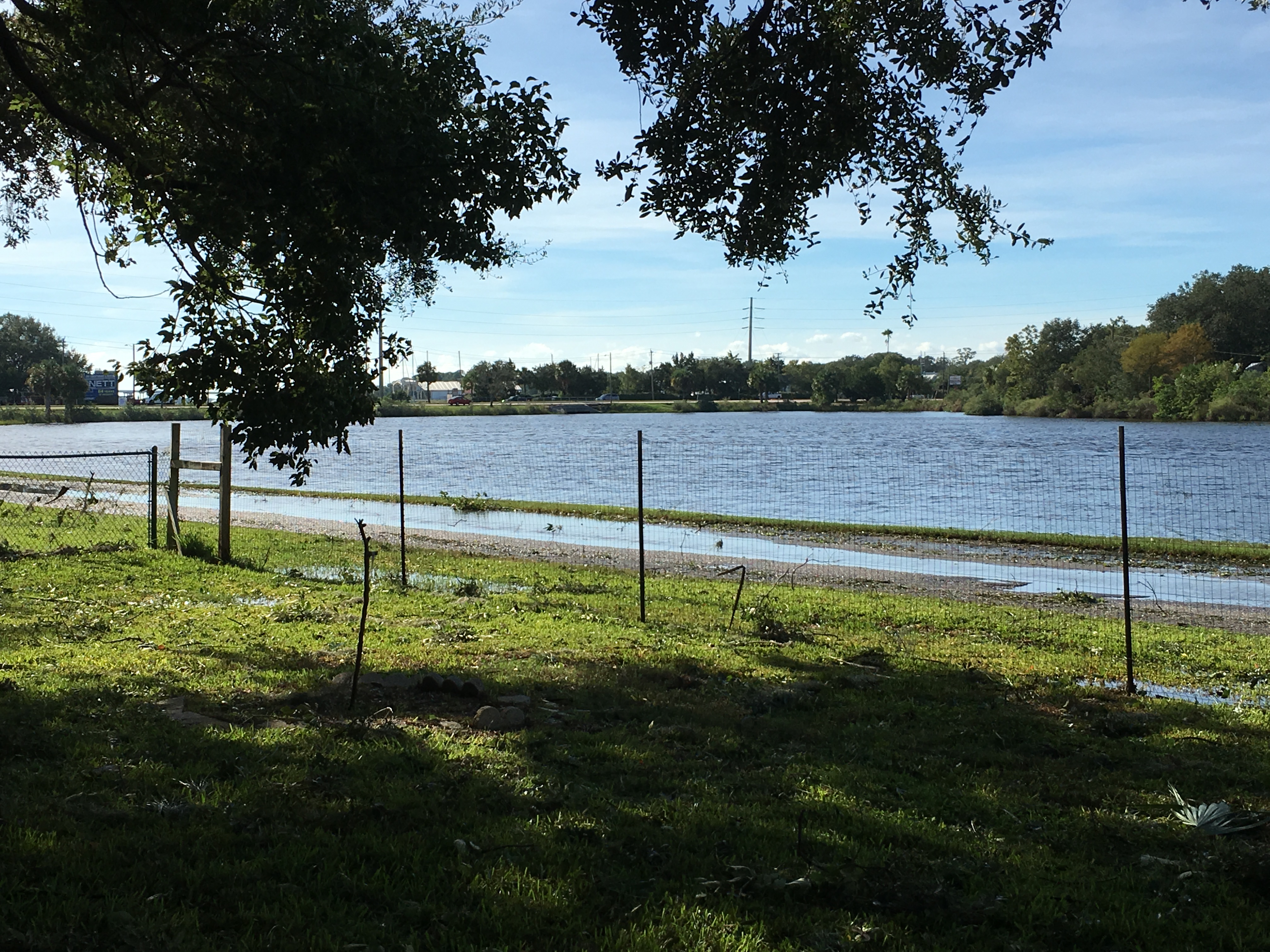
If there was any good news it was the fact that Matthew was downgraded to a Category 3 storm overnight. Thanks to the land interaction on the west side of Matthew it managed to weaken the system slightly. But only slightly. It was still a high end Category 3 storm with winds reaching up to 130 mph as Matthew churned close to the Space Coast. A day before Disney World in Orlando shut down the parks, this was the 4th time this had ever happened since Disney World was opened. Although inland, Orlando was receiving torrent rains and tropical storm force winds as Matthew brushed the coast. At this point I was checking the lake outside my house constantly awaiting the deadly storm surge which was forecasted to reach 10 feet along the coast and about 6-7 feet in my area. Down the road there was some flooding, but the storm surge had not arrived yet. I started warning people through social media that since we are on the left side of Matthew storm surge will be the main threat, especially as we approach the eye wall of Matthew. Due to the fact that a hurricane is going in a counter-clockwise direction the water beneath the storm is also generally moving in this direction. By the time the eye wall brushes Saint Augustine this will be the time when the storm surge will be coming in. Meteorologists started to provide storms surge feedback saying that between the hours of 2 and 6 will be the worst. Saint Augustine will be passing through the eye wall (though not going through the eye) and the storm surge will arrive.
11am, everything changes.
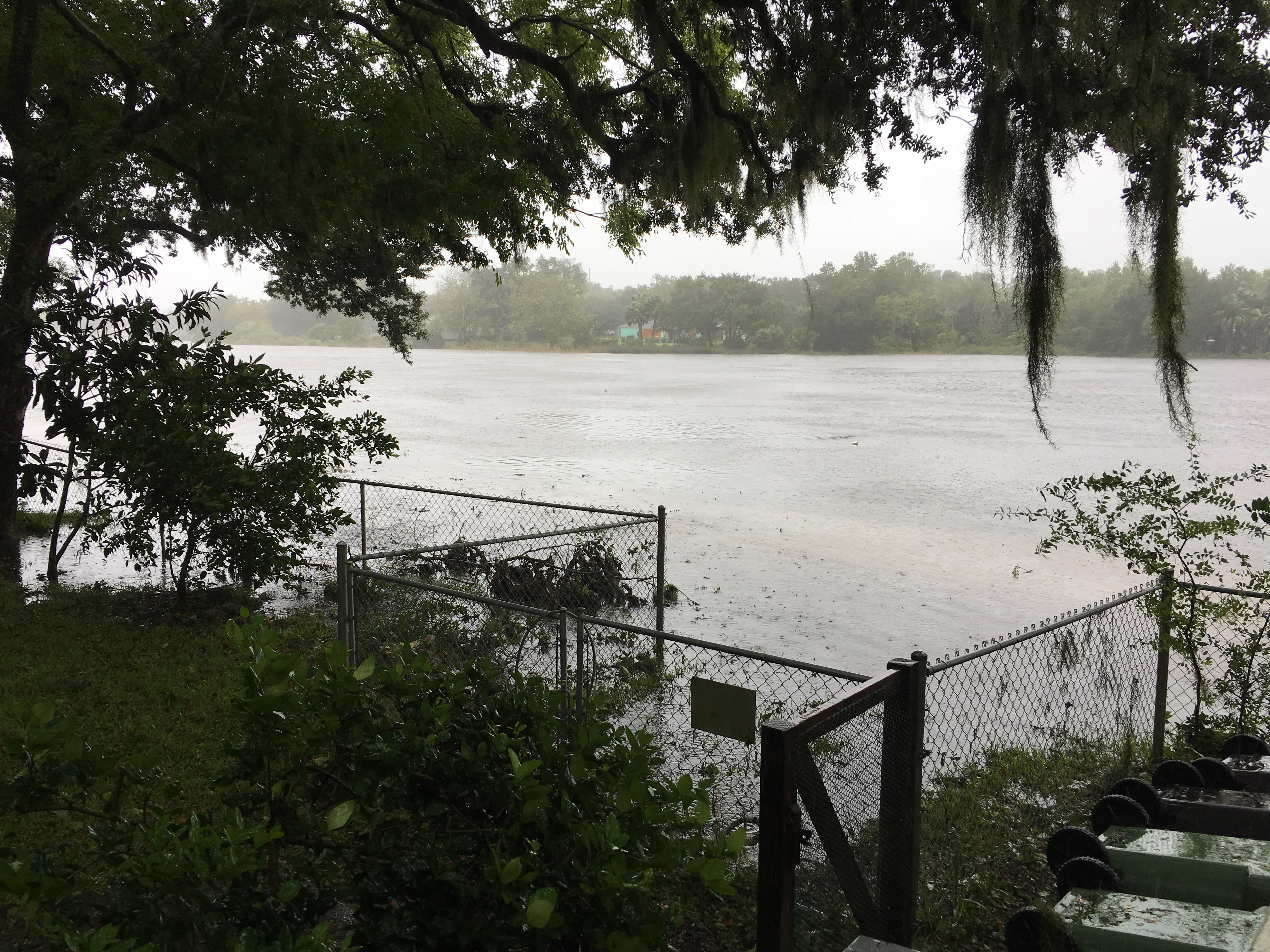
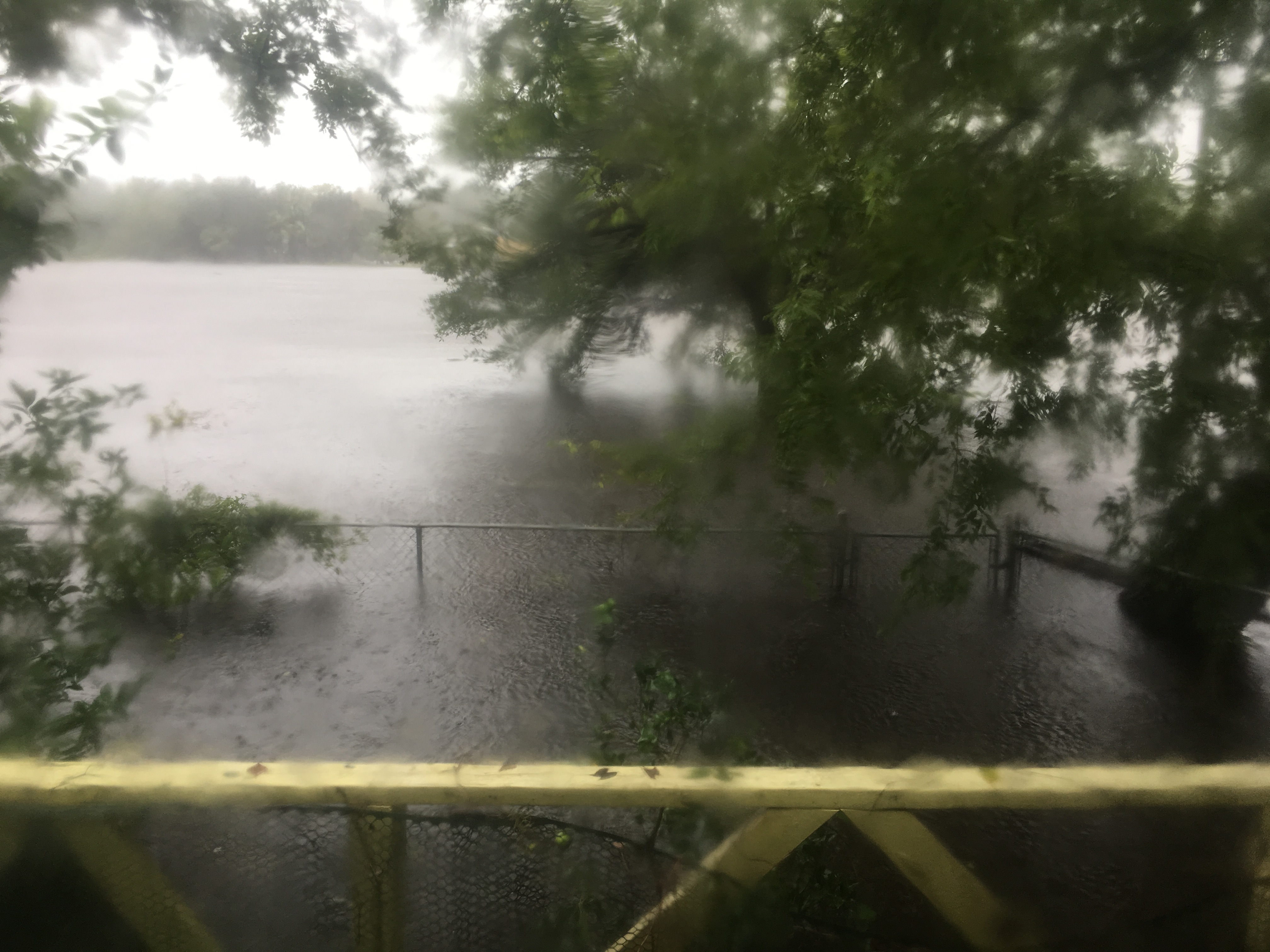
Storm surge arrives and it is early. The eye of Matthew is still down around Daytona Beach and we are already seeing storm surge move in. A few broadcasts were delivered at this time with information saying tropical storm force winds were still currently in the area but that in the next hour we would be feeling hurricane force winds with some areas seeing values close to 120 mph. I return to the house to upload more information and less than 30 minutes later I return to this:
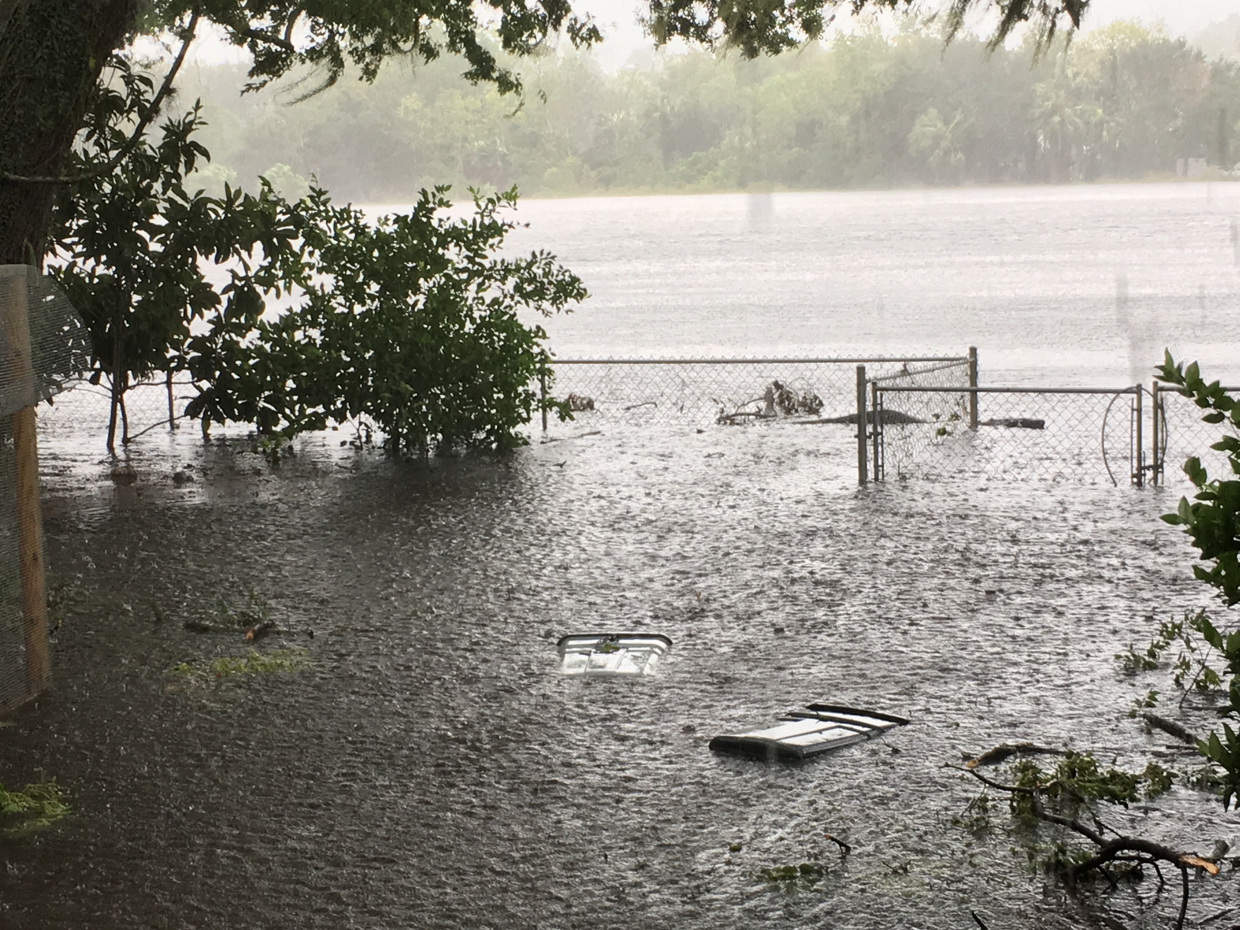
The fence is now half underwater, trash cans floating, the back of my deck and house slowly being submerged.
There was no end in sight and at this point I took a break from updating Weather Goddess servers and took care of my own family. At this point I moved my mother, grandmother, and dogs to the attic and took up the food, water, medical supplies, flashlights, candles, extra clothes, blankets, etc. However before any of that, there was one important thing that was evacuated to the attic first: My thesis research.
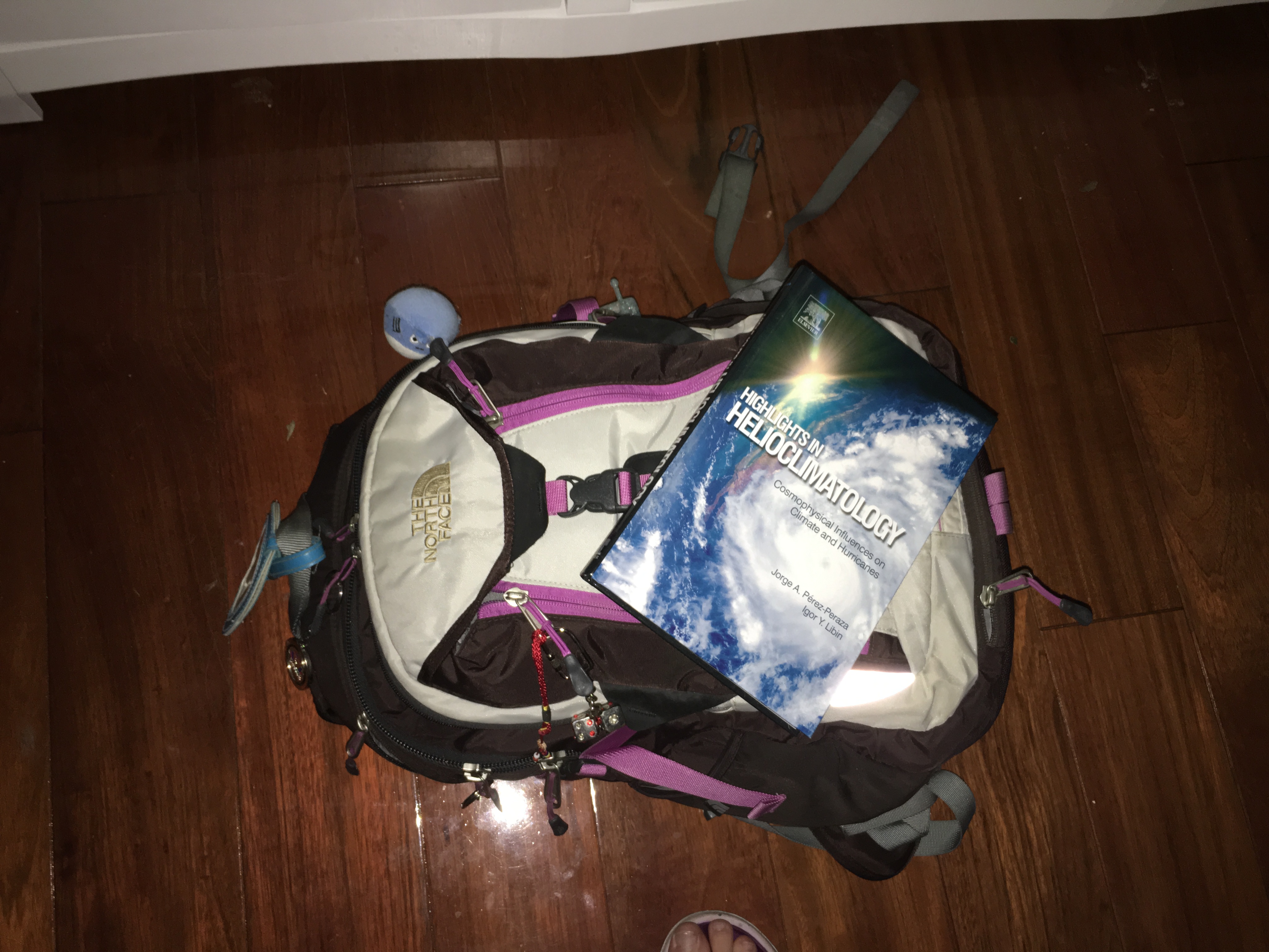
Funny yes, and it gave the world a little chuckle in the midst of this disaster. At one point I tweeted:
It seemed to catch the attention of Weather Underground which were nice enough to mention me in one of their blogs: click here for the blog.
As the waters continued to rise I capture footage and updated vlogs as much as possible to inform everyone who was still watching what was going on. Eventually these reports will be uploaded to this website but for the moment you can find them in the video section under the Weather Goddess FaceBook Page. In many reports the hurricane force winds blew through my area and broke large branches and flung any loose items into the rising storm surge. Some of my neighbor’s houses began to flood and emergency personnel came in the middle of the storm to try and get them out before the water became higher. The majority of my house was still above water at this point and my family was safe and somewhat cozy in the attic. For the most part we were somewhat safe.
I did not find out until after the storm, but residents that were pulled from their house who brought their animals were later turned away at shelters which emergency personnel brought them to. Yea. I was just as shocked to hear the stories. Shelters were not allowing these people who were just pulled from the water to enter because they brought their animal. It gets worse. They were told to either leave the pet outside or they could return back to their flooding house. The people I spoke to said they returned to the flooded house. I would have done the same thing. Without a doubt, this was the story that angered me the most. That people were rescued, they were smart enough to take their beloved companion and then they were turned away at the shelters. I hope others come forth with their stories that are similar to this. Because this needs to be addressed immediately. Unacceptable in every way.
At around 2:45 pm EST, Matthew arrives. Although the eye stayed offshore we went through a piece of the strong eyewall. Winds gusts reached 110 mph with values closer to 130 mph closer to the shore. At this point I retreated to the attic and continued to update using words. Pictures and videos were becoming too hard to download and upload and I resorted to only words.
The wind was hurling anything it could lift into structures. This was the time that some people experienced their roofs collapsing or peeling off. Those that experienced this were told to either retreat to a room with a roof still attached or evacuate under a sturdy object like a desk and cover themselves with pillow, mattresses, blankets. Large trees began to tip, break, sway and some even crashed down on houses. The surge kept rising and the back of the house, connected to the deck was beginning to collapse and move (which I found out after the surge started to retreat). We had one thing to be thankful. The eye did not go over us. If this happened Saint Augustine and Jacksonville would have had a second round of storm surge and a second round of passing through an eye wall. Because Matthew off shore by only a few short miles this saved a lot of Saint Augustine.
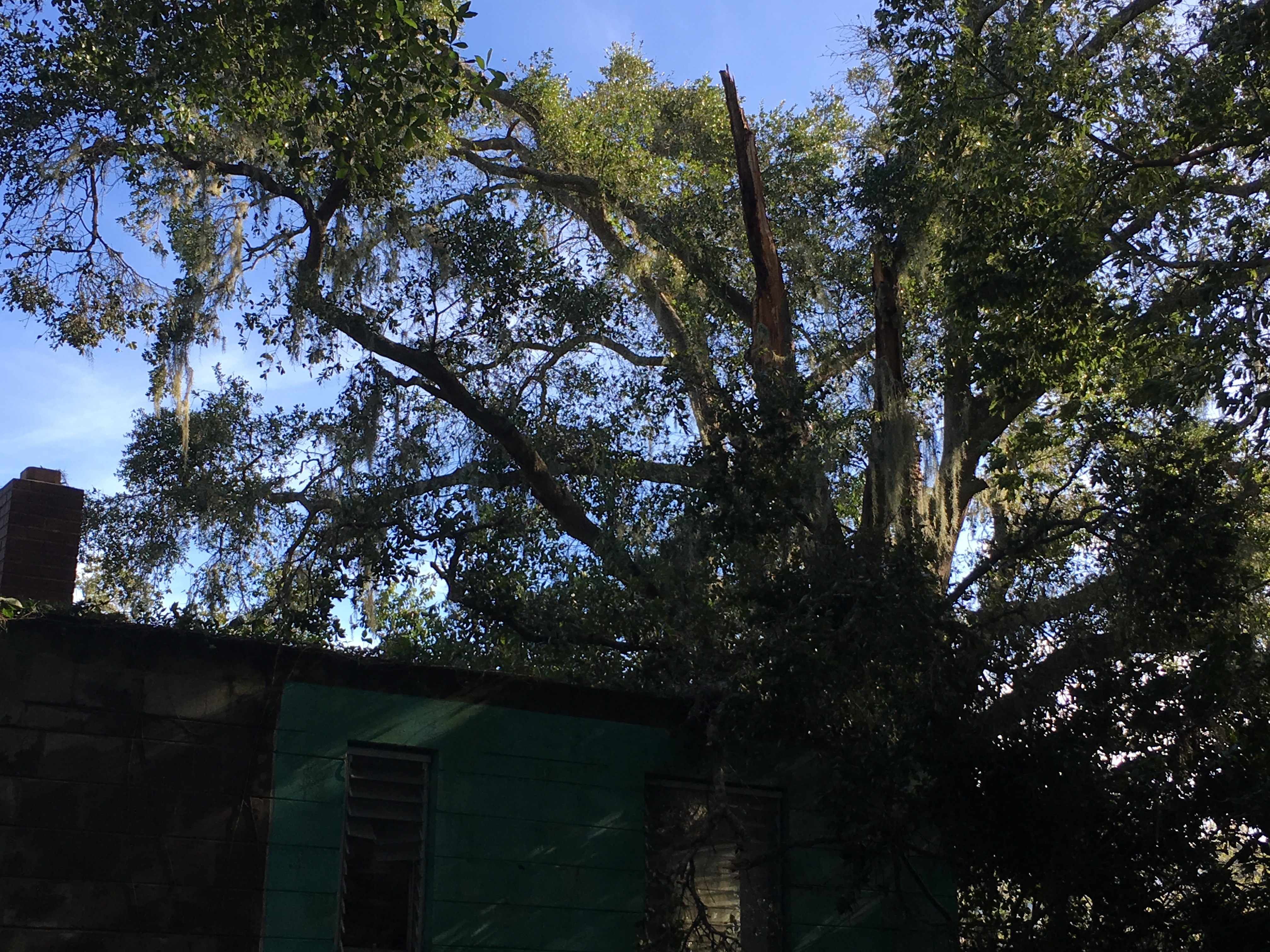
Around this time Matthew began to change shape. It began to expand and grow larger:

(October 7, 2016 Hurricane Matthew)
Matthew was starting to undergo the primary steps of extratropical transition. A process where the storm starts to transform itself into a cold core system due to the fact of it interacting with land and continental air masses. The bad news is that this growth is what caused most of the devastating floods in the Carolinas.
As the eye slowly close to Saint Augustine and Jacksonville the rain and wind was so loud that it was hard to get any wink of sleep which I was in desperate need of. Debris constantly hitting the house kept everyone on high alert. The sound of the rain smashing against the windows and adding to the storm surge beneath our attic. There was a point that the low pressure finally got to a lot of us riding through the storm. Many humans feel the effects of low pressure. In a sense we are our own barometer. During low pressure (rainy days) many people will feel tired and lazy compared to high pressure days when you feel more alert. I have known for many years that low pressure effects my body. A headache hit me like a ton of bricks as Matthew passed by and delivered us a low pressure of around 985 mb. I slept at one point surrounded by the heavy winds and rain. I awoke an hour later to an erie less loud atmosphere. It was sunset and the storm surge was finally starting to retreat as Matthew moved away from Saint Augustine and onward to Jacksonville, slowly starting to follow the bend in the frontal system and move further out to sea and away from the Florida shores.


Many people who have gone through a hurricane describe the sky, especially around dawn and sunset after the storm has passed. Many have trouble describing the color, the feeling, the feeling that it brings and I can completely understand that from Matthew. These pictures don’t give it justice but it was almost a purple looking sunset that night with Matthew moving away. Tropical Storm force winds were still being felt and people started to pull themselves out of there house and take a look around their property. Water was slowly lowering. Trees and branches littered every roadway. Power was out, water was shut off and darkness was approaching. For those that were prepared candles and flashlights started to light up inside everyones houses.
Matthew moved northward into the Jacksonville area but spared the city due to a last minute turn, thanks to the stationary front over Florida. Right after Matthew passed Saint Augustine it began to turn slightly eastward bringing the eye further away from the shore. Jacksonville only experienced a small part of the eye wall but enough to cause damage. Especially in the Vilano Beach area, just south of Jacksonville Beach.

(Photos courtesy of Jason Thomas from WTLV First Coast News Jacksonville)
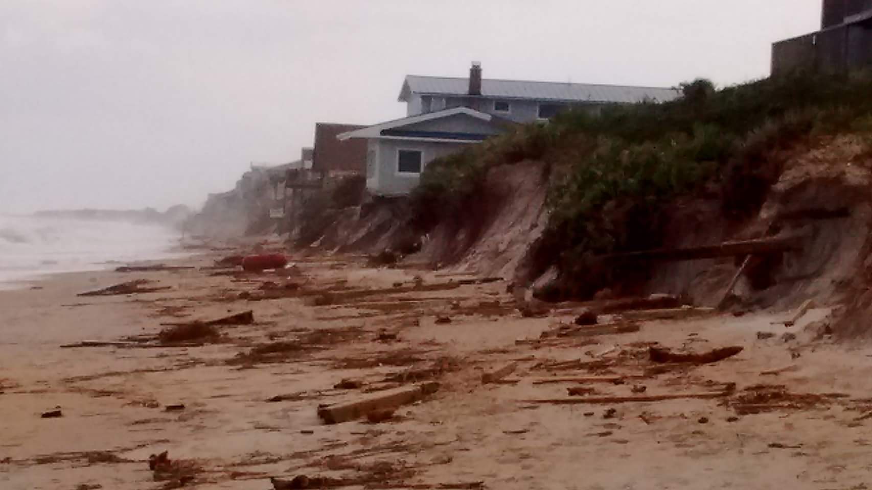
Houses close to the shore were either leaning dangerously off cliffs or gone completely. However, if the eye of Matthew came over land, this would have been much worse, probably on the scale of Galveston Texas when Hurricane Ike came ashore in 2008. All houses would have been destroyed without a doubt. This is sort of what we saw down in Flagler Beach, just south of Saint Augustine:
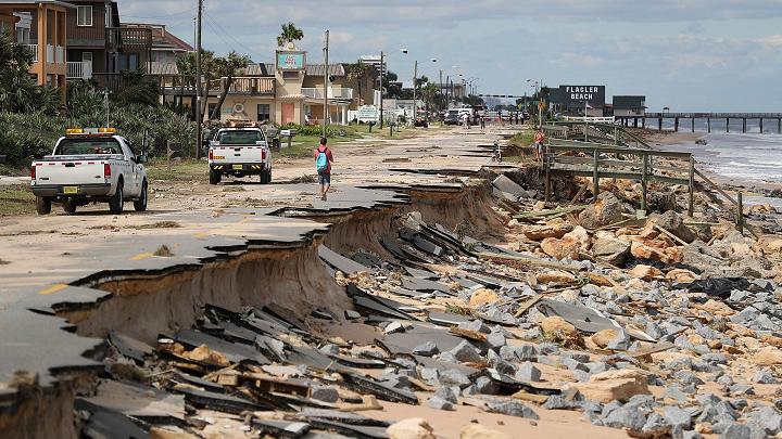
Roadways were washed out completely and houses in this area took the full beating of Hurricane Matthew. Flagler Beach is closed indefinitely due to all the debris in the water, the lack of roadways, sewage leak problems and gas line leakages. In meteorological terms Matthew’s eye was so close to the shore around Flagler Beach and this is why the damaged in this location is worse than compared to Vilano Beach (about a 1 hour drive North from Flagler Beach). By the time Matthew made it to Vilano Beach it was starting to turn back out to sea making the eye (usually the most damaging part of the storm) move further away from shore. Jacksonville (although storm surge was a problem for the city) could have experienced catastrophic damage if Matthew did not do a last minute turn. Matthew turned thanks to the bend in the stationary front which happened to be bending just south of Jacksonville. When Matthew interacted with this front air mass it changed direction and moved parallel to the front, following the fronts shape. However, no amount of movement could prevent Georgia and the Carolinas from receiving a direct impact from Matthew.
By the time Matthew was moving away from Jacksonville it was weakening quickly. The past 24 hours Matthew’s west side was carving through Florida which allowed for drier air to wrap into the storm and weak it. Nevertheless, because the eye of Matthew stayed off shore it was still sucking up all the warm water moisture it could to keep its strength steady at a Category 3. Once moving into Georgia Matthew weakened to a Category 2 and soon after a Category 1. Matthew made a direct landfall just southeast of McClellanville, South Carolina as a Category 1 Storm.
.
At this point you may be thinking: “it’s just a category 1, no big deal.” Wrong. Georgia and the Carolinas knew that no matter what category Matthew was, the direction and path the storm was going was going to create some historic flooding and storm surge.
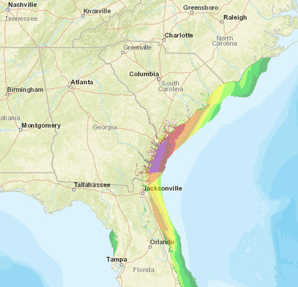
Once again, take a look at the shape of the south east coast of the United States, it curves inward. A hurricane, like Matthew, that travels close to this bend pushed water into the land area. The hurricane is turning counter-clockwise, so as it moves past Florida it gathers up the water from the right side of the storm and then hurls it to the west side. The water has nowhere to go but inland. Luckily the state of Georgia was prepared and days before Matthew issued mandatory evacuations for anyone living along the coast. This mandatory evacuation happened even before Florida started issuing evacuation warnings. Georgia knows how dangerous their coast line is and how a hurricane can devastate the area so they prepared ahead of Matthew. The Carolinas faced a different problem. Though Matthew was down to a Category 1 and the eye was starting to move over land gradually weakening the storm they experienced the primary stages of extratropical transition. Lets compare the two images of Matthew below:
The first image is Hurricane Matthew as a Category 3 located off the Space Coast on October 7, 2016. The second image is a day later as Matthew comes ashore as a Category 1 in South Carolina. Notice anything? Matthew is bigger. Much bigger. This happens when a hurricane interacts with the land. The power source for the hurricane (warm ocean waters) is cut off and the hurricane has a choice: dissipate and die, or evolve to survive. Matthew did the latter of the two. Matthew began to transform itself into a cold core system by pushing all of the rain to its north and secluding it from the powerful winds which was pushed southward. The eye began to retreat to the south as you can see in the second image. Because Matthew was “walking the tightrope” along the Carolina coast, inland areas of North Carolina experienced torrential heavy rains due to the change in shape. For those who have been through North Carolina, it is hilly. We have the Appalachian Mountains that cross through the western and central parts of the state. Between these mountains we have valleys where many people choose to reside. Water + Valley = New Lake/Giant Swimming Pool. This is exactly what happened.
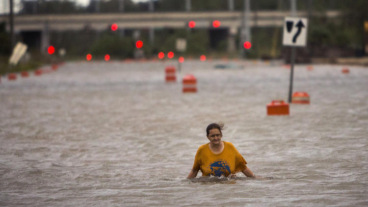
(Courtesy of weather.com : Sean Rayford/Getty Images)
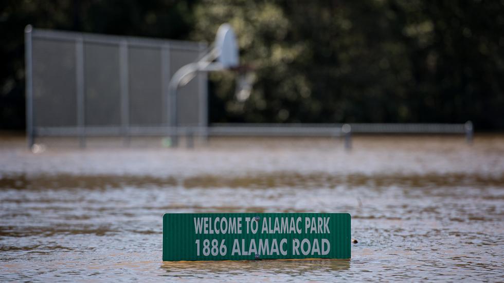
Flooding everywhere from the torrential rains. Although storm surge was the big fear for the Carolinas it turned out to be the rain, and it all had to do with Matthew undergoing extratropical transition. We were educated by this in Hurricane Sandy (2012) as Sandy underwent extratropical transition just prior to making landfall in the New Jersey and New York area. Sandy and Matthew at this point were water storms. The main threat was the rain, not the wind and storm surge (which was more of a problem in Florida). As of this blog 25 are confirmed dead in the Carolinas due to the flooding. Florida lost 4 people from a mixture of wind (tree falling) and storm surge.
Luckily for Floridians Matthew was weakening so quickly that it could not interact one more time with Hurricane Nicole to bounce off and go back towards Florida. Once again we have to thank the extratropical transition of Matthew. Most of the energy was pushed to Matthew’s north, away from Nicole and Matthew managed to move eastward avoiding any interaction with Nicole once more. A sad ending to a romantic atmospheric relationship, but also a blessing in that Matthew was not coming back to Florida.
The morning of October 8, 2016
Cleanup begins across Florida as the Carolinas begin to go through the eye of Matthew. The first thing I noticed was how blue and clear the sky was. This happens after a hurricane has passed. The low pressure is so intense in these systems thatchy just suck in all the surrounding clouds and leave behind blue skies. Almost seems to be the perfect movie ending:
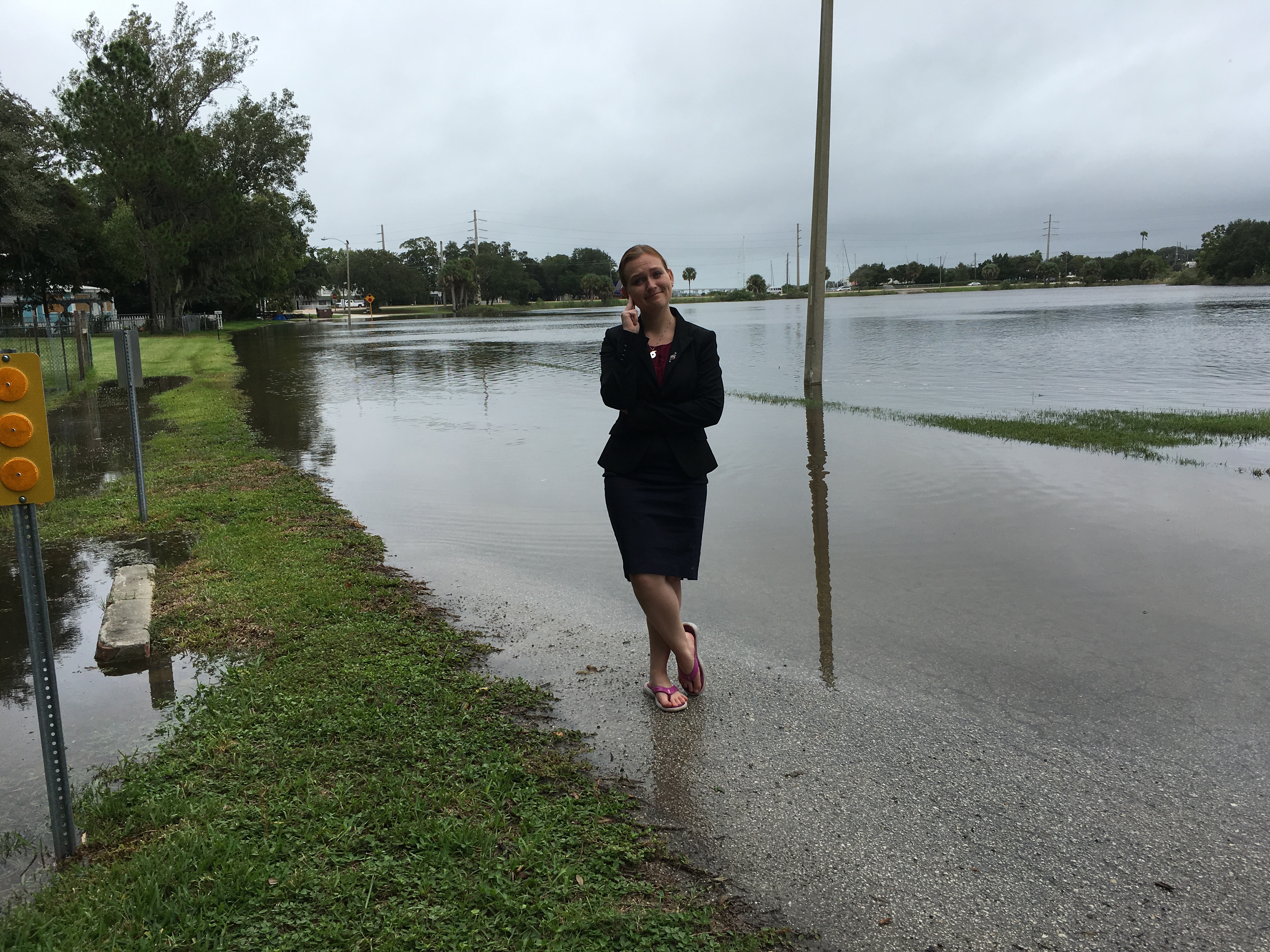
The lakes and rivers were finally going back to normal but all around we had major problems. Trees on top of houses, power outages, gas lines leaking, polluted water and what scared everyone the most was that Saint Augustine Beach was still closed off.
While everyone “patiently” waited for word on when they could go and potentially rescue the people who chose to stay during Matthew on the beach side, cleanup began around downtown Saint Augustine.


(More Pictures on Weather Goddess Facebook and Twitter Pages)
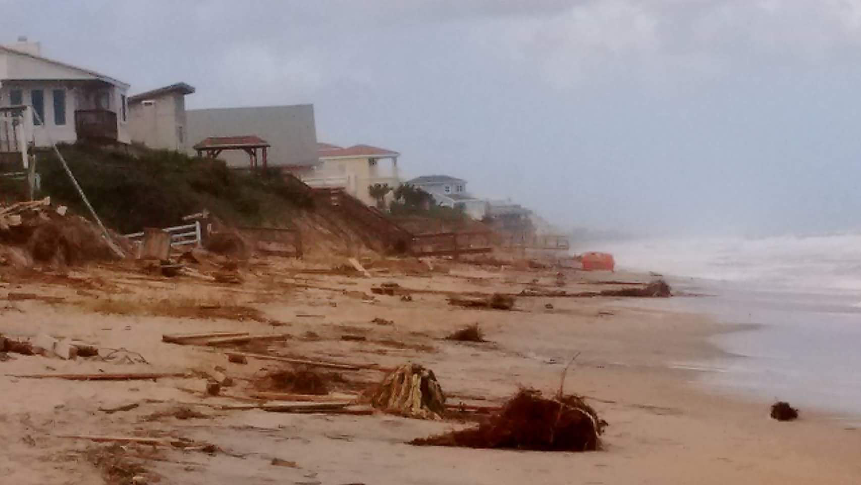
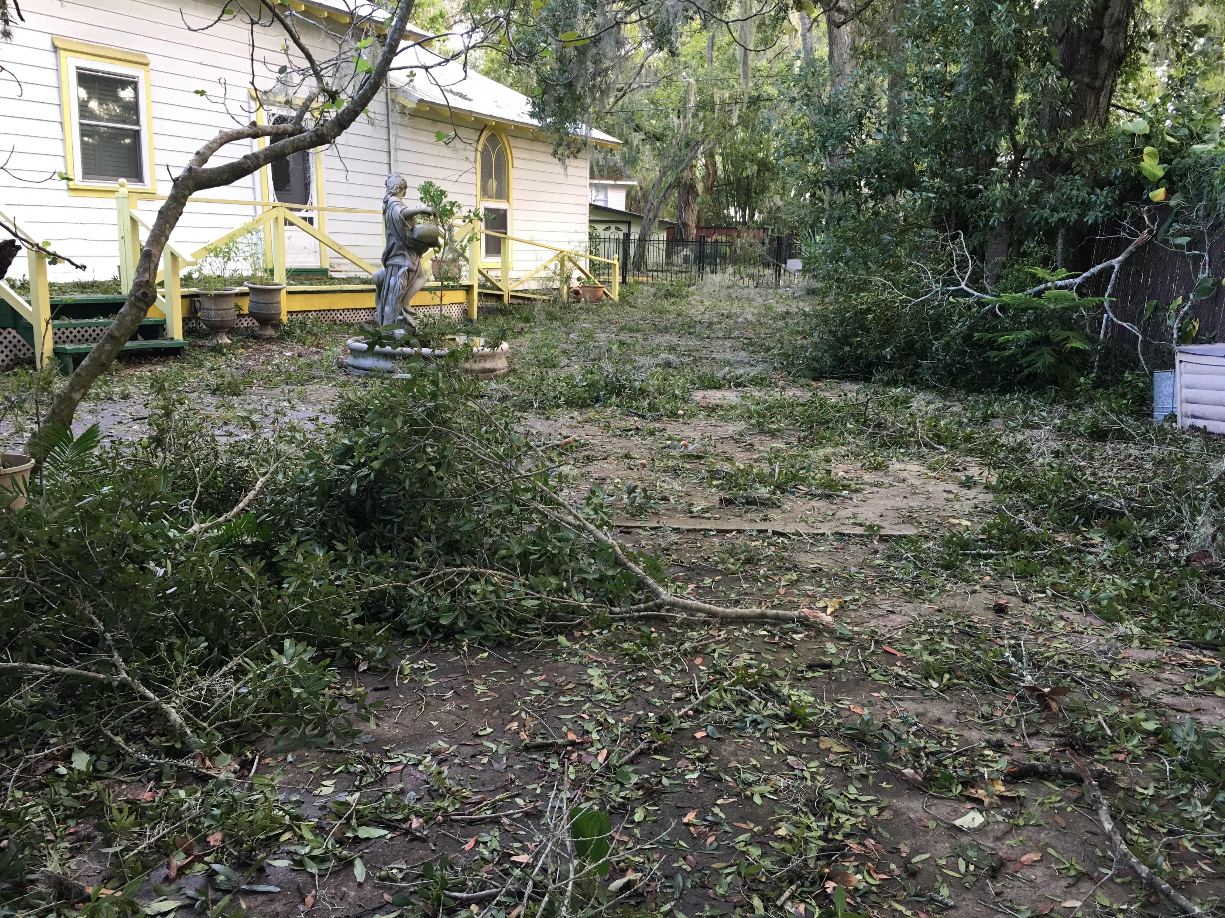
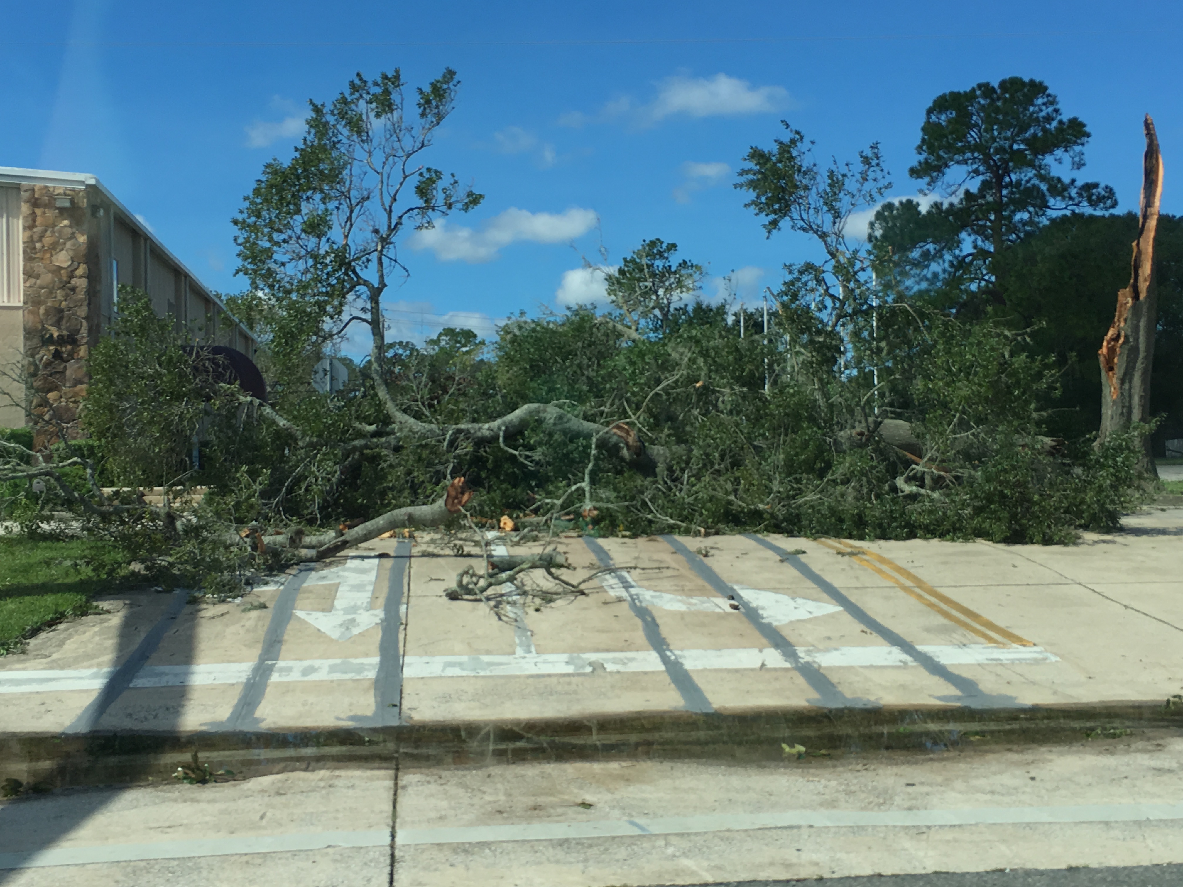
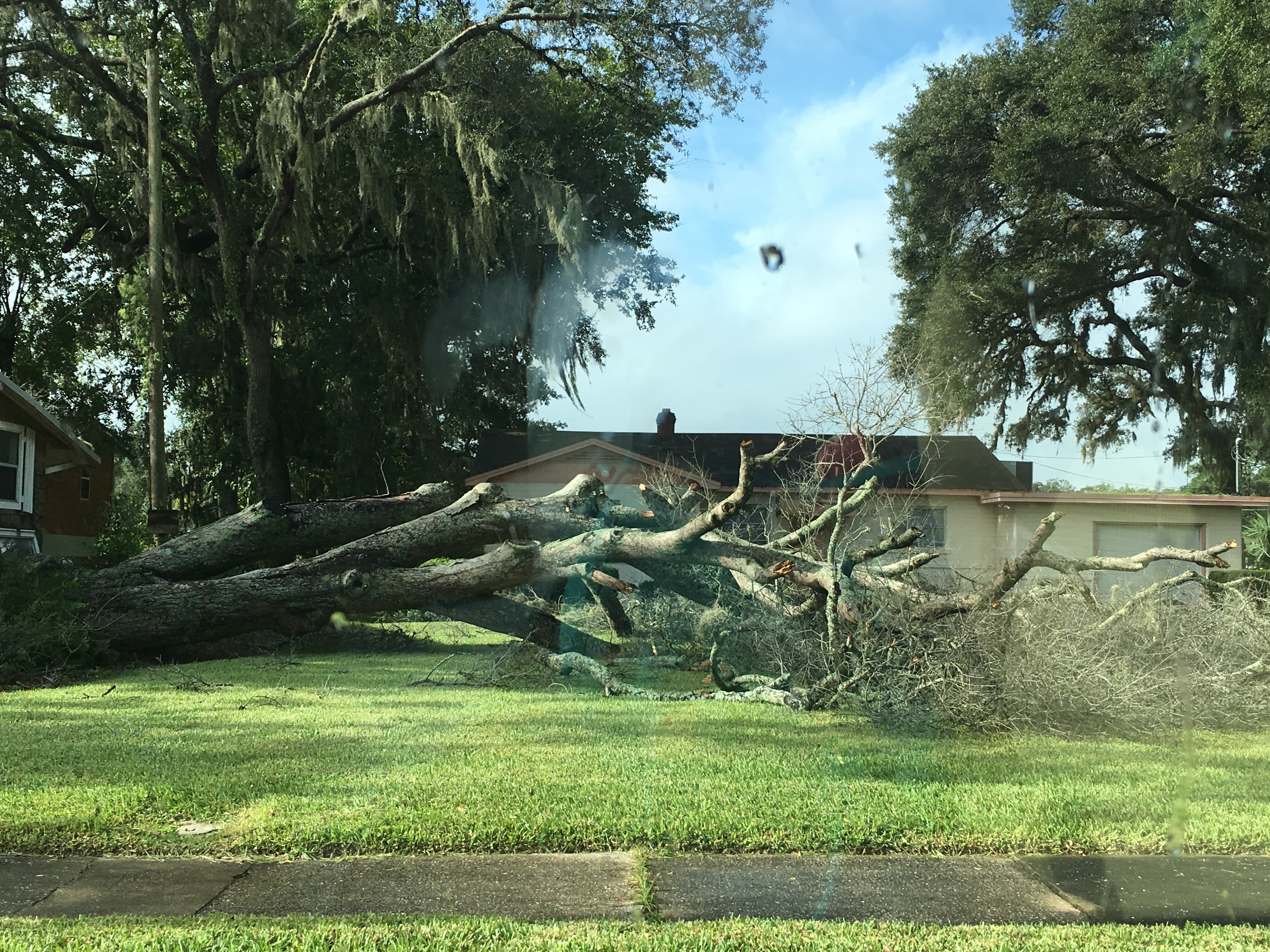
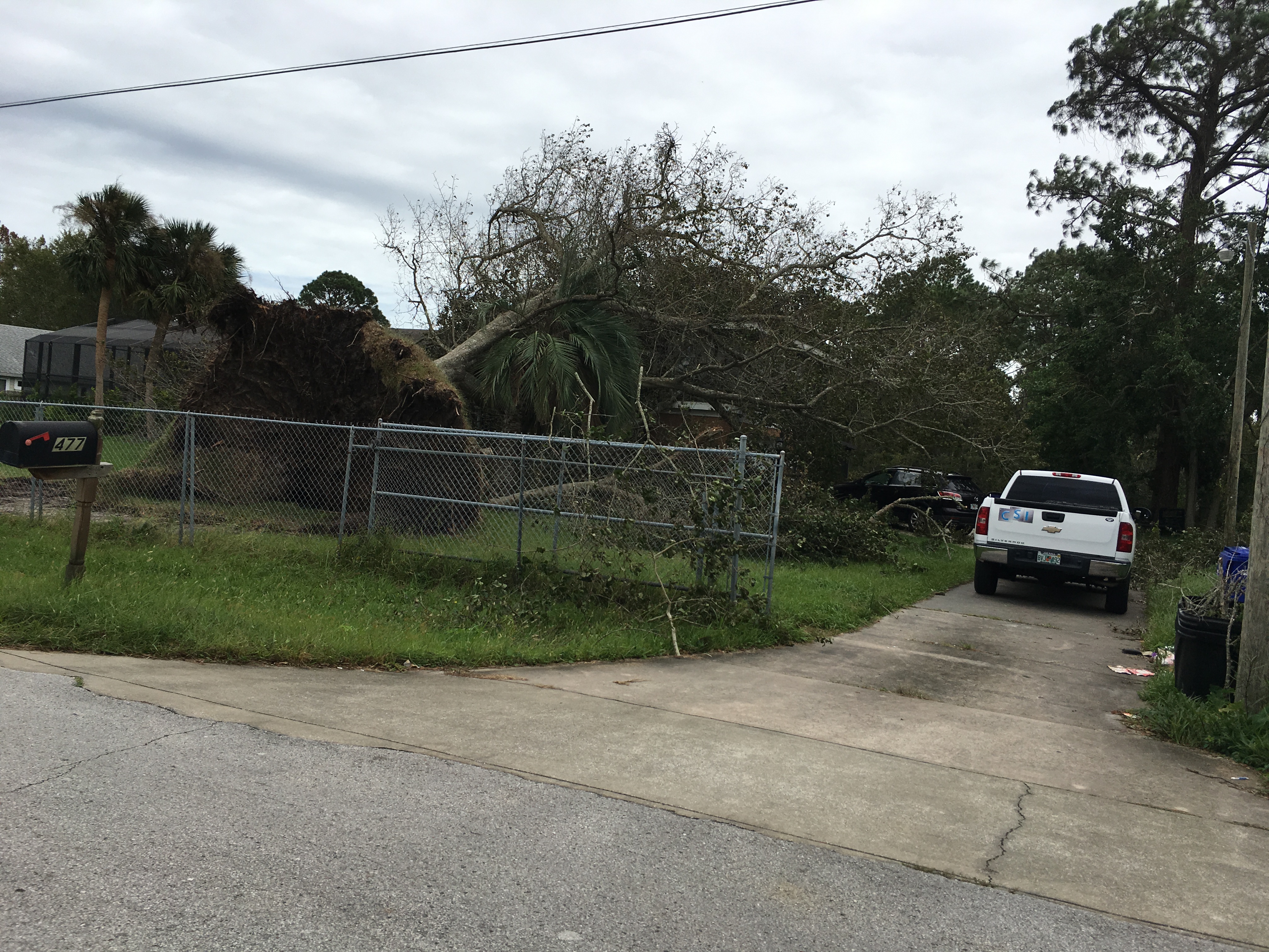
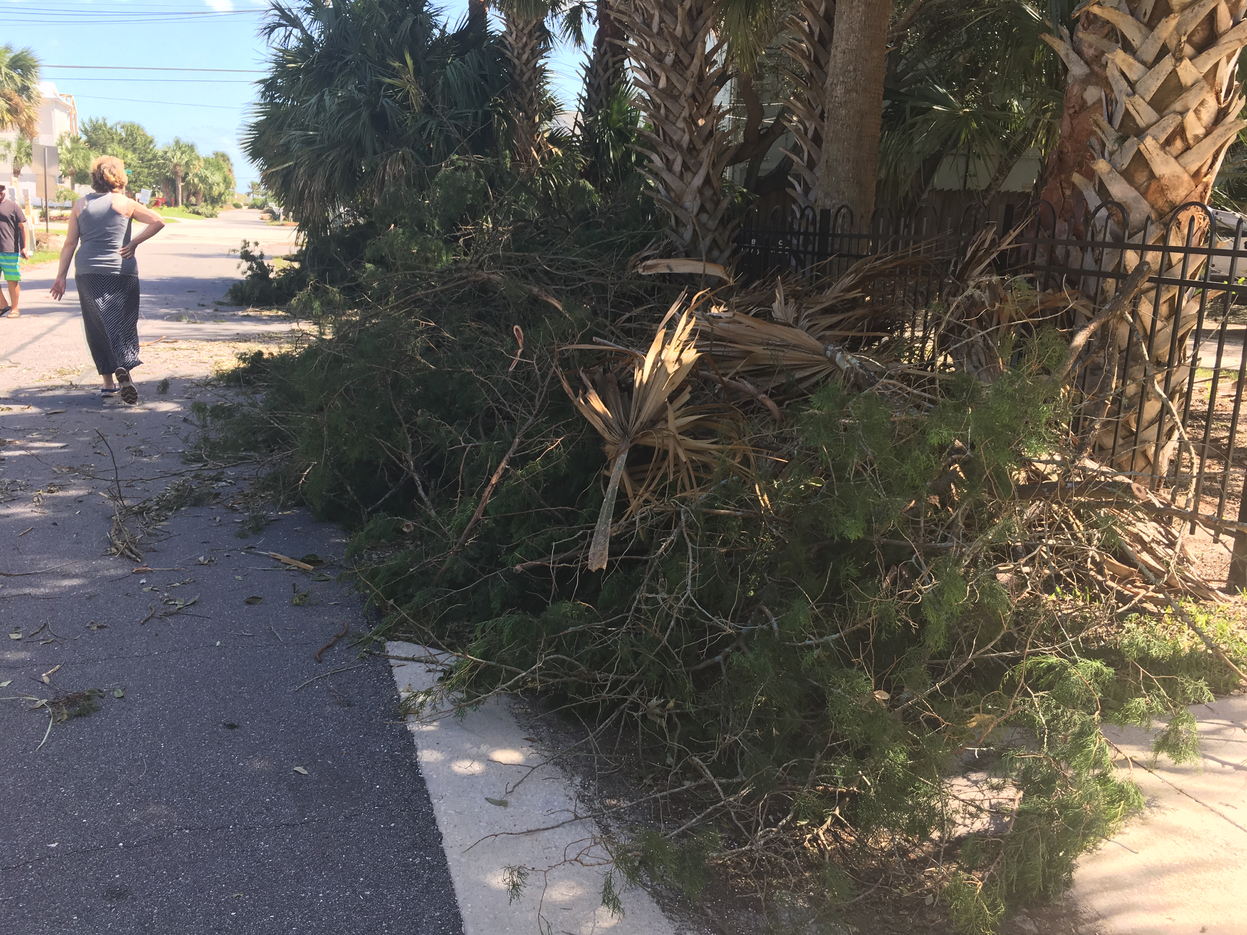
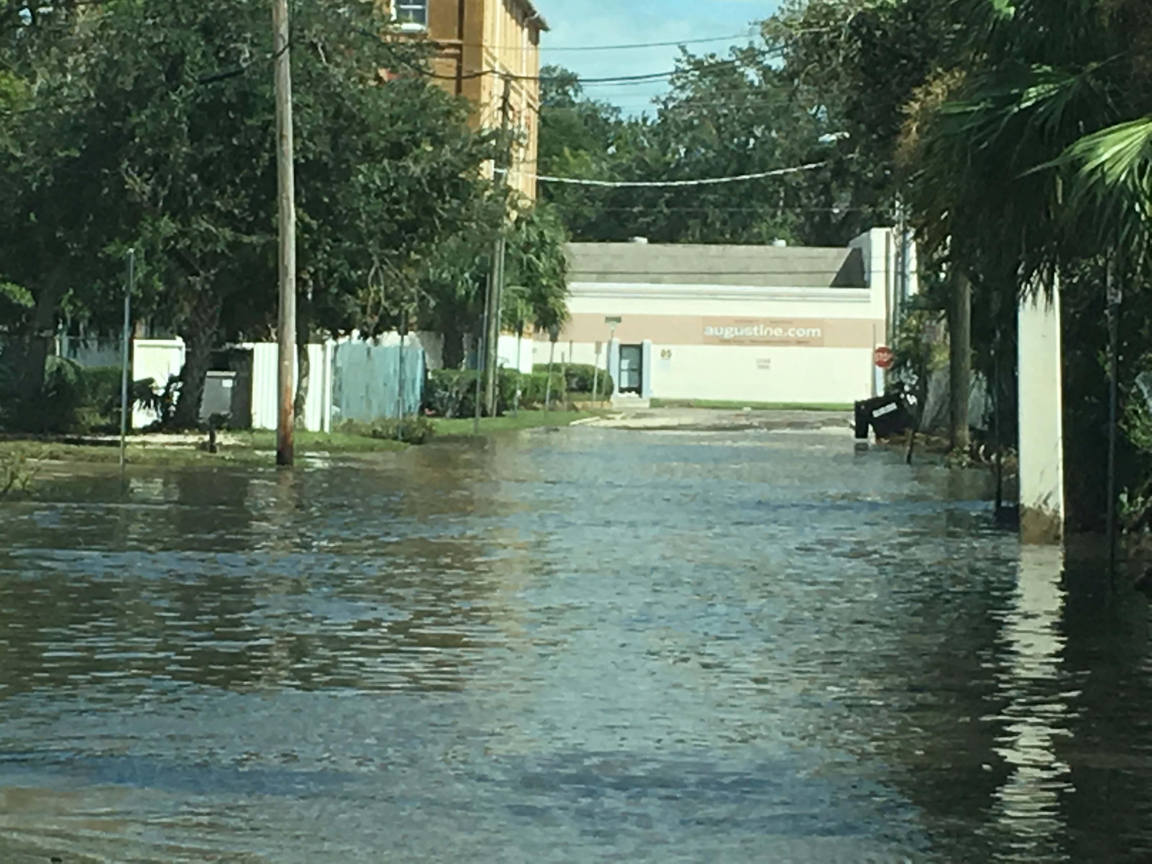
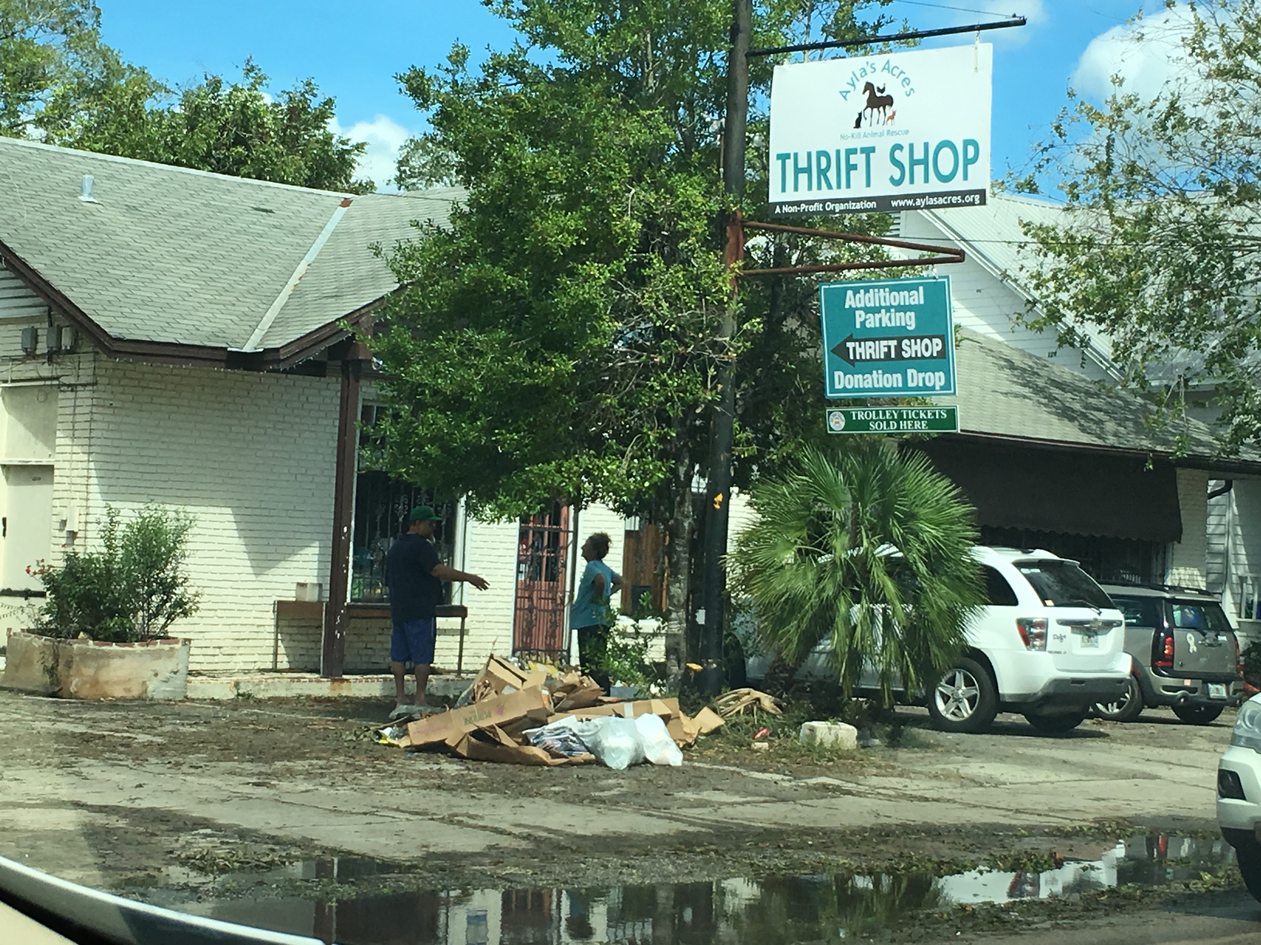
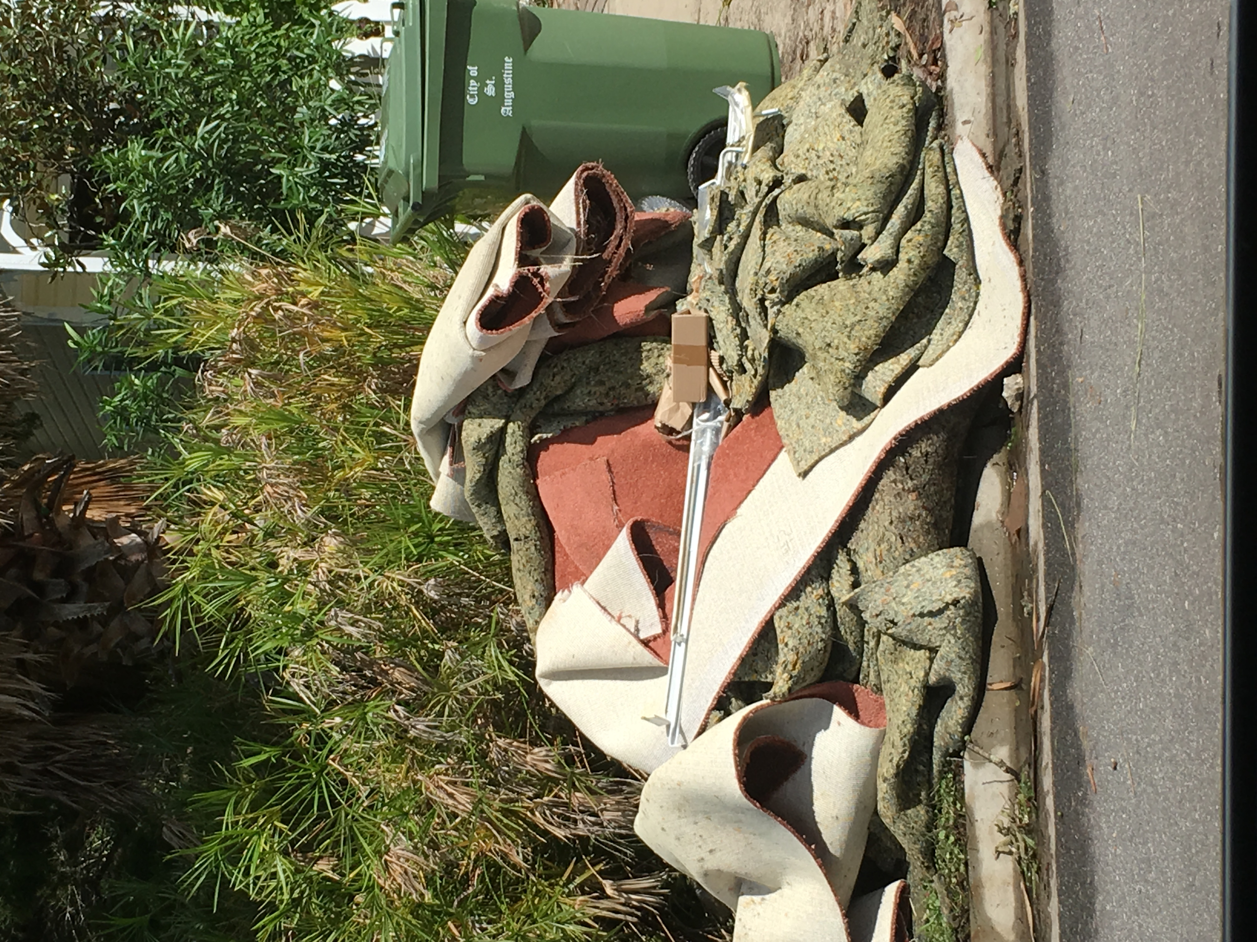
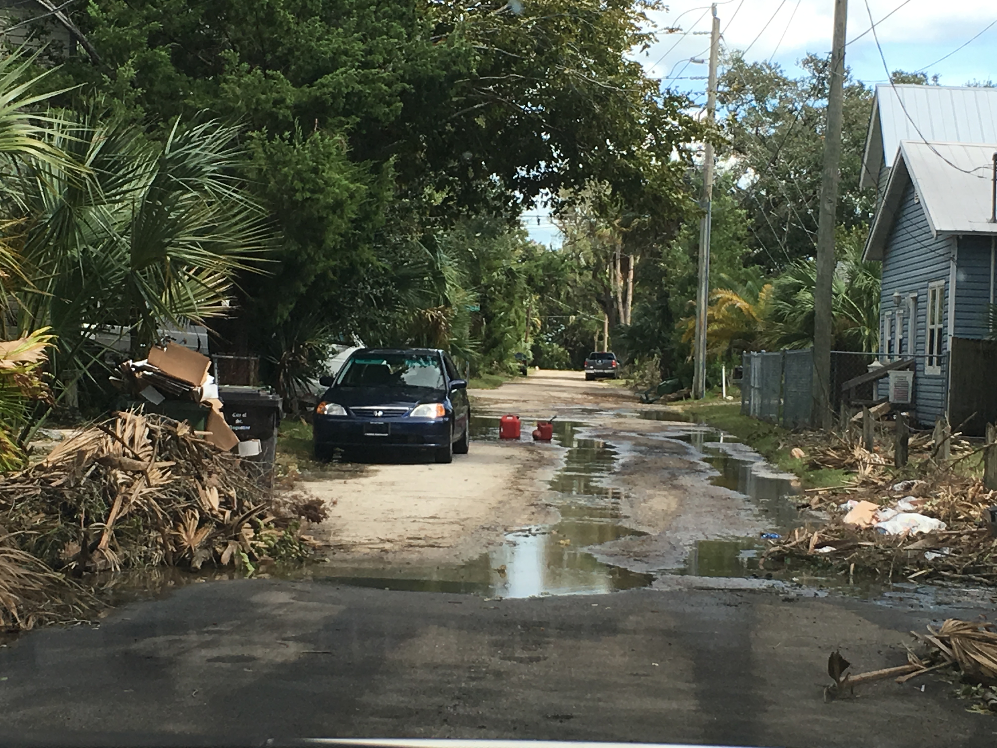
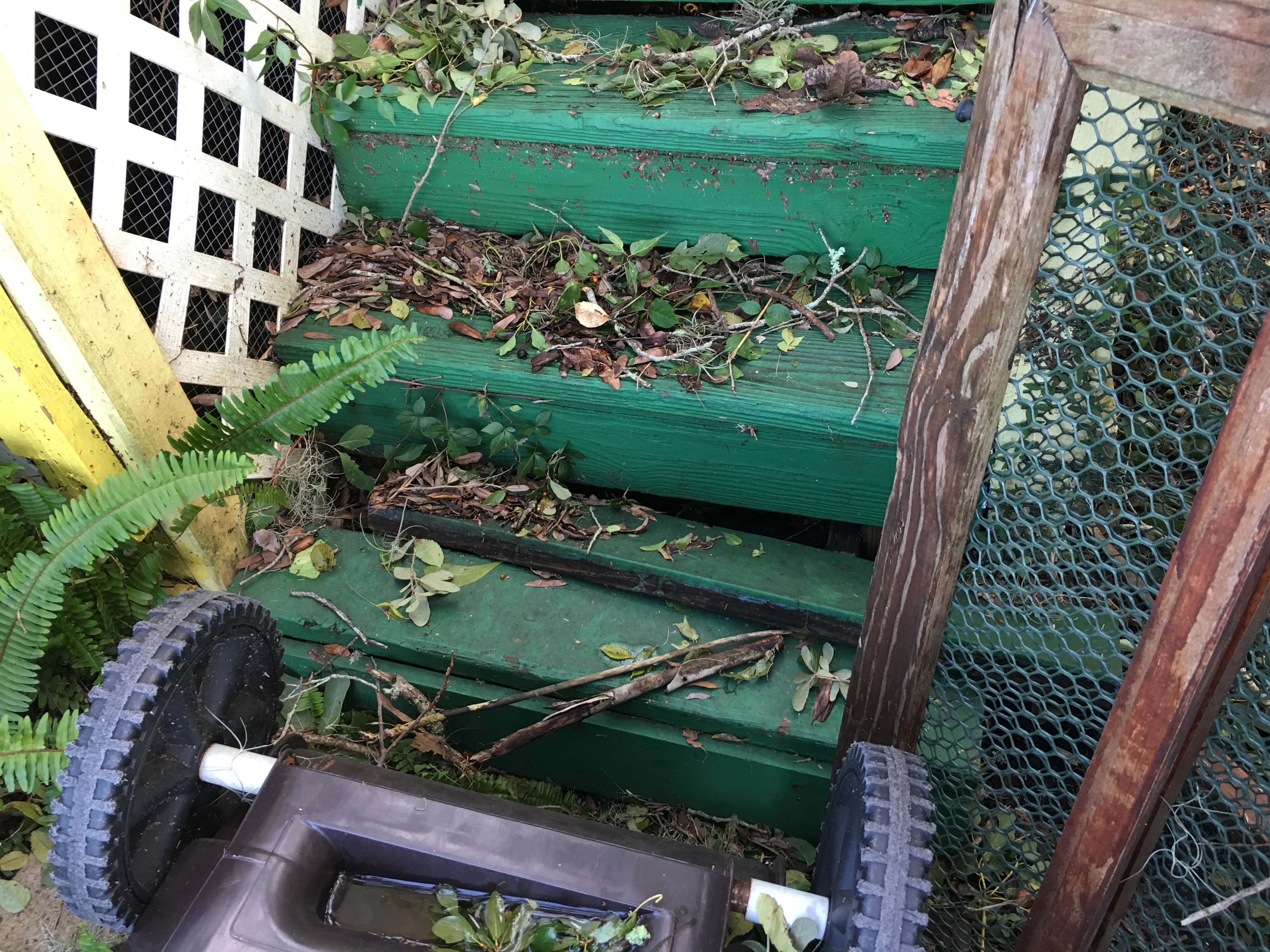
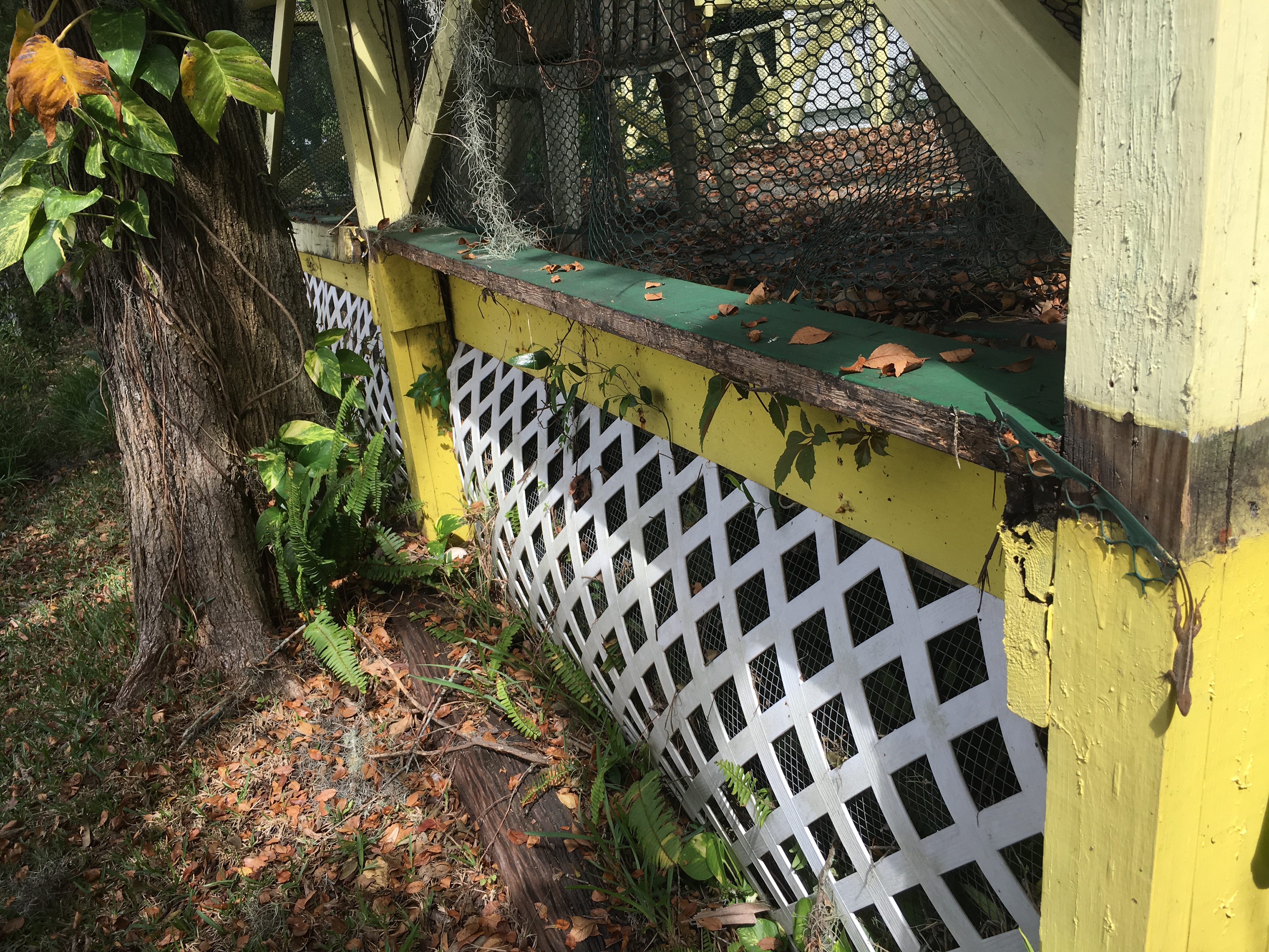
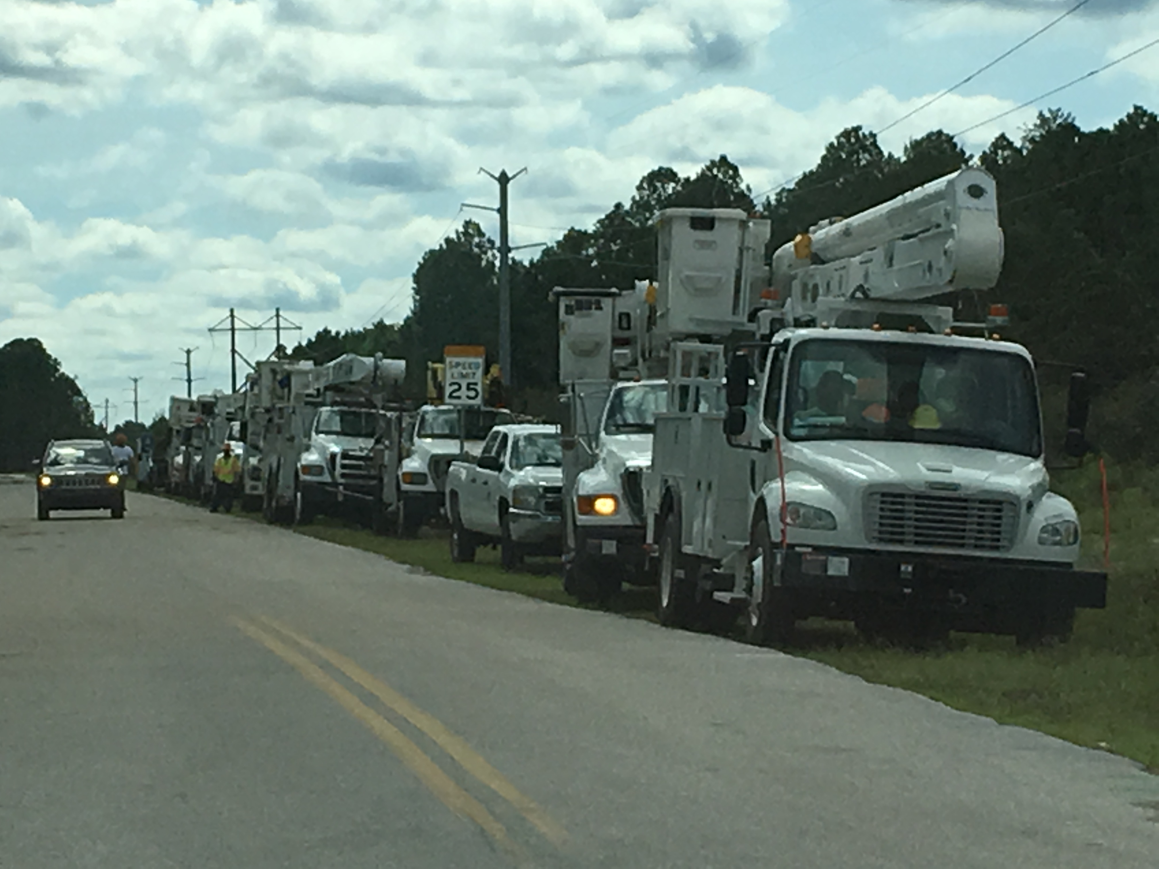
First problem after the storm surge retreated: numerous trees down. A few roofs blown off and power lines down everywhere (live power lines). Roads were still underwater across parts of Saint Augustine and some people were even trapped in their houses until the water levels went down. Chainsaw were the “chirping birds” this day. Everyone was out trying to cut down trees that were still threatening to fall over. Residents ripped out their carpets and damaged furniture and placed it along the curbside next to giant continuous piles of sticks and trees. Plastic tarps were being nailed to roofs to keep out the elements until insurance companies would come and assess the damage.
For my house I noticed after the storm surge retreated that the worse of the water was so strong that it moved the foundation of the back of my house slightly. The back part was starting to collapse!
This was the main damage along with a few trees down. At the timothy blog was posted I still have not had an insurance personal come out and assess the damage to help. This is not a surprise, there are bigger problems and so many of them. I will just have to continue to wait (holding up my house).
However, the main concern was still on Saint Augustine Beach. For hours people lines up waiting to get access to the beach area to either go home or check on their friends and family.

We started receiving false information from radio stations still broadcasting that the bridges to the island would be open at 12pm. Noon came… nothing happened. At this point rumors started to spread across Saint Augustine: “Bodies are in the water”, “The whole island is gone”, “All the roads are underwater”. This is normal after a hurricane. Everyone’s mind goes insane and these rumors fly around which bring more stress and potentially violent acts to the population. Usually after (and even during) a hurricane one big problem are looters. People are in a state of panic and break into stores or other people’s houses and steal what they can. This was a big problem during Hurricane Andrew (1992) and Hurricane Katrina (2005). Even for Matthew we had reports coming in through the storm saying that people were breaking into people’s houses during the storm. Though these reports later turned out to be false, there are isolated examples of this happening.
Hours passed. Bridge was still closed. People who were waiting in line were going out of their minds. Violence even broke out at some locations as rumors grew darker and darker. At this point I was sitting in line for about 2 hours waiting to gain access to the beach to check on another property that belongs to my family. I kept updating the public via social media on the situation and trying to inform everyone when the bridge would open.
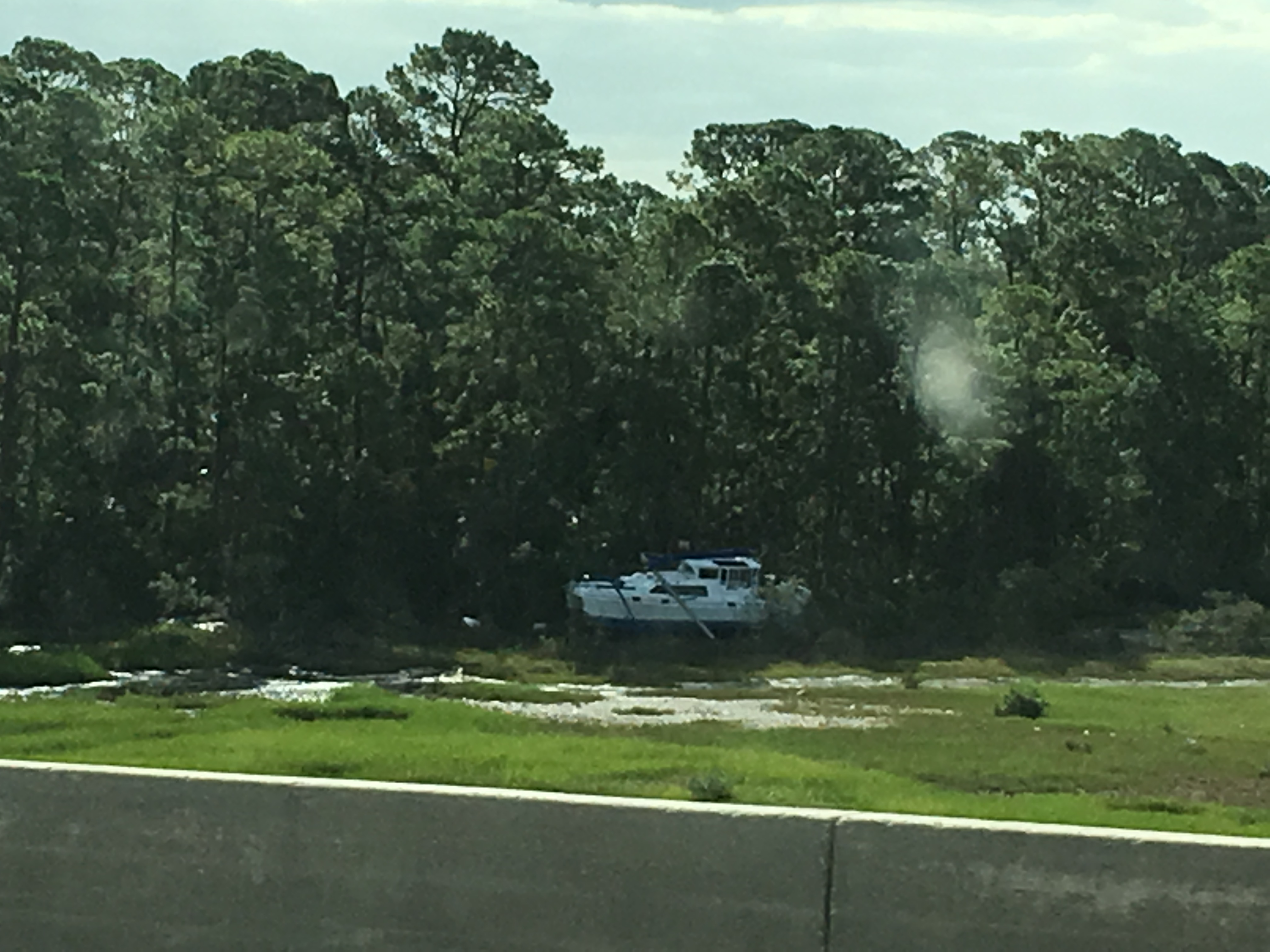
Finally at around 4 pm, the national guard allowed us entry and all of us expected the worst. The first thing we were all aware of was a big boat pushed up into the forest as you cross over the bridge:
Not the best sign so far. Next you notice the many signs that were blown down and torn apart:

For the most part though, we did not see the “bodies in the water”. For that matter there was very little water on the road. Keep in mind though that the National Guard came over and began cleanup in the early hours though. For the most part, nothing was too bad as we continued to the main beach area (street A1A).We even saw some creative plywood phrases:
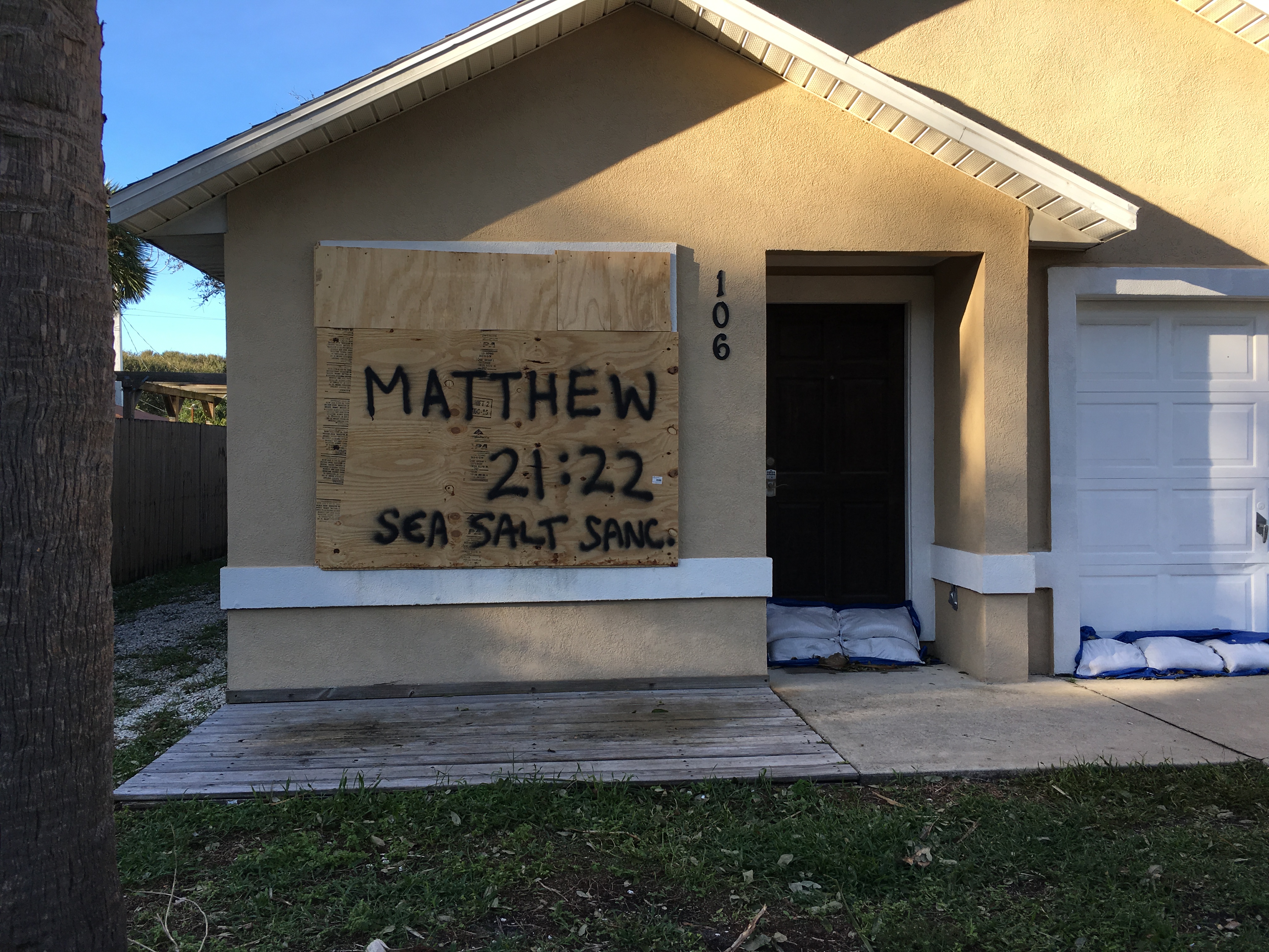
Always fun to see these everywhere.

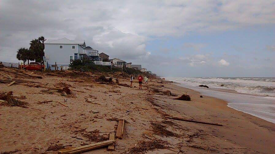
Our first glimpse of Saint Augustine Beach: the sign… still standing! Little flooded though. A live blog was filmed as I made my way down A1A Beach Blvd. to show the damage go to Weather Goddess FaceBook Page, and click through the videos. Now besides a few broken windows and some shingles ripped off roofs…. nothing bad. Really. The worst damage that I saw were fences down and a few trees. Residents who rode out the storm told me that the flooding wasn’t as bad as what they were expecting. Most of A1A was underwater but the water did not reach high enough to invade most of the houses. If anything it was the wind that created most of the damage because of all the trees that fell.


The good news is that thanks to the National Guard and Emergency personnel working early on the island, this area was the first to receive power. By the time we made it over there most of the island had power back on. But this was the question everyone was asking. Why was Saint Augustine Beach so lucky? It has a lot to do with the eye of Matthew, construction, and location.
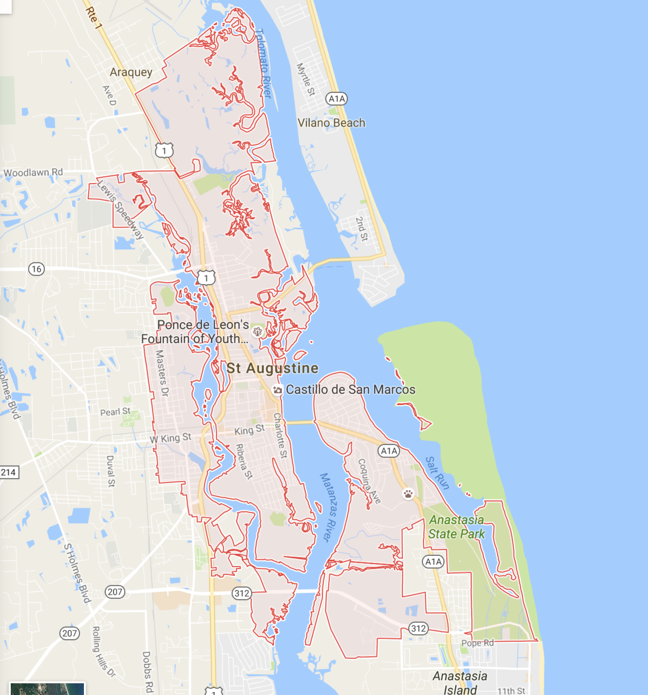
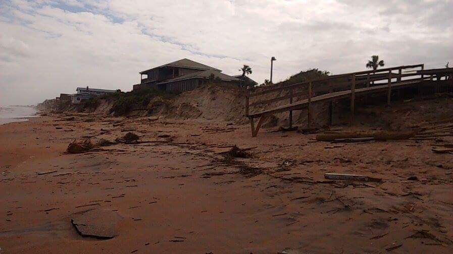
Saint Augustine Beach is located on Anastasia Island (bottom right) The main road to go through this area is A1A (yellow line) and just to the right you have a white line that bends Around the Anastasia State Park, this is A1A Beach Blvd. Most houses are located just along A1A Beach Blvd, still slightly away from the shore. This construction keeps houses further from the ocean and therefore Saint Augustine Beach is huge. You have to walk over a few dunes and a field of sand to get to the water. Here are some images of Saint Augustine Beach after Hurricane Matthew passed:


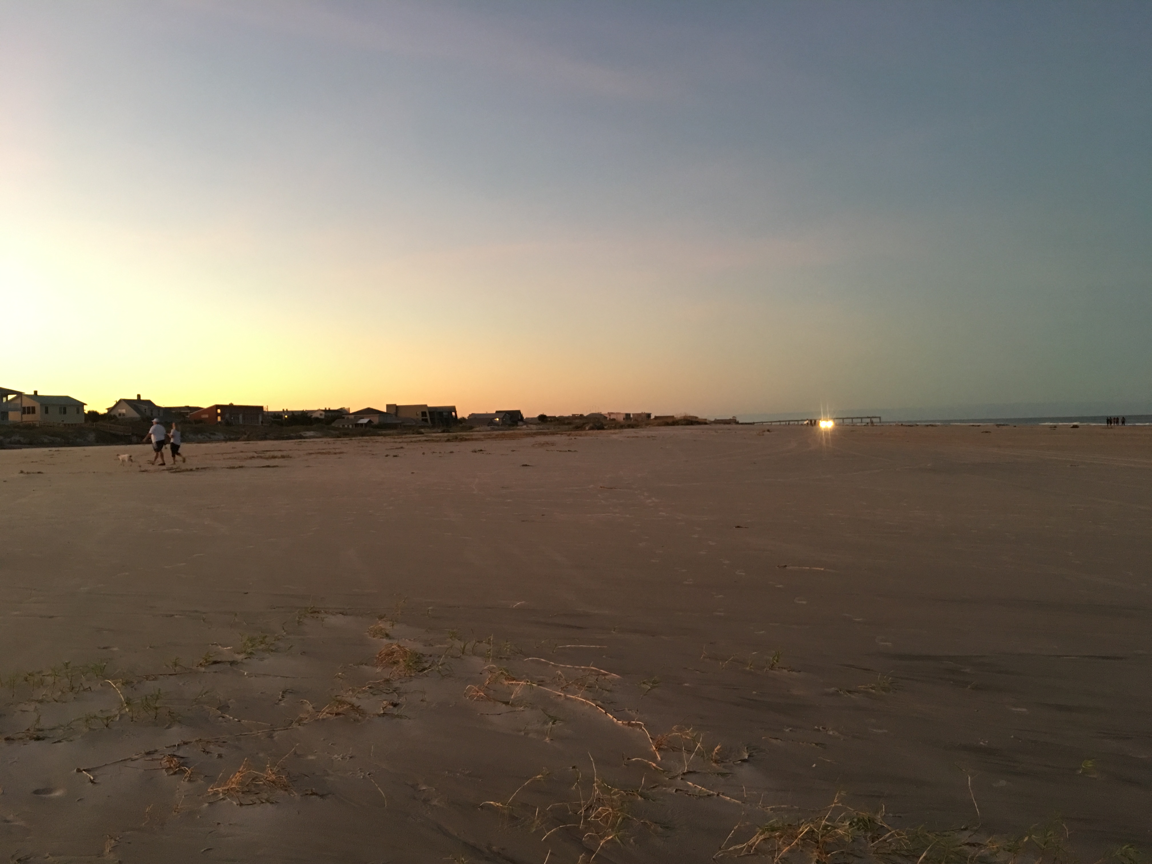
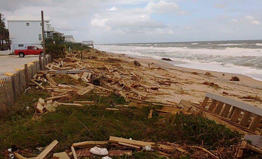
It’s a long beach. The only sad story is that the dunes were washed away from Matthew. I can also add that this one one of the most beautiful sunsets I ever experienced. Matthew may have brought destruction, but beautiful weather followed. In addition, Saint Augustine Beach came up with a genius plan. For each roadway that led to the beach, emergency personnel built a giant sand wall to help block the storm surge:
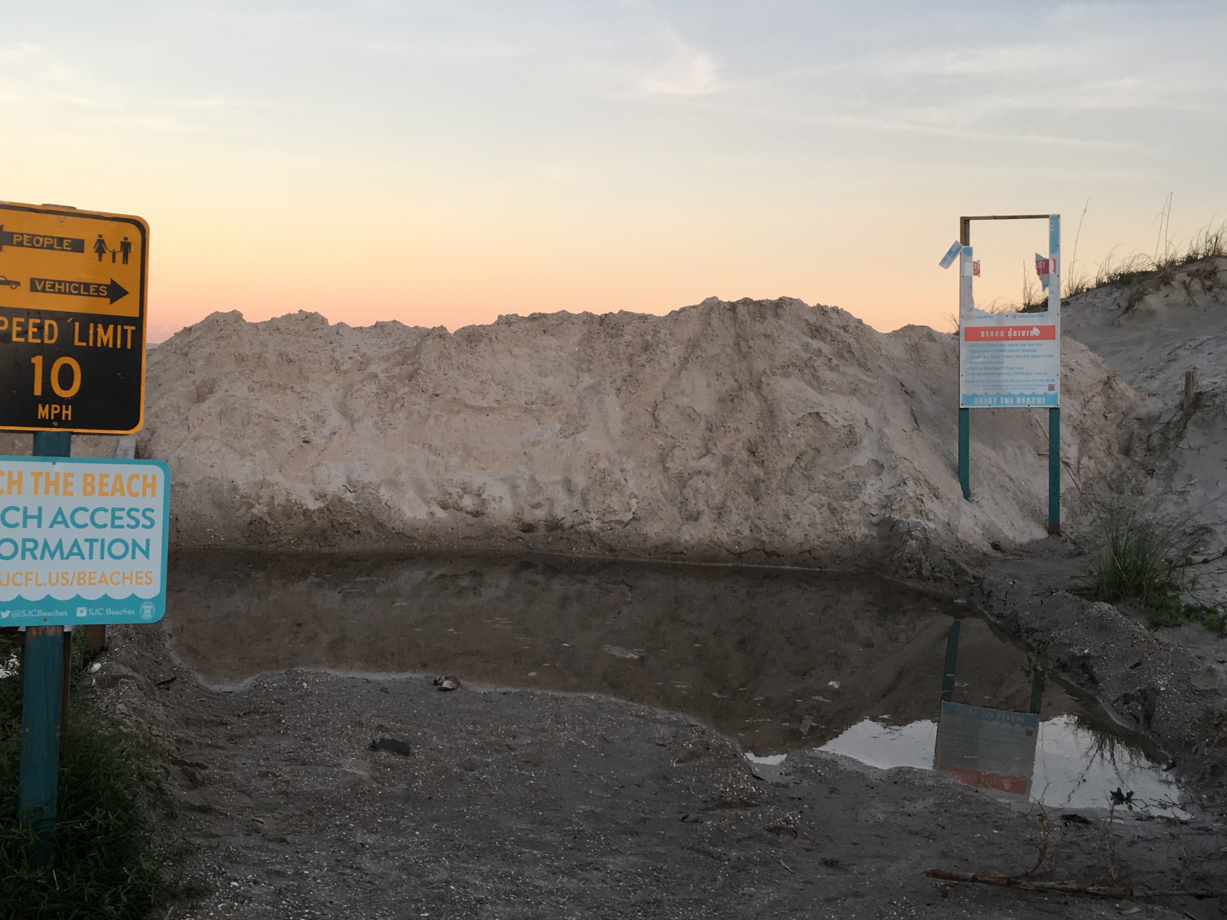
It did help! This wall was about 10 feet high but could have been higher before Matthew arrived. On the other side of this sand wall (where the beach is) everything was perfectly flat. Usually Saint Augustine Beach has hundreds of large dunes with beach grass and other vegetation surrounding them including a few fences to keep pedestrians and beach motor vehicle traffic apart. The dunes were all gone. Very small stumps of sand were left in some areas if the dunes were tall enough. The fences:
Completely covered in sand. These fences are about 4 feet tall. Matthew was so strong that it managed to bring in sand with the storm surge and cover these fences until they were completely entombed. If that sand wall wasn’t there, some houses close to the shore could have become this fence.
Now let’s take a look at downtown Saint Augustine located in the center of the map above. First thing you might notice, immediately surrounded by water on both sides. What made the storm surge so bad in this area was the force of the water pushing into the river systems and continuing to move further inland. Once the water was forcibly pushed in it could not go out easily. Because of Matthew’s powerful winds it pushed debris and sand into the mouth of rivers and sealed them allowing water to stay and accumulate. This is what happened in Saint Augustine. Water kept coming and could not be released back out to sea. Videos went viral in the downtown area during the storm surge (easily found on youtube). Here are a few pictures showing the surge rising in the downtown area near the Bridge of Lions:
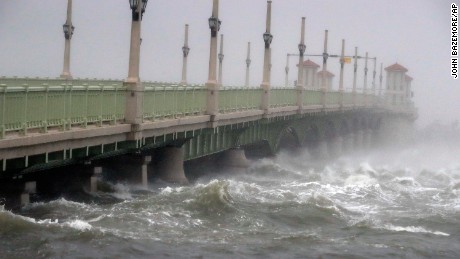
(Photos courtesy of First Coast News, Jacksonville Florida)
The water came up so high that it appears the “Bridge of Lions” could be submerged if the storm surge kept coming.
Finally, we look at Vilano beach, located just northeast of Saint Augustine. Notice where A1A is… VERY close to the shore. These houses are pretty much built right next to the ocean and are known to flood even during a simple thunderstorm. Whoever decided that it was a good idea to build houses along this shore is probably regretting their decision right now. Because the beaches in this are were so short and right up to the houses, the water immediately smashed right into the houses full force. This is why we see the destruction along this area (as well as Flagler Beach). Houses are either tipping over or are completely gone.
The Learning Experience
So what did we learn from Matthew? For starters, Florida’s hurricane drought (which lasted for almost 10 years) is now over. It’s a reminder that Florida is a state the experiences hurricanes, major hurricanes. It also reminded us a lesson that Hurricane Sandy taught us: hurricanes that undergo extratropical transitionary just as deadly as when they were tropical cyclones. The Carolinas saw the greatest damage in the form of flooding, and this occurred during Matthew’s transformation. Florida experienced the major hurricane side of Matthew: intense winds and high storm surge values. Florida had a typical tropical hurricane. Nothing that we have no seen before and defiantly not the last time we will see a major hurricane. What made this storm so deadly (besides the obvious meteorological components) was the length of time Florida went without seeing a major hurricane. The last major hurricane struck south Florida in 2005 (Hurricane Wilma). Since this time population has exploded in Florida. Many people who have moved have never experienced a hurricane and do not know what to expect. Matthew was a wake up call for all of Florida, even Miami which was spared.
I stated this in my master’s thesis on “Extratropical Transitions in the North Atlantic with Special Reference to Hurricane Igor”: just because a hurricane undergoes extratropical transition and weakens does not mean that the danger is over. The Carolinas learned this lesson the hard way from Matthew.
On a sadder note we cannot forget about the Bahamas, Cuba and Haiti which took the main hit of Matthew as it came across as a strong Category 4 storm. Haiti is one of the poorest countries in the world. This country was still recovering from the strong earthquake that hit in 2010. Matthew came through and destroyed everything again and even more. A tweet went out a few days ago indicating that 90% of southern Haiti was in ruins.
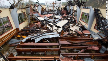
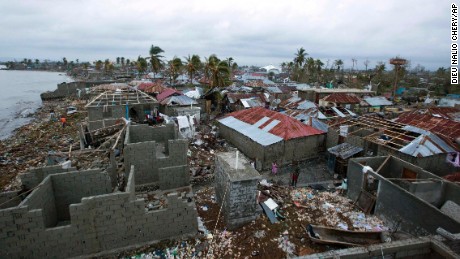
(Photos courtesy of CNN)
Death rates are still going up with estimates saying it could be in the 1000’s by the end of October. Haiti is no stranger to hurricanes, but because of the state of the government this country cannot withstand any natural disaster both meteorological and geological.
In one way we need to consider ourselves lucky in the states. There were other areas that had bigger problems and now they cannot recover from the disaster. While many of us are still waiting for insurance money, hot water and electricity we have to at least be thankful that these necessities will eventually come. For Haiti, this may not happen.
The Two Viral Images of Matthew
There are always some iconic satellite pictures from each hurricane. Matthew had two, each one burned into the survivors minds (at least it is for me):
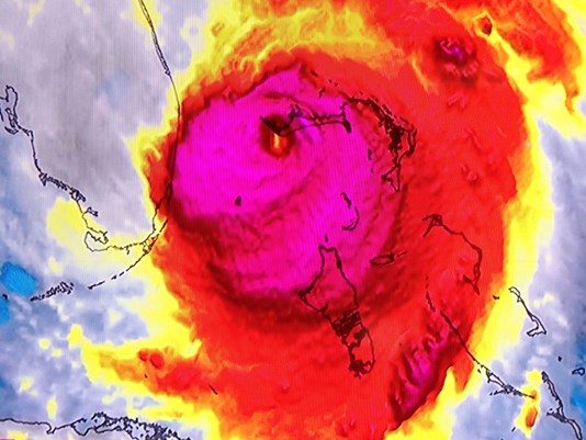
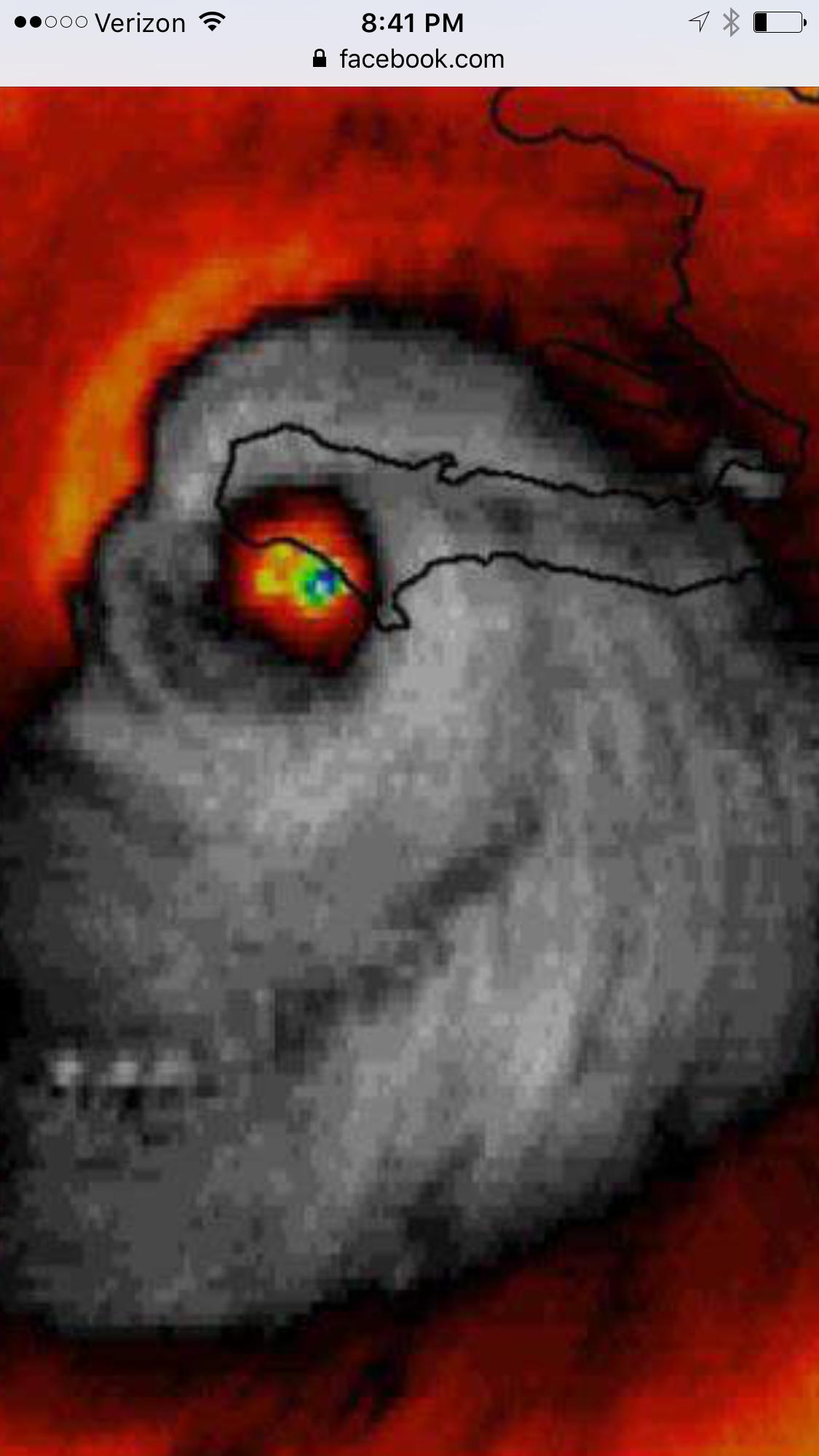
Above is one of the images that started to go viral across the web. This was Matthew just off the coast of Florida as a Category 4 storm. Does it resemble anything to you? A dinosaur maybe? Throughout the life of Matthew this storm had a few faces. The most famous satellite image would likely be this one:
Clearly shows a skull as Matthew was coming ashore in Haiti. A perfect picture for a storm considering the incredible number of deaths in Haiti (currently around 400 but likely to go up over the next few months).
Final Thoughts
Really what can you say after you have been through a major hurricane. The pictures say more than I can possibly write. The question I get asked a lot now is: “Would you go through a hurricane again?” Yes. Of course. It’s my job, it’s my passion, it’s my research. I want to take people through the storm and help them through it as much as possible. I hope that I at least helped and informed some of the residents that stayed across the First Coast in Florida. Our job as meteorologists is to keep you and your family (yes including your animals) safe. This is why we take you through the storm and give you an idea on nature’s fury. This is to show you how bad a situation can get and why the next time you should consider evacuating. Someone has to do this and just because we are meteorologists doesn’t mean we are immune to the weather. We are effected just as much as you are. We kept scared, we worry, we second guess our choices. But someone has to walk into that storm and report to help get others through it. This is my passion, and nothing will change that. I will see you all in the next storm that threatens my area.
I leave you with one last image. One of my dogs eating a chicken treat surrounded by foliage. We should follow her example and be happy that we survived. We can replace material items but we cannot replace lives:

Note: Videos showing the Live Coverage of Hurricane Matthew and more images can be found on the Weather Goddess Facebook Page and the Weather Goddess Twitter Page.
Live Coverage in Saint Augustine, Florida. Weather Goddess covering Hurricane Matthew
Updated October 06, 2016 @ 3:16 pm EST
Due to the severity of Hurricane Matthew and how conditions are changing so quickly I will now be doing short vlogs (video blogs). Please click on the links below which will take you to the official FaceBook and Twitter pages of Weather Goddess. Videos and Information regarding the storm will be posted there. As long as I have power and cellular reception I will be blogging and keeping you safe through the storm. These are your last few hours to prepare Florida and Georgia.
Matthew Approaching Bahamas. Game Over Florida; Major Impacts Expected
Updated October 05, 2016 @ 1:46 pm EST
Note first. These written forecasts may be updated to short videos soon. Due to the severity of the storm and the impact that Florida will be receiving it will be easier to give video updates and warnings.
Track has changed very little over the last few hours. If anything it has become worse and we have a tiny little Tropical Storm to thank for this. Just to the east of Matthew we have Tropical Storm Nicole that formed.
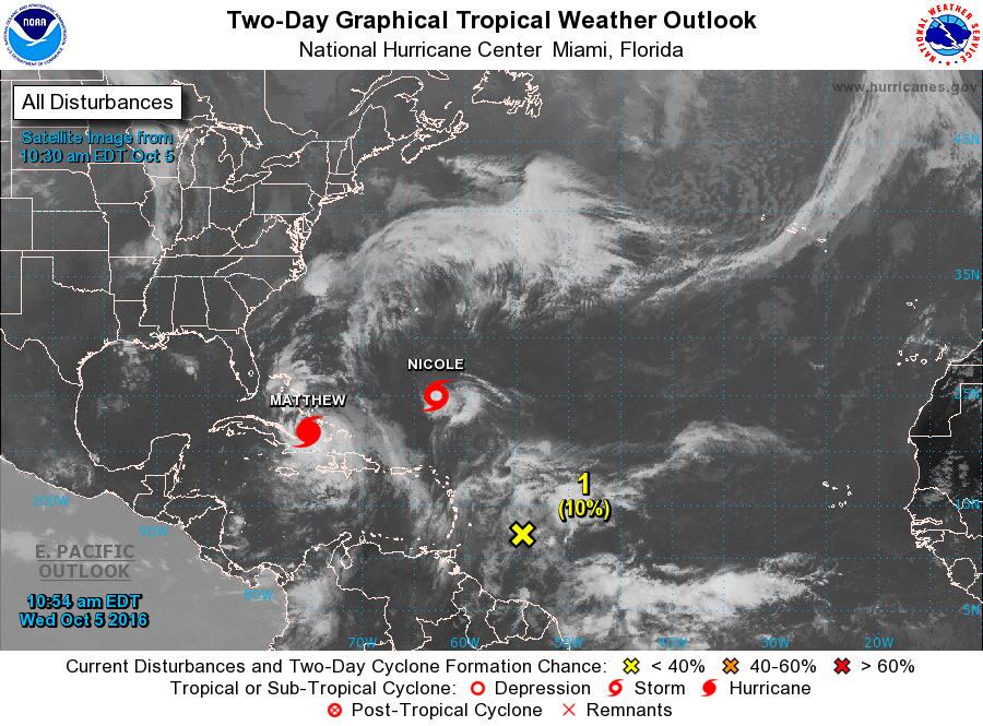
This little storm is not expected to make an impact anywhere for a while as it is lingering just to the south of Bermuda and swaying back and forth:
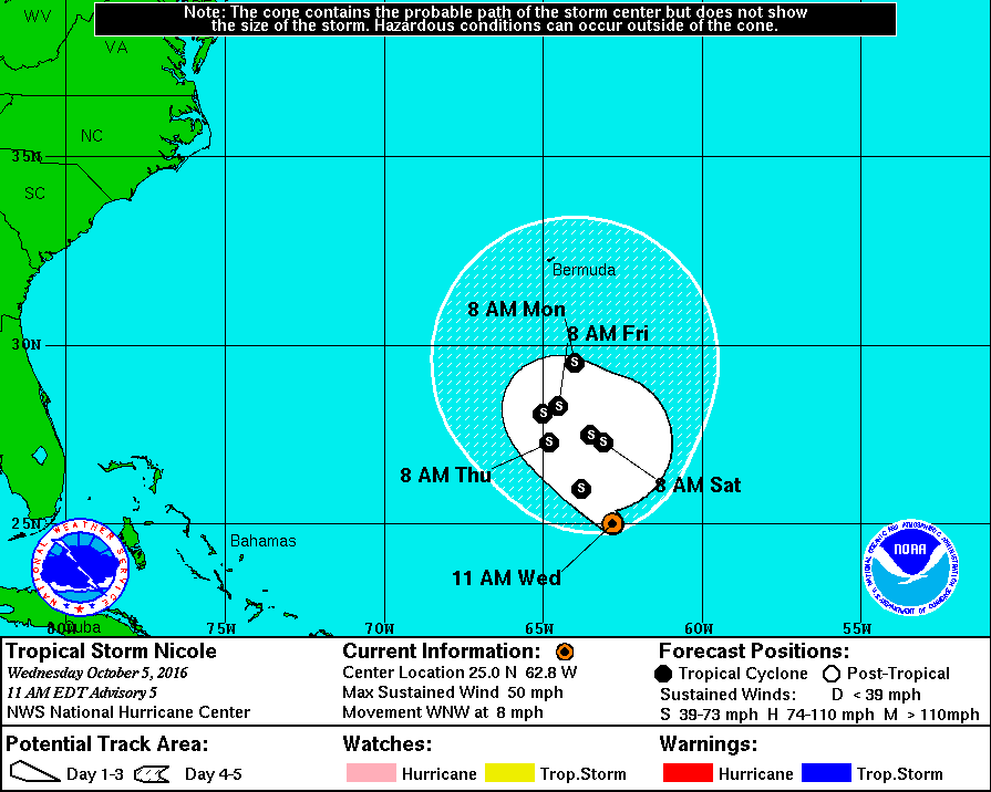
However, this tropical system is having a say on where Matthew is going and could pose an interesting threat over the next few days. We will not discuss this now but we will talk about it in the next few days if conditions are still possible (if you want to read ahead on this start looking up Fujiwhara Effect).
The main problem is that Nicole is pushing slightly against Matthew and keeps it further west, right along the east coast of Florida.
Late last night Matthew pushed through Haiti and extreme eastern Cuba as a powerful Category 4 storm. Heavy rains lashed the islands and flooded roadways and downed power lines. A few major bridges were washed away in Haiti leaving areas stranded and cut off from aid. Death toll was at 8 late last night but is expected to rise as aid workers push through and enter these cut off areas.
Now let’s take a look at Matthew and where he is going next:
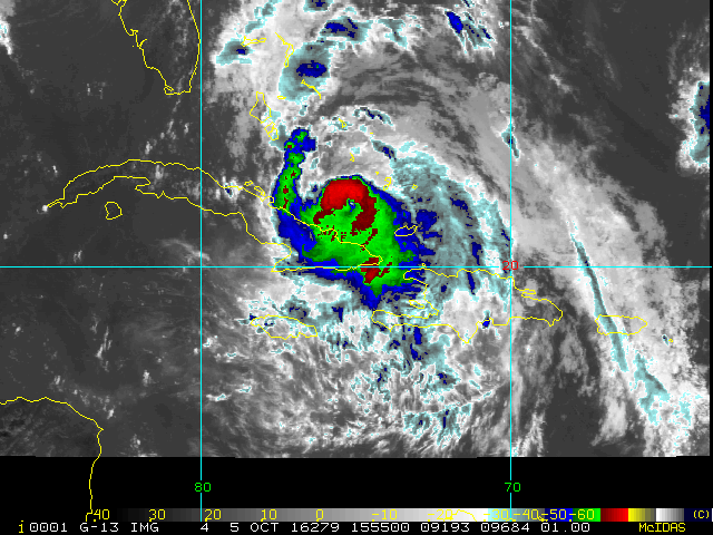
(Click for animation if not showing)
Matthew is moving further away from Cuba and now entering back into the Atlantic currently as a Category 3 system. The Bahamas are now under a hurricane warning and the islands have been preparing non-stop for this system. Storm Surge values are estimated to be up to 15 feet for some of the islands. That is an insane amount of water, especially on tiny islands where there is very little land mass in general.
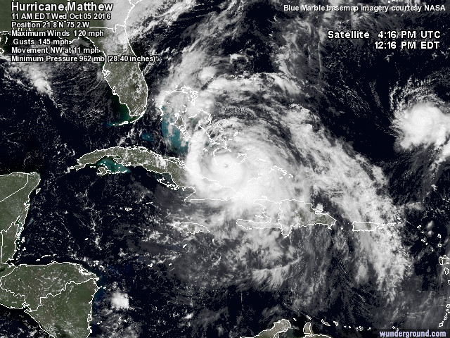
Although the storm is now down to a Category 3 it is expected to restrengthen once more as it approaches Florida. This is thanks to its (still) very slow forward speed. Matthew is now turning NW and moving at 11 mph giving this storm ample time to strengthen over the warm waters surrounding the Bahamas. This strengthening is already evident by looking at the eye that is starting to reform in Matthew.
Late last night (October 4, 2016) while Matthew was impacting Cuba it started to struggle a bit as it was interacting with land. The eye began to dissappear and pressure started to rise to 950 mb (it was closer to 940 mb earlier that same day).
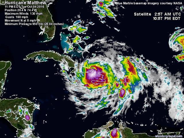
(Matthew struggling as it impacts eastern Cuba on October 4, 2016).
Matthew went from a Cat 4 down to a Cat 3 as it exited back into the Atlantic. Pressure is now at 962 mb showing that it is weaker compared to last night. Hurricane Hunters are currently flying through the storm to determine the maximum wind speeds and the lowest pressure that is currently in the storm. The next advisory will be up at 2pm. It could be that Matthew will be back to Category 4 status at this time (although more likely to be at this stage tomorrow, October 6, 2016). However, we are expecting Matthew to restrengthen once more and be a weak category 4 before it approaches Florida.
Once again Matthew has been a very complicated storm to forecast and a lot of it has to do with its slow forward speed. We are to the point now that we have a fairly good idea on where Matthew is going in terms of Florida. Hurricane warnings are now issued from West Palm Beach up to Melbourne and these are expected to move further north in the next few hours.
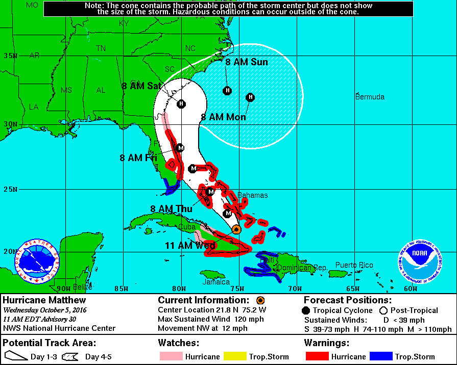
Here is the question on everyone’s mind: “Will Matthew make a direct landfall?” We don’t know, no one knows. Matthew is walking the “tightrope” meaning it is forecasted to go super close to the east coast of Florida and could possibly just skim the coast line (probably around Cape Canaveral). At this rate it doesn’t matter if Matthew makes landfall or not. The eye of Matthew will come so close to shore that heavy impacts will be felt regardless. The closer the eye is to the shore the more likely we will see an increase in damage (being that the eye wall contains the most damaging winds and heavy rains).
At the moment this is what Florida will be preparing for:
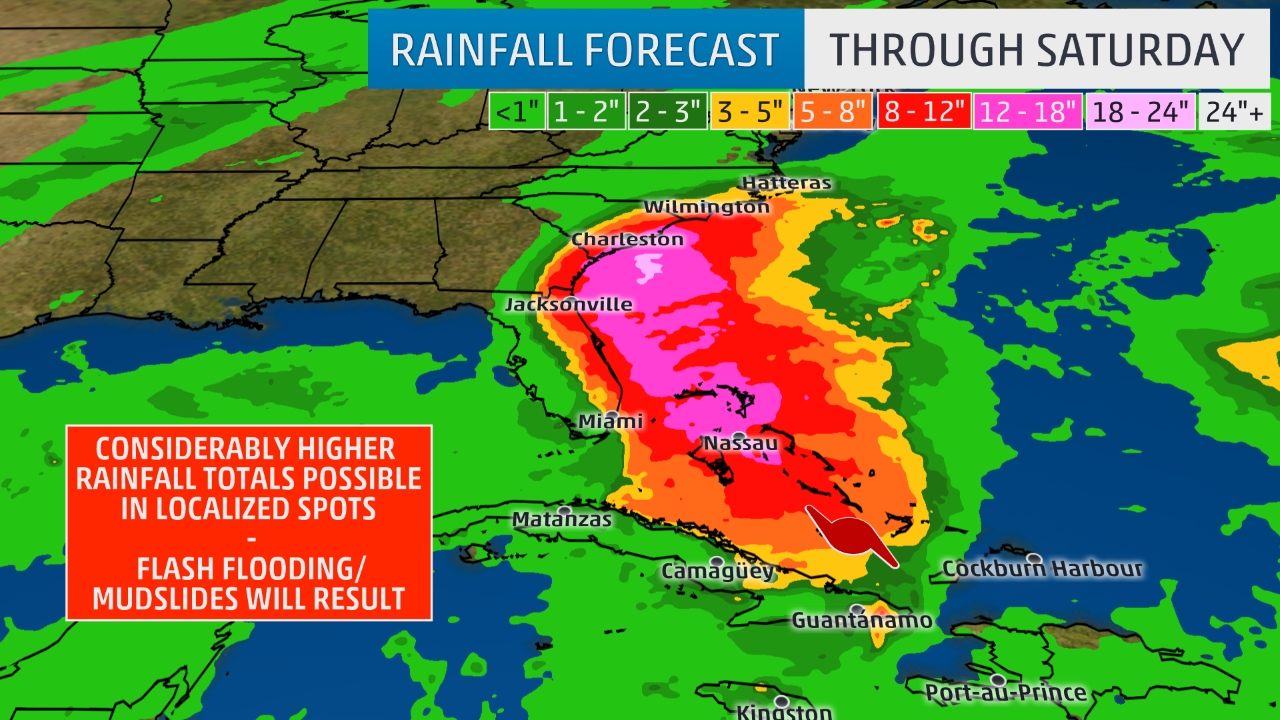
Rain will be the main threat to the east coast with some areas expecting to see 12-18 inches of rain as Matthew pushes through. A big concern is how saturated the ground currently is in Florida. For example, the past few days northern and central Florida has had a stationary front right above dumping immense amount of rain which has been backing up drains and flooding roads. This is the worst case scenario. Matthew isn’t even here yet and already areas are being flooded by a simple frontal zone. The soil is too wet to suck up anymore rain and rivers and lakes are filled. Very bad news for these communities as Matthew approaches. Flooding will be the number one threat with Matthew even far inland. On a personal note, this is what concerns me the most. I am currently residing in Saint Augustine, Florida and my house faces a lake which is connected to the ocean. The lake is already filled up and minor flooding is already taking place outside my home. With Matthew approaching I expect half my house will become a floating home. Many residents are experiencing the same issues and concerns as well. The best defense for this would be sandbags. Although not a permanent solution it can help to keep the water away from your property.
Next threat: winds.
The forecast will likely change as Matthew churns closer but south Florida around the Miami area will be the first to experience the gusty winds of Matthew (expected to be a Catgeory 4 storm with winds of around 131 mph at this point).


By Thursday Miami should be experiencing winds of around 60 mph as Matthew approaches with less wind speed values further north. On Friday north Florida will start to feel more of the stronger winds.
Currently the east coast of Florida has a 50% chance of seeing hurricane force winds (74 mph or greater). This percentage will likely grow over the next 24-48 hours.
Finally Storm Surge:
Storm surge and especially beach erosion is what is causing a mass amount of evacuations along the east coast and even as far up as South Carolina. The threat is very real from Florida all the way up to North Carolina. For the first time the National Hurricane Center is issuing watches and warnings for storm surges. From West Palm Beach up to Palm Coast, Florida we have a storm surge warning indicating that storm surge condition will occur in the next 48-72 hours. Northward of Palm Coast we have Storm Surge Watches meaning that conditions are favorable for storm surge. Right now we are forecasting 5-6 feet storm surge values along the coast with higher values in Georgia and South Carolina (around 10 feet). Once again, as the system approaches and the strength changes these numbers will likely change. Georgia and South Carolina will receive the worst of the storm surge due to the shape of their coast lines and the northward direction the storm is taking. The water has nowhere to go but further north and straight into land.
So let’s wrap this up and discuss what you need to do if you are living along these areas. State of Emergencies have been issued from Florida up to North Carolina. Evacuations orders are underway as well. Review your evacuation route and the evacuation zone you are in. If you are close to the shore you will be the first to be evacuated. This is the time to leave. Hotels and Motels across Florida are filling up fast you need to go now to get a place to stay. Shelters are open for the public. Some of these shelters allow you to take your animals but please seek a shelter for your pets. Pet shelters are open and taking in animals. Now is the time to get your furry friends ready. Do NOT leave them behind.
If you are staying and riding out the storm here is what you need: batteries, NOAA Weather radio/regular radio, 1 week worth of extra medication, 2 weeks of drinking water, non-perishable food (canned food), flashlight, blankets, towels, emergency medical kit.
Check in on your neighbors, especially the elderly and help them. Many are scared and do not understand the dangers or how to get out of their home and go somewhere.
Fill up your gas tanks now. Lines are around the block all throughout Florida, Georgia and the Carolinas, but you want to have enough gas in your car to get out of harms way. Gas lines will probably be down after the storm and won’t be repaired for a few days.
Get some cash out of the bank. ATM’s will be locked after a hurricane usually and no one can get money out. Get at least $300 if not more in case you need cash for a few days after the storm.
As for your cars, if you do not have a garage consider placing them in a garage building that is solid concrete (preferably above ground). This will protect your vehicle from flooding and projectile damage.
Once more this is a dangerous hurricane that is currently over the Bahamas and expected to restrengthen back into a category 4 storm as it approaches Florida’s east coast. These are the last few hours to prepare and everyone should take this seriously. This is the first major hurricane to threaten Florida since Hurricane Wilma in 2005. If you need to evacuate do so now. Get your house ready if you are staying. Take in patio furniture, take in your pets, secure any loose objects.
I will be staying in my home in Saint Augustine, FL throughout the storm giving up to date information on Matthew as it approaches. Power outages are likely and cell phone towers could be affected cutting off communication.
I will try to post video blogs during the storm to get your the information faster. Otherwise go over to Weather Goddess Facebook page and Weather Goddess Twitter for the latest information and posts regarding the storm.
Matthew is a very rare and unique storm and has already broken a few records with possibly more on the way. Currently it is the longest lived Category 4 hurricane for the month of October as well as the southern-most Categroy 5 storm to have ever formed in the North Atlantic Basin.
We will get through this together. Florida has been hit by hurricanes before and we have managed to survive. Get ready for this storm because time is running out!
Florida State of Emergency. Track Shifts Westward
Updated October 04, 2016 @ 12:13 am EST
There comes a time when meteorologists and the public alike come to realize that modern technology is not enough to forecast the weather, especially dangerous weather like hurricanes. This is one of those times. Hurricane Matthew has made a big mistake over the last few hours and has therefore put more lives at risk for the coming days.
Pin the last blog and advisory that was published earlier this morning we discussed Matthew’s forward speed and how it will be changing over the next few days as it continues northward and over the Caribbean Islands. Meteorological models picked up on the fact that Matthew would be moving at a faster forward speed once it began a northward turn. This increase in speed would have allowed the storm to interact with a frontal region that is currently over the state of Florida and moving eastward.
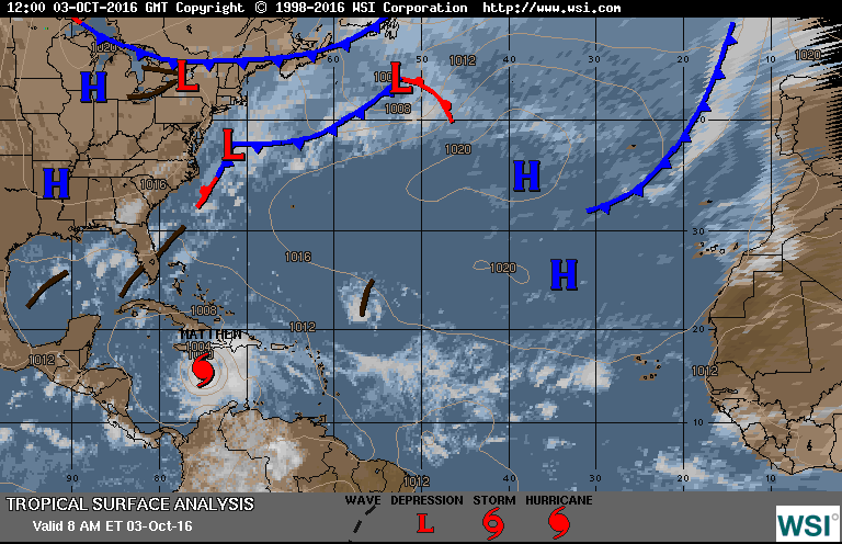
This was the image that was discussed earlier showing the frontal region over Florida (shown in black). This area would have helped to keep Matthew further east and away from land. Although, still present, this front is weakening considerably and is less likely to make a big impact on Matthew now.
The low pressure that was dragging this front behind it is now moving further east and leaving its weakening frontal area behind. Matthew, ideally, should have interacted with this system and have been kept further to the east while still skimming the east coast of the United States (but further out). Now that the frontal area has weakened Matthew has more of a chance to churn closure to Florida causing heavier rains, gusty winds, and storm surge which will likely cause extensive beach erosion for Florida as well as Georgia and the Carolinas in the coming days.
So here is the latest track from the National Hurricane Center:
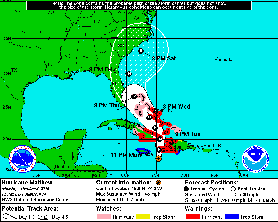
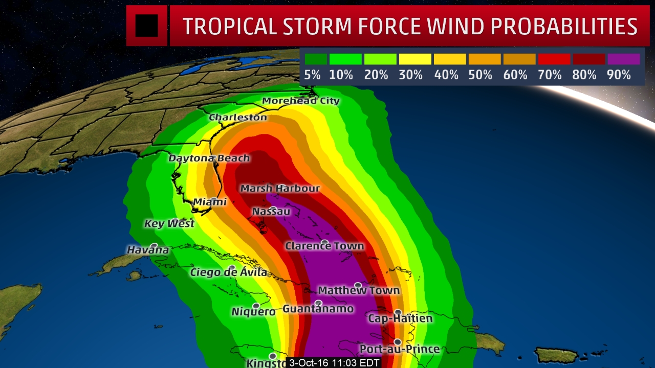
Florida is now further in the “cone of uncertainty,” and even though a direct impact is still a few days off from being confirmed Florida is now in a State of Emergency. Without a doubt Florida as well as Georgia and the Carolinas will feel some intense impacts from this system. Just like I mentioned in my previous entry, just because a hurricane does not make landfall (eye goes over land), does not mean an area will have no impact.
Florida was always going to receive an impact from Matthew even before this track shifted, the only difference now is that the storm will be coming so close to shore, that the Sunshine State will see a stronger impact. Currently, there is a 60% chance of tropical storm force winds that will be experienced for southern and central east Florida. This could be higher in the coming days as Matthew pushes through the Caribbean and back out into the Atlantic.
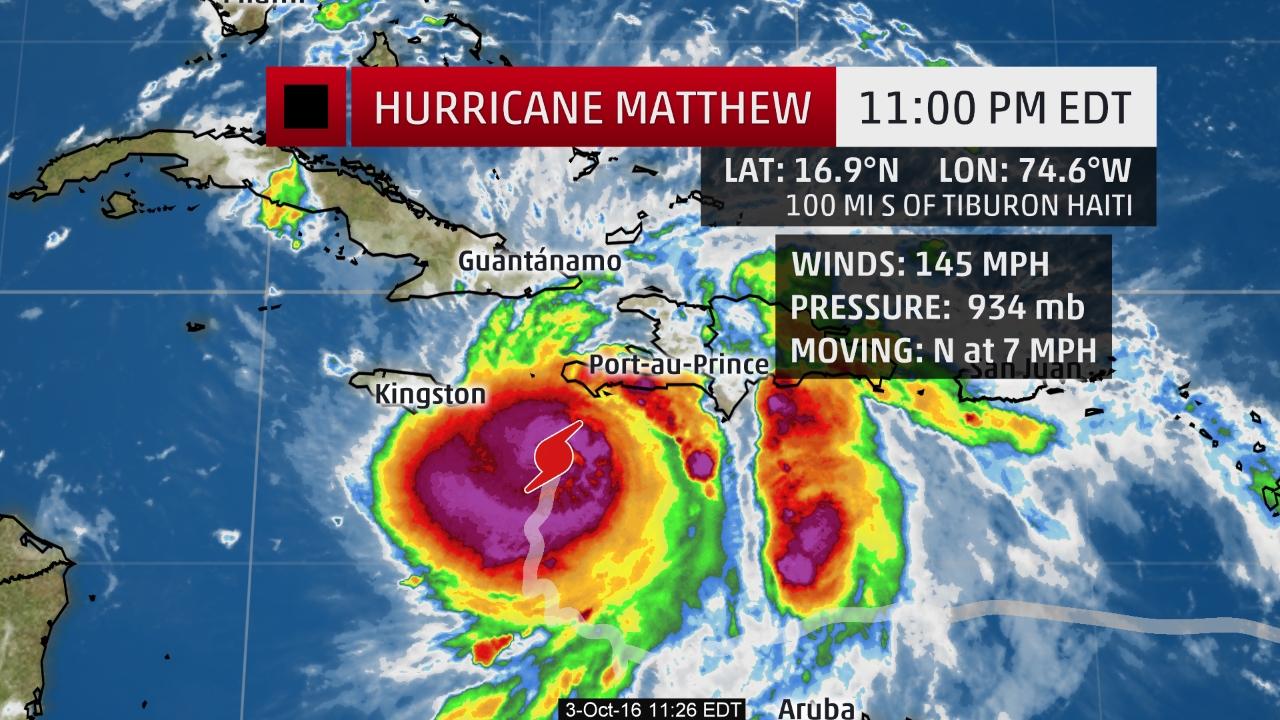
In addition another factor caused Matthew to change its path very slightly. Matthew is back up to a strong Category 4 system. However, it is still growing and strengthening. Pressure was around 945 mb last night (October 2, 2016) and dropping into this afternoon where it stayed at about 941 mb. However, the pressure is still going down indicating strengthening. Pressure as of the 11pm update is at 934 mb! Incredible but horrifying. Also, because of this strengthening the hurricane has managed to shake off the two “blobs” that were hanging on the right side of the system. Matthew managed to reform itself and become more organized as pressure dropped. Usually when there is a very low pressure, all of the thunderstorms that are surrounding the eye start to become more tightly compact. Everything rushes to the center and the storm becomes more organized and sturdy. This is what we are seeing here. Now with the decrease in pressure and thus the added wind speeds, Matthew has a little say over where it will go. Notice how on the left side of the system the thunderstorm activity has grown compared to the last advisory.
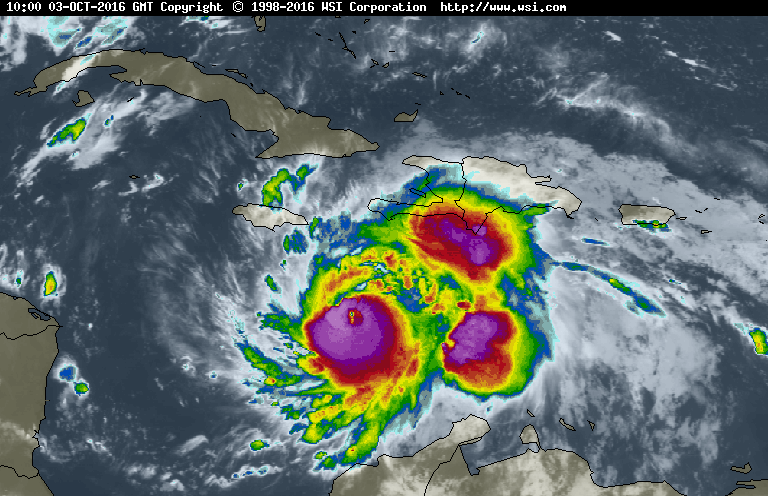
(Matthew earlier on October 3, 2016)
Clearly there is now more thunderstorm activity and more structure on the left side of the system. We can call this a “leaning effect”. Hurricane have weight (surprise surprise). In many cases it can alter a storms path slightly. Being that the left side is becoming heavier, Matthew can turn itself slightly towards the heavier side, which would be to the west. This has not been studied extensively but past hurricanes have exhibited this strange but obvious trait. Now let’s be clear. This little piece of knowledge is only effecting the storm a little bit in its direction. One of the main reasons is that Matthew was too slow to come into contact with the frontal area that was supposed to “slap it” and keep it further to the east and away from the East coast of the United States. Alas, this isn’t the first time a hurricane proved us wrong. What is important now is that the southeast coast of the United States needs to prepare now. Impacts will occur regardless on if the storm makes landfall or not.
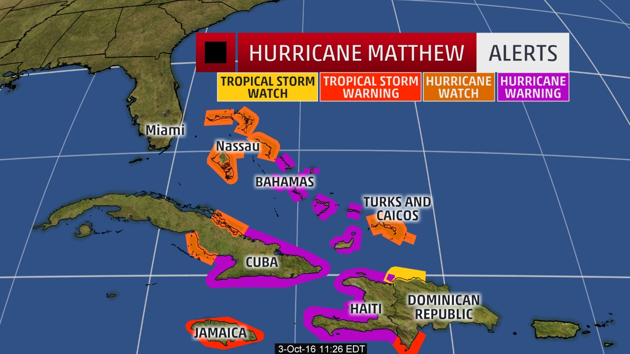

Hurricane watches and warning are up for the Bahamas and Florida is likely to follow soon. Possibly as early as tomorrow (October 4, 2016) the southeast coast of Florida will be in a Hurricane Watch zone, followed by northeast Florida.
Rain forecasts are still coming in but areas close to Cape Canaveral, Florida could see 5 – 8 inches of rain so far. These values will likely change in the next couple of days.
In closing, Matthew tricked us, changed form, missed its opportunity to interact with a frontal region and is now shifting westward closer to Florida. Once again, a State of Emergency is in place for Florida and evacuations have taken place for a few areas. This is the time to prepare. Matthew is likely to remain a major hurricane (Cat. 3 and higher) as it travels close to the coast Wednesday – Friday.
Avoid shorelines, storm surge will be possible over the next few days as well as heavy rip currents. River flooding will also be a main concern as water will be pushing heavily against the shoreline.
Heavy rain will likely be accompanying the storm, especially if the left side of the system holds together where we are seeing a large amount of rain currently.
Next blog and forecast will be up soon as more updates are made and more computer models come through. Prepare now, Matthew surprised us once, and could very well continue to surprise us… And not in a good way.
Ready or Not, Here Comes Matthew to the Caribbean; is the United States Next?
Updated October 3, 2016 @ 11:40 am EST
Game Over for Haiti, Cuba and Jamaica, Matthew is now speeding towards you and preparation time is coming to a close. Late last night we saw a decrease in strength from Matthew as it was continuing to stay in its favorite spot just south of the islands. Matthew has been staying in this area for the past few days enjoying the warm Caribbean waters and the very low wind shear values. This helped the hurricane grow into the monster Category 5 for a brief amount of time.
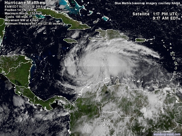
(Matthew close to Category 5 strength)
However, very similar to Tropical Storm Julia, which we discussed back in September, the slow speed that Matthew is going is killing the storm. A hurricane cools the waters beneath itself due to all of the cool rain that is being dumped into the ocean. Once the waters reach below 80F (about 26.5C) the storm starts to weaken. So due to the fact that Matthew has been overstaying its welcome in this area, it pretty much is killing itself. This is why we are seeing the storm downgrade to a Category 3 system. However, this does not mean that the storm is dying completely and we have nothing to worry about. All vacations have to come to an end, and this is the same for Matthew. Matthew is now finally starting to gain some forward speed and work its way northward. Now that forward speed is in play Matthew is entering territories where the ocean water is warm and has not been affected by its cooling rains. This equates to reintensification and we are currently seeing this take place.
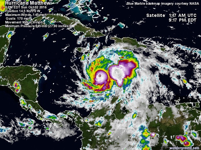
Late last night (October 2, 2016) Matthew looked like the above image. Pressure was rising to 945 mb, indicating the storm was loosing strength. In addition the shape of the system changed and began to take on some unhealthy characteristics. The bright colors (heavy thunderstorm activity = colder and higher cloud tops) started to become more of a spiral shape, and sections were breaking apart away from the center of low pressure. This is an indication that some drier air (possibly from the higher levels of wind shear just to the north of Matthew) is being sucked into the storm. However, let’s look at today:
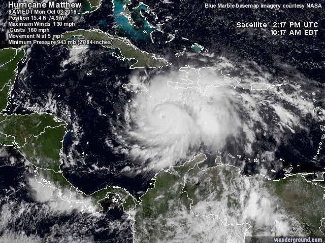
Yes, we still see some of that dry air that is being wrapped into the storm (you can see it in the second image where there appears to be a line curling around just north of the eye), but look to the right side of the storm and you will notice two massive purple areas. This system managed to create a second heavy thunderstorm area outside of the eye where heavy thunderstorm activity is occurring (depicted as purple and white colors). For days meteorologists have been teasing the storm noting the “extra blob” it was carrying with it to the right of the eye. Well now Matthew has split it into two large clusters. Very dangerous as this is the area that holds the majority of the rain. Worst of all it is heading straight for Haiti. A nation that does not have the infrastructure to withstand major natural disasters such as Matthew. Haiti is still cleaning up after the devastating 2010 Earthquake and hasn’t managed to get completely back on its feet yet. The last thing this nation needs is a large natural disaster like Matthew.
The latest forecast so far from Hurricane Matthew: At 1200 UTC, 03 October 2016, Major Hurricane Matthew was located in the North Atlantic basin at 15.4°N and 74.9°W. The current intensity was 120 kt and the center was moving at 5 kt at a bearing of 5 degrees. The minimum central pressure was 941 mb.
Now we are seeing the pressure dropping again from 945 mb (last night) to 941 mb, currently. Immediately we can say that Matthew is restrengthening as it moves northward and will likely be a Category 4 when it makes landfall late tonight or early Tuesday morning somewhere in southwestern Haiti before moving over to extreme eastern Cuba.

Hurricane warnings are up for the following: Jamaica, Haiti, east Cuba, and the central Bahamas. Tropical Storm warnings are up for the southwestern shores of the Dominican Republic.
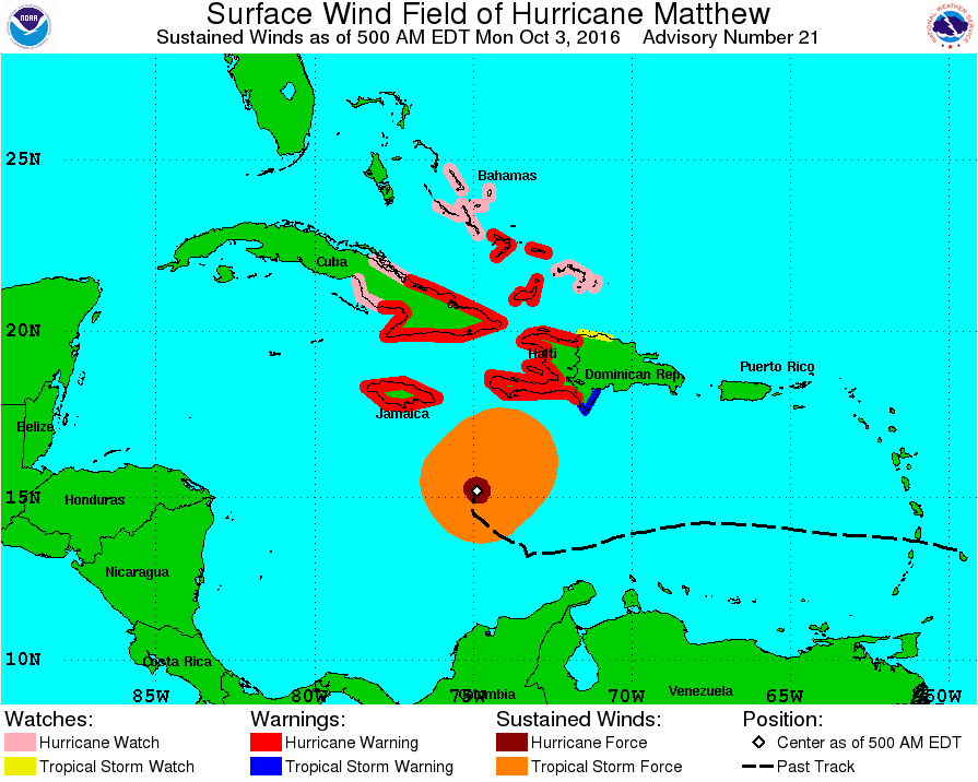
Tropical Storm force winds are still offshore for the next few hours but Haiti will be the first to experience these winds in the coming hours followed by Jamaica. Rain has already been making itself present for days due to the size of Matthew and the outerbands reaching upwards and over the islands. Rain, and especially flooding, will be the main threat with this system.
Let’s discuss those two blobs again that are just off to the east of Matthew’s eye. These blobs will deliver the majority of the heavy rain due to how cold these cloud tops are in these areas. The colder a cloud is: the higher the cloud, therefore the more rain the cloud can hold. Unfortunately, these two areas are going to pass right over Haiti. So immediately we can say without a doubt that Haiti will recieve the brunt of the rain with this system.
Haiti could see rain values of up to 25 inches. A few areas, especially in the valleys could see maximum values reaching 40 inches. The main concern with Haiti will predominantly be the rain and intense flooding. Now, as for Jamaica and Cuba, they will be experiencing the left side of the storm. This side of the storm does not have the stray rain bulges so rain will not be the main concern. For sure, these areas will experience heavy rain with some places seeing upwards of 25 inches. However, the main concern will likely be storm surge. Typically the worst storm surge is located on the west side of the storm in the Northern Hemisphere. Due to the fact that this storm is still intensifying, storm surge values could reach upwards of 17 feet for Eastern Jamaica and eastern Cuba. These surge values will cause catastrophic flooding. Residents living close to the shore should evacuate to higher ground immediately and get far away from the shore as possible, as well as below sea level areas.
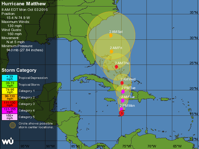
Most likely during the next hurricane advisory Hurricane Matthew will be back to Category 4 strength before it makes landfall late tonight or early tomorrow morning (October 3-4, 2016). We know for certain that Jamaica, Haiti, Cuba, and the Bahamas will receive the brunt force of Matthew but our next question is what happens after Matthew has moved through the Caribbean and exits back out into the Atlantic? Now we have to start working on where Matthew will head next.
Potential US Landfall?
For almost a week now the United States has been demanding answers from the meteorological community on if this system will impact the United States. Like always, government agencies don’t quite understand the difficulty with forecasting these systems. At best we can forecast a system up to 7 days in advance. After that, it is like flipping a coin and saying: yes it will make landfall, or no it won’t. Once again what makes this system so complicated is that it is slow moving. However, now that it is starting to speed up we can get a better idea on where Matthew will be “vacationing” next.
I will post this track image again. This image has gotten residents along the east coast scared to death for the past few days and for good reason. It does clearly show that Matthew is heading straight into the Carolinas. However, this image does not tell the whole story and will change in the next few days.
Meteorological models are in agreement that the Carolinas will be spared from a direct hit and most are in agreement that Matthew will be staying away from shore until it approaches northern New England:
At this point the models start to contradict each other, with some saying Massachussets will be hit, some saying Maine, some missing the United States all together and impacting Nova Scotia or Newfoundland instead. Here is what we can say at the moment. The southeast coast of the United States will be spared from a direct hit and this is thanks to a low pressure hanging out just offshore of Virginia and Maryland. This low pressure has a front associated with it which is currently being dragged across Florida (Note the black line over Florida in the picture below).
This front will act as a “whip” in some way. It will interact with Matthew in the next couple of days and push it to the east making it miss the Carolinas. In addition, there are two continental high pressures over the central United States at the moment. These High Pressures will help keep Matthew further east and away from the shorelines. However, even though Matthew will not make a direct hit on the southern United States coast does not mean that residents should brush this storm off. Effects will be felt along the whole east coast of the United States for the next couple of weeks as Matthew continues northward. The outerbands will still be delivering heavy downpours as the storms passes, and let’s not forget about the main concern with the left side of a hurricane. This is, once again, where the heavy storm surge is usually located. Beach erosion will be a threat to many coastlines in the coming days as well as some river flooding. Beaches will likely be closed due to extreme rip currents as well, so stay out of the water until the storm has passed your area. Just because Matthew does not make landfall, does not mean that you should ignore the storm.
By late this week models and forecasts will have a better idea on where Matthew will be going once it enters into the water of the Atlantic. Matthew is expected to weaken considerably after exiting back out into the Atlantic but could restrengthening once again in the coming days. It could be that Matthew does not survive past the Carolinas, depending on sea surface temperatures and wind shear values closer to this time. However, I advise the following areas to monitor this system closely: Massachussets to Maine, Nova Scotia and Newfoundland. These areas are the ones I will be looking at closely over the next few days. If Matthew survives, these areas will likely be in the pathway of Matthew. If Matthew does make it that far northward it will likely be transitioned (or in the process of) into an extratropical storm and be roughly 10x bigger. Delivering heavy rain to Nova Scotia and Newfoundland, and gusty winds to the New England coast.
For the moment our focus is on the Caribbean as Matthew continues to strengthen one last time before making landfall. Devastation is likely, especially for the island of Haiti. These are the last few hours to prepare. We can now call this a “Hurricane Emergency” where there is, for certain, a 100% chance of this Hurricane directly impacting these areas.
Seek shelter immediately and God bless to the people riding out this storm. Next forecast and advisory will be up once Matthew pushes through and out into the Atlantic.
Hurricane Matthew Could Cause Some PTSD Symptoms for Some
Updated September 30, 2016 @ 5:23 pm EST
If you do not think weather can cause PTSD symptoms then you have not been through a catastrophic atmospheric event. Usually after a major disaster most “sane” people would pick up and move far away to a place that does not experience that certain disaster that destroyed their lives. You will soon see why I titled this blog the way I did.
For about a week now meteorologists have been keeping an eye on a disturbance that was coming off Africa, which is now known as Hurricane Matthew. About a week ago a low pressure are came off the west coast of Africa and traveled westward south of the Cape Verde Islands. Immediately we saw this system as the start of a Cape Verde Hurricane even though it wasn’t fully developed yet. The reason why we are concerned with Cape Verde type storms (basically hurricanes that start to form over by the Cape Verde Islands) is because they have a lot of time crossing the Atlantic to gain strength. If storms form south of the Cape Verde Islands they are interacting mostly with very warm waters and take a predominantly westward track. The Bermuda High, which usually stays to the north does not affect these systems as much if they form south of the islands. So these hurricanes have “free passage” to go westward. The only killer for these storms would be high wind shear values. Matthew was lucky and made it across the whole Atlantic and entered into the Caribbean where it underwent a rapid intensification overnight from a Tropical Storm to a major Category 3 hurricane.
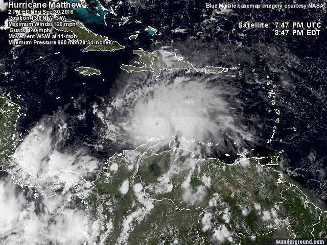
This storm is very healthy and this is proven by the perfect “pin” eye which is located just to the north of the island of Aruba. Pressure is stable at 960 mb (as of the 2pm National Hurricane Center advisory) indicating that this is a powerful system. At the moment only tropical storm warnings are in place for the extreme south Caribbean islands and Columbia. Matthew has managed to place itself perfectly between the Caribbean Islands and the continent of South America. This area is a prime location for intensification due to the low sea surface temperatures and the minimal wind shear values.
(Wind Shear values from September 29, 2016)
Looking above at the wind shear value map there is a patch of heavy shear over the Dominican Republic stretching a little bit towards the southwest. We see Matthew in the image above creeping around the very edge of this high wind shear area. Now let’s look at Matthew’s position today in association with the wind shear:
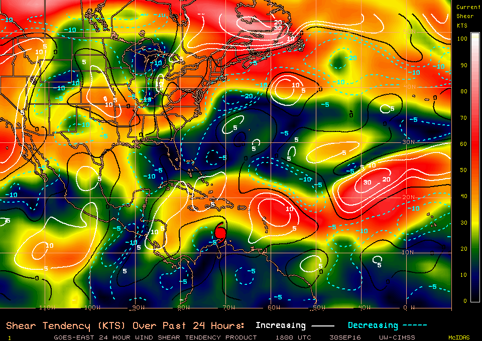
Smart storm, right? Matthew has managed to place itself just to the south of this large pocket of high wind shear. In addition, let’s take a look at the sea surface temperatures in the Caribbean at the moment:

It is warm, very warm for a hurricane. Tropical systems needs warm ocean waters that are generally 26.5 degrees C (about 80 F) or warmer in order to grown and strengthen. Currently, Matthew is over waters that are about 85F warm which is excellent for intensification. And, sadly, this is what we are expecting: for this system to continue to strengthen. We could see Matthew turn into a Category 4 storm overnight before it comes into contact with some wind shear and land.
So now comes the question that is on everyone’s mind: where is Matthew going? Below I have two climatological pathways that hurricanes typically take depending on what month it is:
The first image shows typical climatological tracks that hurricanes take in the month of September and the second is for October. Due to the fact that September is over we are going more with October now. There is clearly a difference. September we usually see systems travel on a east to west fashion, where hurricane would enter into the Gulf of Mexico if they take the same path that Matthew is currently taking. However, in October the upper level winds shift in the tropics and instead of hurricanes taking a general westward path, they start to go northward or back to the east. This is what we are seeing with Matthew. Instead of entering into the Gulf of Mexico it will now start to turn northward. In addition we have a powerful front over the Gulf of Mexico that is blocking Matthew from continuing any further:
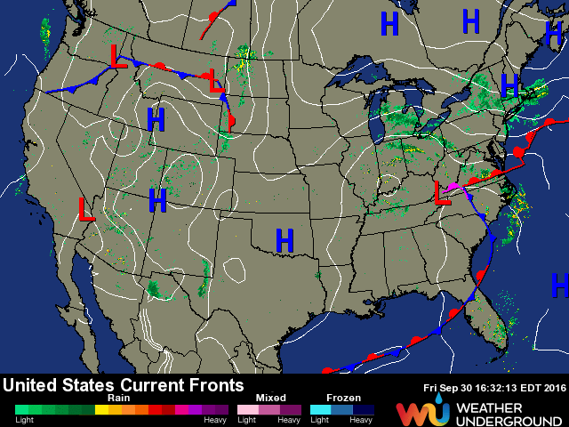
(Note the long stationary front crossing the Gulf of Mexico and over Florida).
Hurricane Matthew is expected to make its northward turn starting late this weekend. But in the meantime Matthew will be moving very slowly as it hangs around in the Caribbean Sea (currently moving WSW at 11 mph). This slow movement will allow for an increased chance of Matthew becoming a Category 4 storm, or at least a very powerful Category 3 system before curving and making landfall either on the island of Jamaica or Cuba.
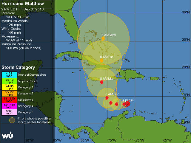
By tomorrow (October 1, 2016) Jamaica and Cuba will most likely have hurricane warnings up and closures will be announced for both countries. These areas are already preparing for the imminent threat and the Bahama islands will be next starting early next week. But what about after? How about the United States? Well this is where I get into the whole PTSD syndrome. So everyone look at the projected track above, and now look below:
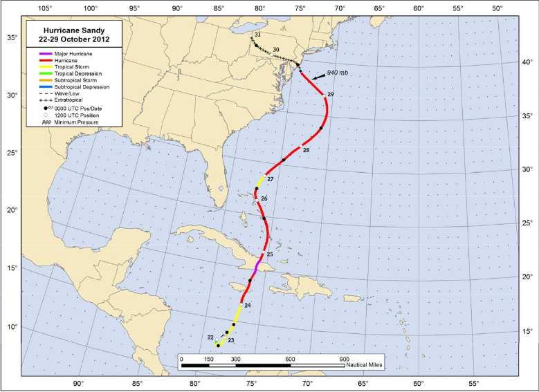
Look familiar? Well this isn’t Matthew’s projected path… This was Hurricane Sandy’s (2012) path. Very similar to Matthew Sandy hung out in the Caribbean undergoing a rapid intensification until it reached Category 3 status crossing over Jamaica and soon after Cuba before exiting into the Atlantic and continuing on its northward track before switching west and impacting the New Jersey and New York areas. So for those of you who went through Hurricane Sandy, is the PTSD starting to come about?
Now before we all start to pack our bags and call around for a Holiday Inn Hotel that is further inland away from the shore we need to step back and state that no two hurricanes are the same. We are still a week away from knowing if this system could potentially be another Hurricane Sandy. Not all meteorological models are in agreement on where this storm will go after it has entered into the Atlantic Ocean:
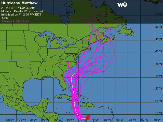
Without a doubt Jamaica and Cuba will be impacted as well as some of the Bahama islands, but after this point model predictions start to stray away from each other. A few forecast that Matthew will impact the south United States (Carolinas down to Florida) while others take the storm on a more eastward path before curving back to the north and impacting New England or even Canada. At the moment though it does seem that almost every model is predicting that somewhere along the east coast of the United States or Canada will get a direct hit from Matthew. We can all blame the month of October for this once again. This is a typical path for a hurricane to take in October after all. As Matthew gets higher up in longitude it will start to interact with the Bermuda high (which will be located to its east side) and other pressure systems coming from the North American continent (which will be located on the west side of the storm). The Bermuda High will keep Matthew predominantly close to the United States until Matthew reaches the northern-most point of the high pressure, at this point it will circle up and around the high pressure and turn more to the east. However, models are forecasting that Matthew will not make it to the north side of the high pressure system and therefore continue on a more northward path instead of starting to turn eastward. The driving factor for Matthew will be what will come off the North American continent and drive this system. A high pressure close to the east coast shore will prevent Matthew from impacting land, but a cold pressure could help draw the storm into land. At the moment it is too far out to forecast what systems will be in play and how they will affect Matthew. More will be discussed on the track of Matthew after it survives the mountanous terrain of the Caribbean Islands.
So let’s turn our attention back to Matthew hanging out in the Caribbean. At the moment the hurricane force winds are far away from land masses allowing for the National Hurricane Center to only issue Tropical Storm warnings to the south of the system:
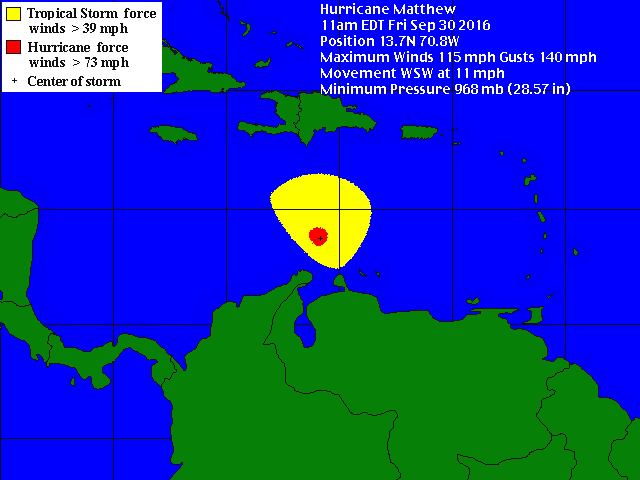
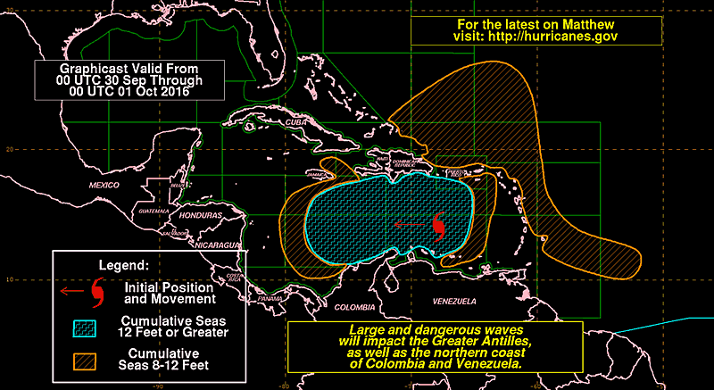
The major impact at the moment will be to sea vessels in this area where seas could reach 12 feet or high closer to the eye of the storm. Matthew’s large size has already been delivering rain to the Caribbean islands. Matthew is already responsible for the death of a 16 year old in the Leeward Islands. Rain will continue for the Caribbean Islands this weekend and into early next week. 10 inches of rain or more could accumulate for Jamaica, Cuba and Haiti over the next few days. Flooding will be a major concern especially in the mountanous regions and the country of Haiti.
Jamaica and Cuba will have the majority of the storm surge with surge heights possibly reaching 10-12 feet.
As Matthew works its way over the islands it will weaken thanks to the land interaction and the higher amounts of wind shear that will still be present in this area over the next few days. However, Matthew is expected to come out and into the Atlantic as a tropical system still maintaining hurricane strength. At this point we will need to monitor the sea surface temperatures and the wind shear to see if it is possible for Matthew to reintensify back into a major hurricane. In addition, at this stage we would have a better idea of where Matthew will be going and who could be directly impacted.
More to come as the second major hurricane of the 2016 Atlantic Hurricane Season continues to grow and intensify down in the Carribean.
Jamaica, Haiti, Cuba and the Bahamas. This is the time to prepare. This system will be a major hurricane as it approaches. Warnings will be issued soon.
Julia Forms… Over Land?!
Updated September 14, 2016 @ 4:12 pm EST
You read the title correctly, a tropical system has formed over land. You might be thinking: “wait, hurricanes form over water not over land! They die over land!” Well yes, you are correct. So let me explain what happened with this particular storm and why it is so unique.
To begin, for the past few days the National Hurricane Center has been observing an area of disturbance that was moving very slowly up the east Florida coast. For days the Hurricane Center stated that this storm had a 0-10% chance of developing.

Even yesterday morning (September 13, 2016) they still stood by the fact that this system would not evolve into a named system. I personally knew something was up with this system. The proof is shown in the Weather Goddess Facebook page and Twitter. When this system was moving up the coast yesterday it was very clear that this system was spinning around an organizing low pressure center and an eye wall was even trying to form as it approached Saint Augustine and Jacksonville, Florida. Here is a screen shot taken yesterday showing the system moving up the east Florida coast:
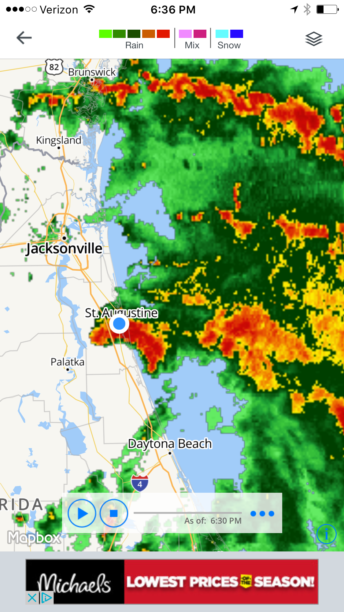
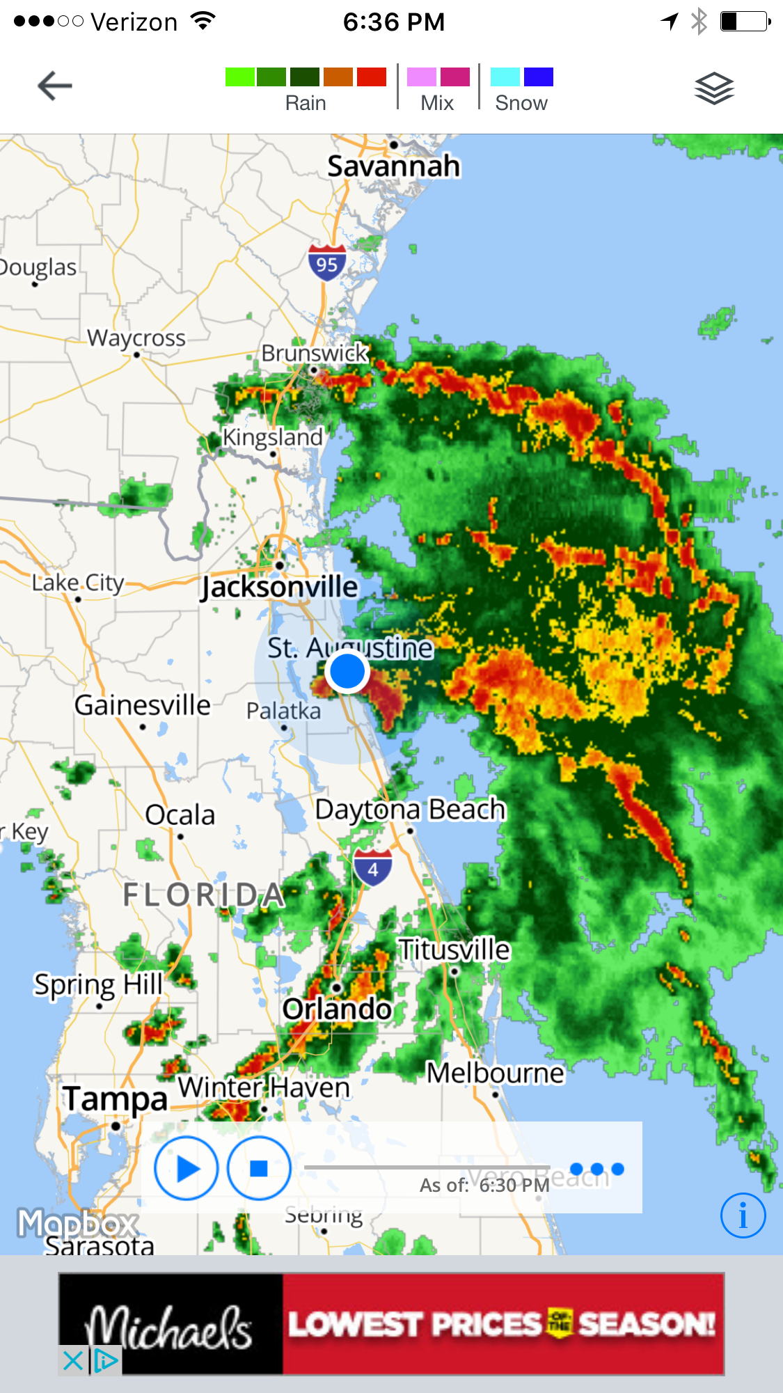
At this point the system was so organized in my opinion. Thunderstorm activity increased and a definite spin was shown on the radar which the city of Saint Augustine punched through the forming eye wall. At this point I started to call the system a Tropical Depression even though no official report was announced (note to everyone: The Hurricane Center is not always correct, trust your local meteorologist, they know what they are talking about 😉 ) It was around this time that the National Hurricane Center realized that this system was indeed something to worry about and started to bump up their percent to 40% that this system would become a Tropical Storm:
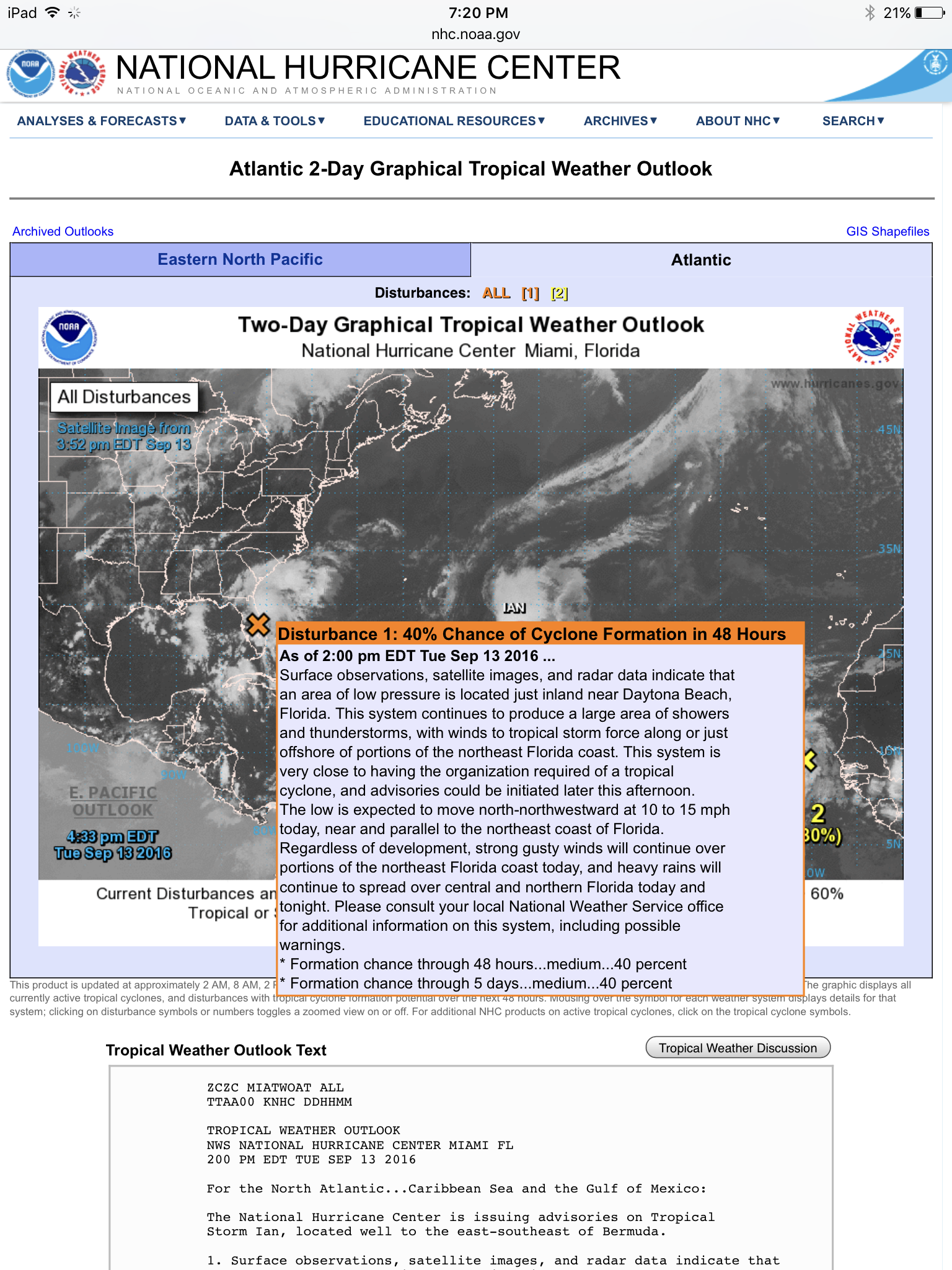
To be fair though, I will explain the reason why the Hurricane Center probably called for a 0% chance up until the time it pretty much became Tropical Storm Julia. They probably followed a model that kept the storm relatively over land, meaning that there would be no energy from the ocean to allow for this storm to grow. What happened though is that this system was half on land and half over the ocean as it grinded up the east Florida coast. Let’s be honest, weather in general is very hard to forecast no matter who you are or what industry you work for. In the end Mother Nature will do something at the last minute that will make your forecast wrong in some way. This is what Julia did to the National Hurricane Center… Sorry guys, it happens sometimes, we are only human.
So let’s get to the whole discussion that is going around the internet today. Tropical Storm Julia is now known as being the first Tropical Storm on record to form over land in Florida.
It’s also the first to form over land anywhere in the USA in nearly three decades. According to Phil Klotzback of Colorado State, Tropical Storm Beryl was the last storm that formed over land in 1988 in Louisiana. However, what does this mean and how is it possible? Though an official report has not been made yet I can already say what the cause is. Julia is not fully tropical. Instead it is subtropical and will likely be called Subtropical Storm Julia when the final report is released at the end of the year by the National Hurricane Center. A subtropical storm is both a cold and warm core system. A fully tropical system is warm core and depends on the ocean. However, a cold core system can intensify over land. Think of it as a mid latitude cyclone which travel from west to east over the United States, especially in the winter time. These systems come from the Pacific and usually intensify over land as it crosses the continental United States. Although on a much smaller scale this is what Julia is: half cold and half warm. This can also be seen in the shape of the system when it was organizing itself yesterday.
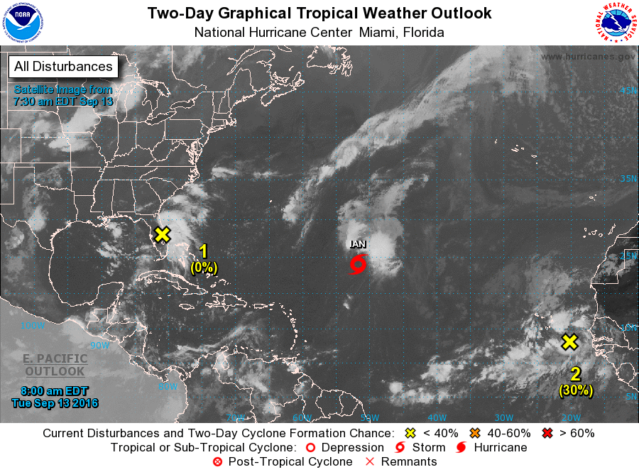
The thunderstorm activity remained mostly to the north and east of the center of low pressure already showing characteristics of something not fully tropical. In addition, these thunderstorms remained relatively over the ocean allowing them to build and fuel the system. Finally, the center of the system remained half over land and half over the ocean for the majority of its journey yesterday. Meaning that the system was technically still being fueled by the ocean. In some way the storm did not form fully over the land. It was still half over the ocean with thunderstorms on the right side helping to fuel the system and keep it alive. So really the media is not labeling the system very well by saying it formed “over” land. Only half of it was “over” land.
So where is Julia now and what are the threats with this system?

First, the system is now starting to show more tropical characteristics as the thunderstorm activity is starting to cover the area around the center of low pressure once again. Julia is currently hanging out off the coast of southeast Georgia and is moving painfully slowly to the NNE at 6 mph. Due to the fact that this storm is moving so slowly the main threat will be rain for the next few days across Georgia, Florida and the Carolinas. This system is fairly weak and is expected to degrade back to a Tropical Depression very soon before it dissipates completely around South Carolina.
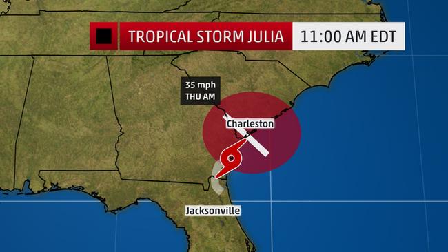
Julia is an interesting storm in the fact that the “cone of uncertainty” is mostly just a circle which shows that we are not worried about the system surviving anywhere to the north of this area. The speed of this system is really what is going to kill it. The slower a system goes the more time it has to cool the waters beneath it. If you ever look at a sea surface temperature map in an area where a hurricane is/has been, the ocean will be fairly cooler around this area. This is because the cool rains lower the ocean temperatures underneath. If the water becomes too cold than the system will start to die. Therefore, as Julia hangs out in this area it will cool the sea surface temperatures beneath herself. In addition, the fact that Julia is so close to land does not help her situation. She is currently skimming the coast of Georgia but is expected to go more inland where the center of low pressure will be permanently cut off from the ocean weakening her further. Sad, but Julia will be dead soon with the way she is going.
This does not mean we should not take her seriously though and this has to do with the rain amounts. Florida already had intense rainfall yesterday as Julia passed through. My area in Saint Augustine recorded 2.5 inches, with more still expected as Julia’s tail whips through the area tonight and tomorrow morning (September 14-15, 2016):
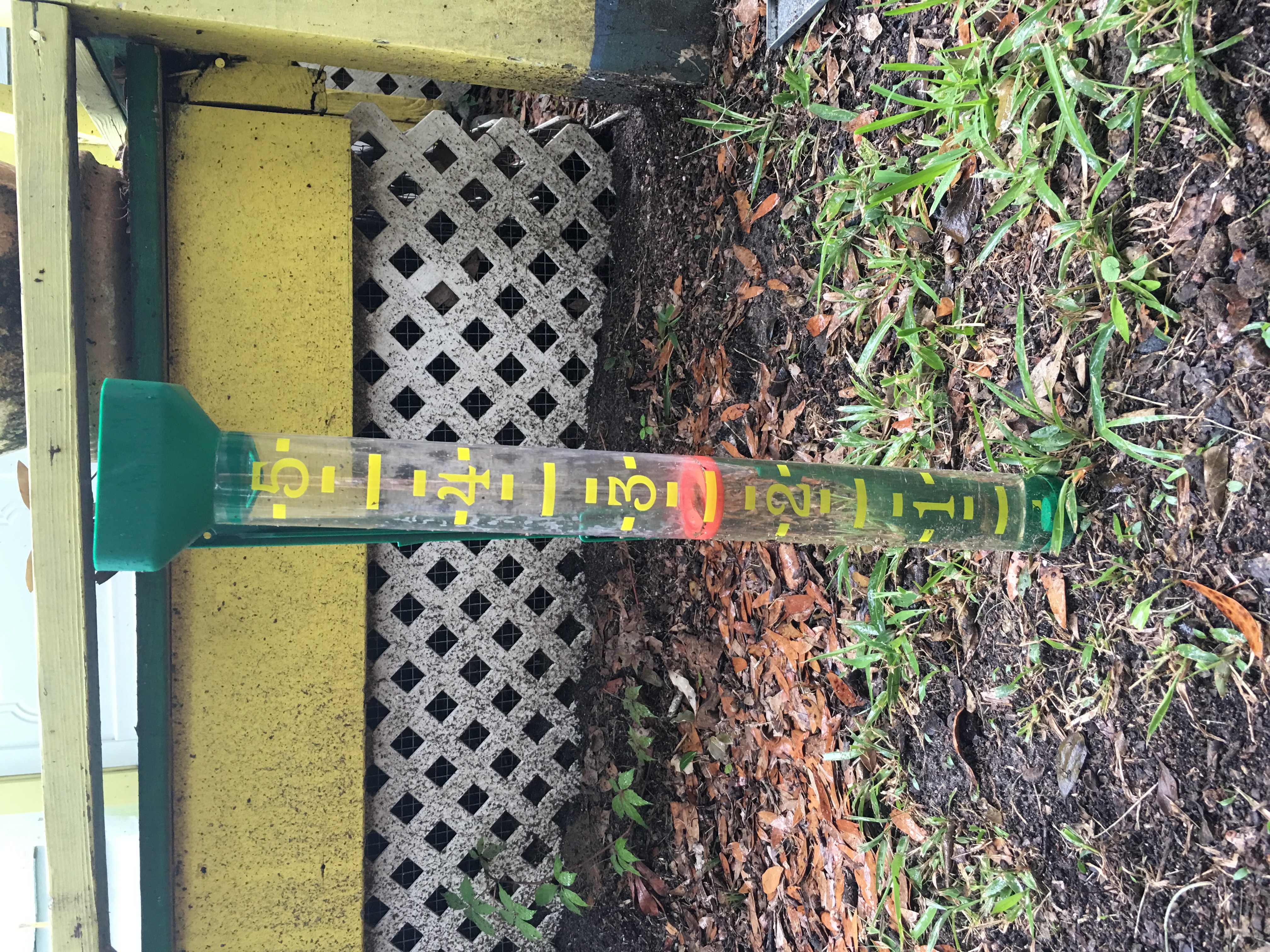
Heavier rains are expected in South Carolina since the majority of the heavy rains lie to the north of the storm:

Coastal areas will see most of this moisture for the next few days as Julia slowly moves northward and weakens. Charlestown and areas surrounding the South Carolina coast could see rain values reach up to 12 inches causing some serious flooding. Tropical Storm Warnings are up for Georgia and southern South Carolina for the next couple of days:

Stay away from rivers and the ocean until this weekend. Although a weak storm, this system is causing rip currents from Florida up to North Carolina.
Finally, I would like to close with a humorous image showing what models are predicting for Julia:
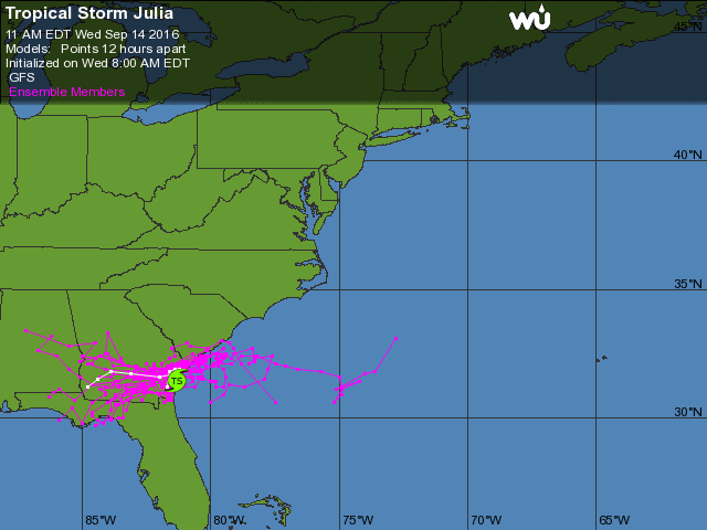
The above image is known as a “Spaghetti Plot” where different meteorological and climatological models are shown depicting where a tropical storm will likely go. The above shape of these models is something many meteorologists dread, I like to call it the “smashed spider”. This is when models are not in agreement at all and are going in many different directions. Now here is the good news: we don’t need to worry for this particular storm. Julia is weakening so rapidly and moving so slowly that we expect her to be dead long before we need to worry more about her. However, if Julia were further out to sea and potentially growing into a hurricane then we would have problems, particularly with the public. Residents want to know immediate information on where a storm is going and in many cases do not mind if a system hits a few miles to the south/north of where you said the storm would hit. It is a whole different story when you say the system is heading out to sea and not to worry and then the next day it hits land as a Category 5 (this happened to my hometown when Hurricane Andrew came ashore in 1992). So really the above image is not humorous, it is serious and important that forecasters get the direction right. Julia, however will not last long though to take a directional change. This is what is saving forecasters from making a hard decision on if the system goes east into land or west out to sea.
In the meantime, Julia continues to travel up the coast very slowly and dumping excessive amounts of rain over the southeast for the next few days.
In addition, we have Tropical Storm 12 that formed over the Cape Verde Islands off of Africa. This system is expected to move westward while fluctuating in intensity from Tropical Storm status to Tropical Depression intensity.
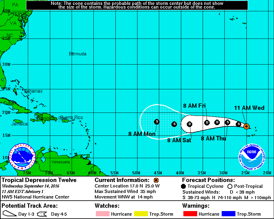
All eyes will be on this system for the next week to see if it survives as it makes its way closer to North America. Stay tuned for more information on this system. In the meantime, for those of you in the southeast prepare for some rainy days ahead.
Hermine is Celebrating Labor Day Along the East Coast
Updated Septmber 3, 2016 @ 8:35 pm EST
Hermine is the most talk about storm so far this 2016 Atlantic Hurricane Season. After almost 11 years of being in a “Hurricane Drought”, Florida was finally impacted by Hermine when she came ashore as a Category 1 storm near St. Marks, Florida. Hermine is not done yet. Hermine was so well organized and had enough strength and forward speed that she managed to travel across Georgia and the Carolinas and exit back out into the Atlantic. Many people would be celebrating and beginning their clean up, thinking that Hermine would continue its journey out to sea… Wrong. In fact, Hermine is arriving in the Atlantic at possibly the worst time. Instead of moving away from land, it is just drifting, almost stationary.

Labor Day weekend is not only going to be a soaker for the east coast, but the rest of this week will be very wet. Hermine is expected to hover just off the coast of Maryland and New Jersey for the next few days. The reason for this is due to the jet stream, a blocking ridge, and the Bermuda high. Let’s take a look at the map below to explain this better:
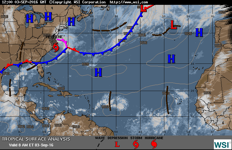
I have explained this in previous blogs, but we shall repeat it here. A hurricane is a low pressure system. Alongside low pressure systems we also have high pressure areas in our atmosphere. These high pressures are the opposite of a low pressure. Unlike a low pressure which delivers wet weather and spins in a counterclockwise formation (in the northern hemisphere), a high pressure is a dry area which spins in reverse. These two systems cannot combine together and tend to give each other space in the atmosphere. Currently, Hermine is trapped in one area with high pressure areas surrounding her from the north and the southwest. Hermine is “bouncing” against the high pressure areas and not being allowed to pass through. In addition, you will see a long blue line just to the west of Hermine that extends up towards the Greenland area. This line is a front that is attached to a separate (and much larger) low pressure system up over Greenland. Similar to the high pressures surround Hermine, this front is helping to block Hermine slightly from moving eastward (not as much as the high pressures though). So the next question might be: why doesn’t Hermine go westward and impact the East Coast? This would then be a very similar repeat of Hurricane Sandy, which many would not want to experience again. However, New England, you are very lucky this week! You should thank the jet stream:
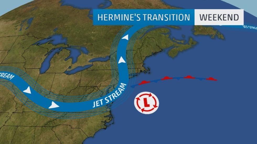
The jet stream contributed to Hermine exiting into the Atlantic and it is also in charge of keeping the storm off the coast of New England. The Jet Stream is a strong force that contributes to a hurricane’s direction and speed. As long as the jet stream remains in this area, Hermine will stay offshore. Good news right? As long as Hermine enjoys herself off the coast we have nothing to worry about, correct? Yes and no. While Hermine may be away from land this does not mean that New England is out of danger. Remember that water is a hurricane’s best friend, and right now Hermine is over some warm waters:
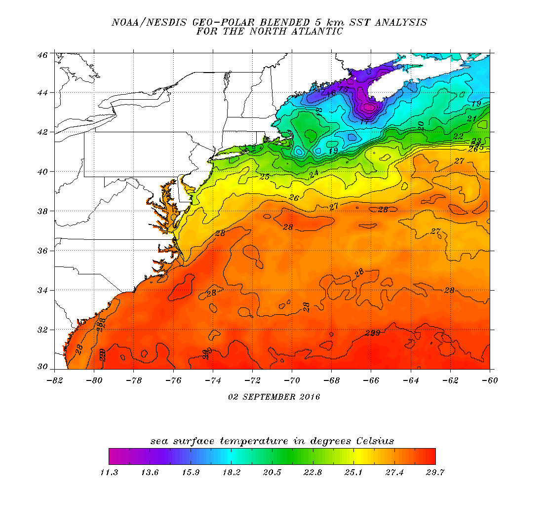
Cold waters are staying north of the storm for the moment allowing for Hermine to benefit from the warm prime waters off the coast of the Carolinas. Not good news.
Hermine has been undergoing extratropical transition since yesterday while she was working her way over Georgia and the Carolinas. This morning she was nearing her completion while keeping her tropical storm strength:
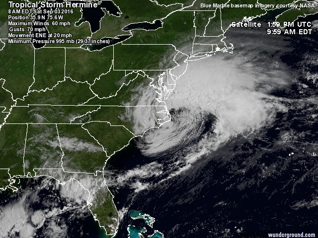
The above image was from this morning as Hermine exited into the Atlantic Ocean. Clearly you can identify that Hermine is much larger and appears to have a different shape compared to when it impacted Florida (see blog below for image). The eye of Hermine is still somewhat present indicating that there is still some tropical characteristics associated with the storm (warm core). However, the majority of the clouds are starting to seclude themselves to one side of the system. This is the big indication that the system is undergoing extratropical transition and turning into a cold core system.
Early this evening Hermine completed its transition and became this:
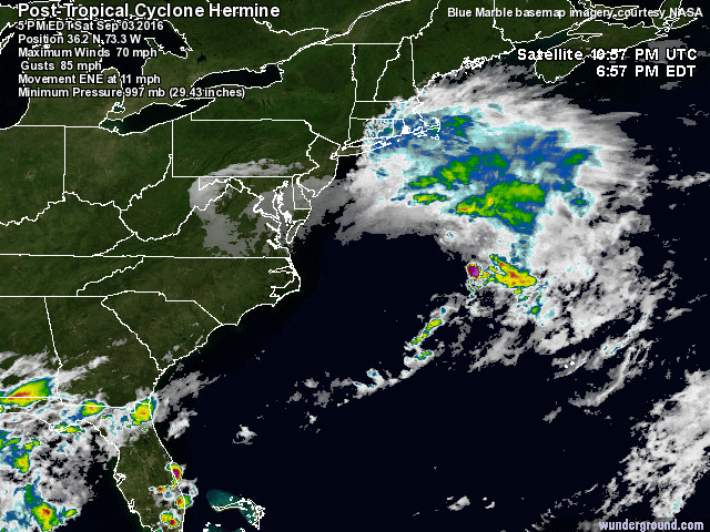
Not very impressive for some but don’t think that the south of the storm is calm. In fact, the south and west of the storm (where we don’t see any cloud cover) is where the intense tropical storm winds are still found. The rain is now secluded to the north and east. This indicates that the storm has completed its transition, when the wind and rain is split in half and lie on each side of the low pressure center (even though you cannot see the eye of the storm anymore, there is still a low pressure center present). The National Hurricane Center is referring to this storm as Post-Tropical Cyclone Hermine (also can be Extratropical Storm Hermine). The naming that the National Hurricane Center uses is very misleading though. I have discussed this in past years. Just because a hurricane has undergone extratropical transition and become “post tropical” does not mean that the storm is weaker. In many cases, it can be even deadlier compared to its tropical form. Hurricane Sandy (2012) proved this point. After transition is complete the storm grows to be larger (about 10x) than its tropical form and can hold in 10x more moisture. In addition, the winds from its tropical form are maintained. In many ways the storm is just a larger version of its previous tropical form, which equals to a very dangerous situation because now the storm impacts more areas now that it is larger. For the sake of the safety for the public I would advise weather agencies to continue to refer to these storms as “tropical” and continue to categorize them using phrases such as “category 1” or hurricane. Because, as many of us experienced in Hurricane Sandy, the storm was not referred to in this manner as it came ashore in New Jersey and New York. Many people were confused as to what it was, which lead to many people not taking the storm seriously and loosing their lives. Therefore, for the rest of this blog I will be referring to Hermine as Tropical Storm Hermine even though she is technically extratropical now. The safety of the public is the number one priority and it begins with the public understanding the terms meteorologists use. It is easier to use the term “tropical” because it is a term that most of the population understands.
Currently Hermine has managed to keep her tropical storm strength, but now that she is over the warm waters off Maryland we could see Hermine strengthen once again to a Category 1 Hurricane by tomorrow (September 4, 2016).
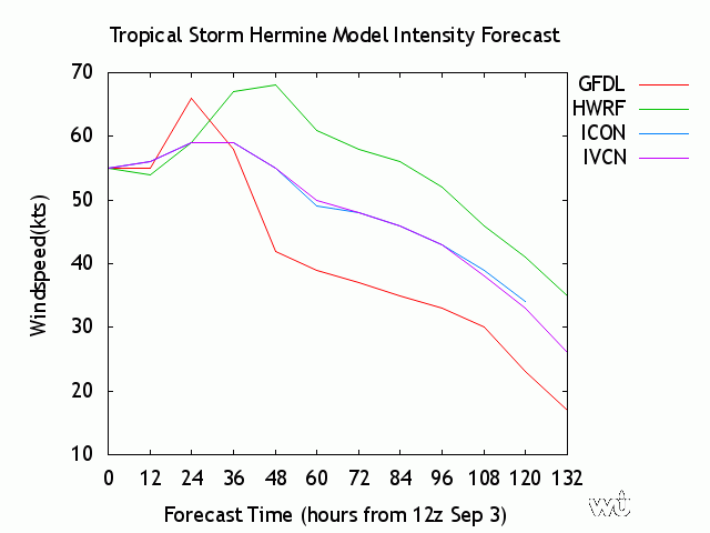

Models are once again in agreement that in the next 12-36 hours that Hermine will reach the threshold for Category 1 status (74 mph/64 kts and above). If Hermine strengthens back into a hurricane the strong winds will remain relatively out to sea. However, tropical storm force winds will continue to impact the coast for the majority of this coming week. However, this is not the only threat. The biggest problem will be the storm surge along the coast, especially if Hermine strengthens. Storm surge heights can reach 4-5 feet in some coastal places. The biggest threat will be the Chesapeake Bay and the New York Bay for example. These inlets will trap water and cause the surge heights to rise faster compared to coastal regions. These areas could see higher surge values closer to 6 feet.
A tropical storm warning remains in effect from North Carolina up to Conneticut. Watches are up from Rhode Island and Massachussets. Rain amounts are a different matter. If Hermine stays relatively far out to sea and the rain bands continue to remain on the north and east side of the system, rain should not be a problem (unless this system undergoes a reverse transition, be we won’t discuss this yet). Most of the rain is expected to be off the coast but some areas close to the system could receive up to 2 inches of rain. However, with the storm lingering in this area for the next few days the amount of rain could increase.
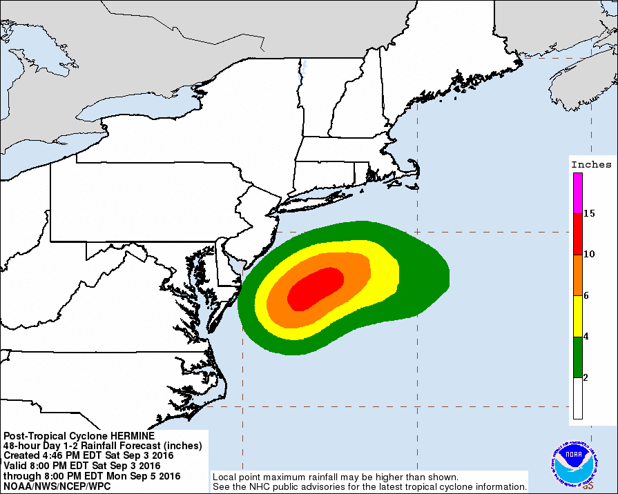
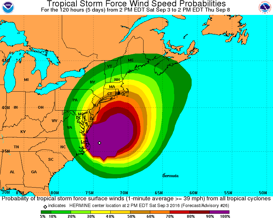
To conclude, Labor Day weekend will be a wet and windy weekend for many. These conditions will also continue into late next week as Hermine continues to be trapped in this area. By next Thursday or Friday however, the high pressures will move away and allow Hermine to finally move on a more north-northeast path back out to sea. Nova Scotia could possibly be impacted by this system by next weekend depending on the timing of the high pressures moving away. An update will be made as this time comes closer.

In the meantime if you are celebrating the Labor Day weekend along the east coast avoid the ocean. Strong rip tides are ranging from Florida all the way up the East Coast. Boating activities should also be kept to a minimum, especially near the Carolina, Virginia, Maryland and the New York area. Occasional rain showers will dampen the next few days and tropical storm force winds will be experienced along the coastal areas. Don’t ignore the threat of this storm. One person has been killed from a semi-truck accident in Virginia already thanks to the strong winds. Stay safe these next few days.
Updates in Florida:
The hurricane drought in Florida is officially over. Hermine made landfall near St. Marks Florida. Storm surge values reached 6.1 feet in Cedar Key, Florida. Thanks to the quick action of emergency personnel and the public being prepared Hermine only claimed one life in Florida. A homeless man was killed when a tree fell on him as he slept in his tent. Florida managed to survive through its first hurricane in almost 11 years.
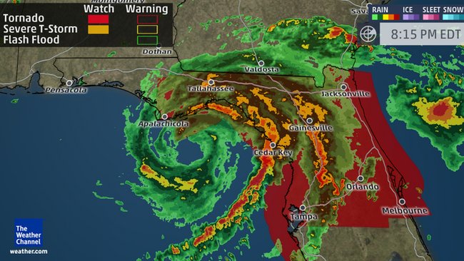
Hermine reaching its peak strength as a Category 1 Hurricane, approaching the northwest coast of Florida on September 1.
Game Over! The Hurricane Droubt in Florida May Finally be Coming to an End.
Updated September 1, 2016 @ 10:01 am EST
Our luck had to run out eventually in Florida. Tropical Storm Hermine can very likely become Hurricane Hermine later today before landfall in northwest Florida. Hermine has been taking its sweet time in the Gulf of Mexico surrounded by minimal wind shear and high sea surface temperatures. This prolonged stay over these waters has helped Hermine become significantly more organized in just a few short hours:
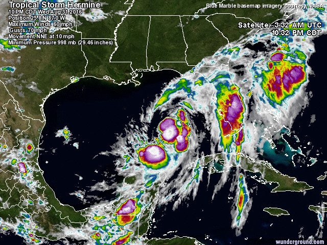
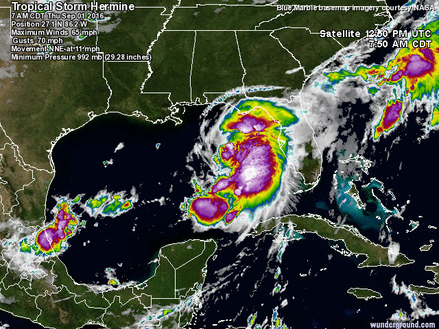
The first figure was from August 31, 2016 at around 10:30 pm UTC. Hermine is slowly becoming more defined with the majority of intense thunderstorm activity starting to gather in the center where the low pressure is located. However, some of these storms are scattered about, such as a large band over the length of Florida. In addition, near the center of low pressure we don not see a continuation une’er storm activity. Instead of a solid wall of thunderstorms we have areas with “gaps”. Particularly on the northeast side of the storm.
Now let’s take a look at the image below the first. This satellite was taken about A day later at around 12:50 pm UTC September 1, 2016. Immediately you can see that thunderstorm activity around the center of low pressure has not only increased but is becoming a solid wall around what will likely be an eye later today. Unlike the previous image where we saw extreme outerbands far from the center, this system is now more compact with thunderstorm sticking as close as they can to the core of the storm. This is a big sign that the storm is strengthening by becoming more organized and compact. In addition, Hermine is still secluding herself away from land and sucking up all the energy she can before she makes landfall in Florida later tonight (Thursday September 1, 2016). Click on the figure below for a time lapse on Hermine from tropical depression status to the present time and you will clearly see how organized this storm has become over the past few days:
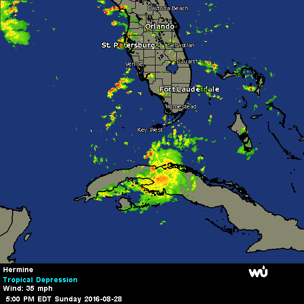
Basically, Hermine has the perfect setup to grow into a Category 1 system (74 mph / 119 kmh winds) and deliver a hurricane to Florida that will end the 10 year hurricane drought in the state.
Believe it or not Florida has not seen a direct impact from a hurricane since Hurricane Wilma in 2005. To be fair, 2005 was a very stressful year for all of us due to hurricanes like Katrina and Wilma. We deserved a break, but a 10 year break is a little much and strange. We were extremely lucky. However, luck runs out eventually and it appears Hermine will be the storm to do it.
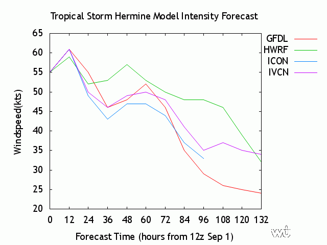
Models are in agreement above showing that in the next 12 hours (later this afternoon on September 1, 2016), Hermine is expected to receive one more strengthening period boosting her wind speed strength close to the category 1 hurricane mark (around 64 kts) before impacting land. Like all typical tropical systems, once Hermine moves ashore is will rapidly start to weaken back to a tropical storm and eventually to a depression.
Let’s discuss the impacts to Florida and Georgia now. In general models have been in agreement for the past week on where Hermine was going, and this has been beneficial. The track has shifted slightly with Hermine taking a more northerly route into Georgia and eventually into the Carolinas:
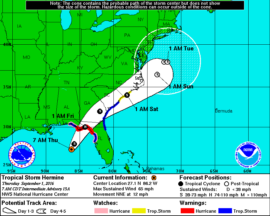
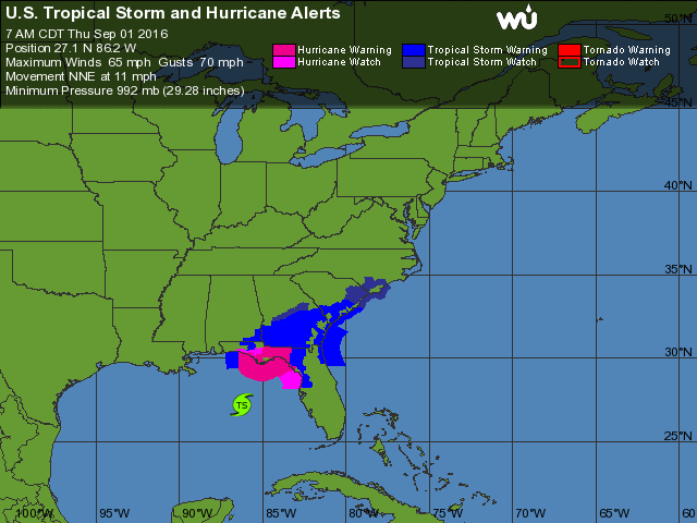
Residents have had ample time to prepare (if they chose to listen). There are still a few hours left to prepare and evacuate if you need to. Hurricane warnings are up for the eastern Panhandle of Florida with tropical storm warnings located on the east side of northern Florida extending upwards to South Carolina. These warnings indicate that hurricane/tropical storm winds will be felt in this area in the next 24-36 hours. The man in concern with this system will be storm surge and rain. Storm surge values could reach around 3-4 feet in northwestern Florida. The National Hurricane Center has released potential storm surge maps showing the amount of coastal flooding that will be possible with Hermine. Some areas could see up to 6 ft of storm surge, but I personally believe it will be in the 4 ft range. We cannot rule out the possibility of higher storm surge values though.
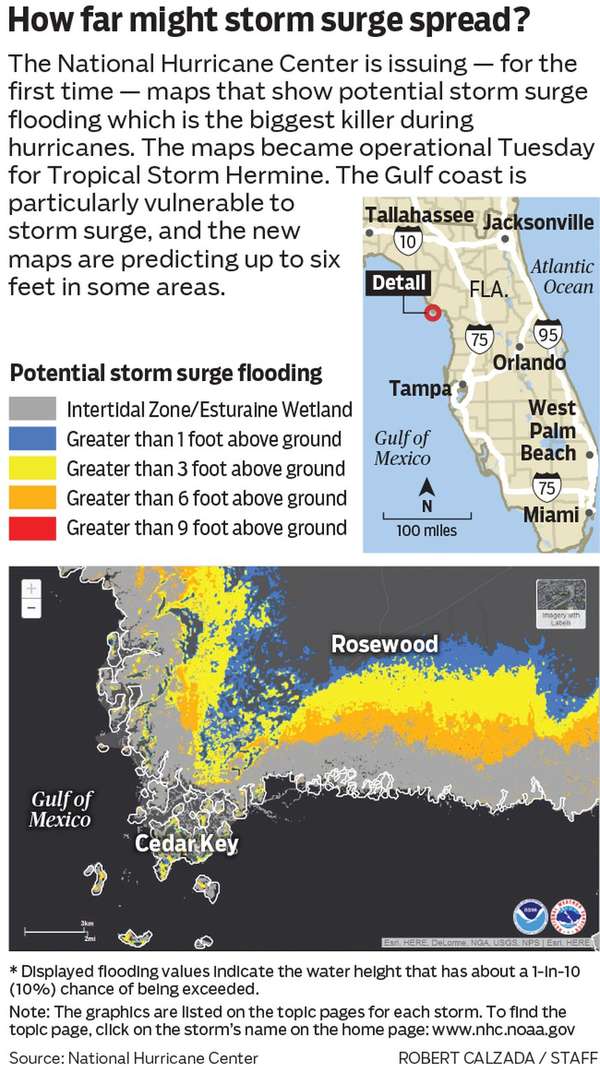
Erosion will be a big problem with this system due to the accompanying storm surge. Residents living close to the shore or rivers should consider evacuating or taking final steps to sandbag around their homes. Do not forget your pets if you choose to evacuate. Shelters are open and accepting you animals in the event you cannot evacuate them with you.
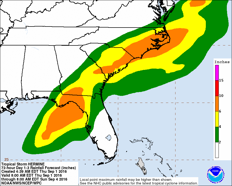
Rain amounts will be generally around 6 – 8 inches across the Panhandle of Florida where Hermine will come ashore and this will spread into the Carolinas over the next day as the storm weakens, expands, begins to dissipate, and even undergo extra tropical transition. This will be welcomed rain for many due to the fact that many of these areas across Georgia, Florida and the Carolinas have been in drought conditions.
(Drought map of southeast United States. The darker the color, the more severe the drought)
Rain amounts could reach into 10 inches in some places, especially along the Apalachian mountains and low valley areas located mostly in Georgia and the Carolinas.
Flooding will be a concern in some areas close to rivers and low lying areas. Do not attempt to drive through flooded areas, go around.
A state of emergency continues to be in effect for Florida as Hermine spins ever so closer to the sunshine state. Landfall is imminent and is expected to take place late tonight (Thursday, September 1, 2016). Take these last few hours to prepare. Power outages are likely especially for northwestern Florida and Georgia. Make sure you have fresh water, medication, food, flashlights, etc. Check out what you need in a hurricane emergency kit here. Once again evacuate if you feel unsafe and make sure to check on the elderly in your areas to see if they need assistance. Finally evacuate your animals or bring them to a shelter.
Hermine is coming and could be the storm that delivers Florida its first hurricane in 10 years. Take this system seriously and prepare for a wet and windy night tonight. This is the final advisory before Hermine makes landfall from the Weather Goddess. A next statement will be issued after the storm has made landfall. Weather Goddess Facebook and Twitter will be updated throughout the day giving up-to-date information on Tropical Storm Hermine. Stay safe and take these last few hours to prepare yourselves, because she is coming and strengthening.
Trouble Ahead! What Florida and the Carolinas Need to Know.
Updated August 28, 2016 @ 10:43 pm EST
Super busy few days! The last time I forecasted and discussed the tropics we only had a small Invest Area in the Caribbean known as Invest 99L and we had Gaston spinning close to the Cape Verde Islands. Well, a lot can change in just three days. Now we have our first major hurricane of the season (Hurricane Gaston) and two depressions with a high chance of becoming tropical storms by tomorrow morning (August 29, 2016). One of these systems is aiming for Florida and meteorologists and scrambling to gather all the information they can to prepare residents and visitors for this storm. In addition, we have another tropical depression heading towards the Carolinas with possibly impacts being felt along the Outerbanks by tomorrow night. It is a roller coaster of insanity with all of these storms, so let’s start with the depression that has everyone’s attention: Tropical Depression Nine.
Guess who survived over the Caribbean Islands? That’s right! Our little Invest 99L that we came to know a few days ago has now been upgraded and named “Tropical Depression Nine”. This storm managed to survive the mountainous regions of the Dominican and exit out into the Florida straits. Since the center of the low pressure stayed relatively over the warm waters of this narrow inlet it was able to become more defined and grow in strength a little bit until it reached Tropical Depression status.
As mentioned in my previous blog/forecast we had to wait and see how this storm would do in this area before we could start becoming concerned over in Florida. Now that this storm has nothing but ocean in its path for the next few days, this is the time to focus completely on this system and prepare for a direct impact.
Northern and central Florida is currently under threat with meteorologists calling for Tropical Storm to come ashore along the west coast of Florida by Thursday evening. But first, let’s take a look at the “health” of the system:
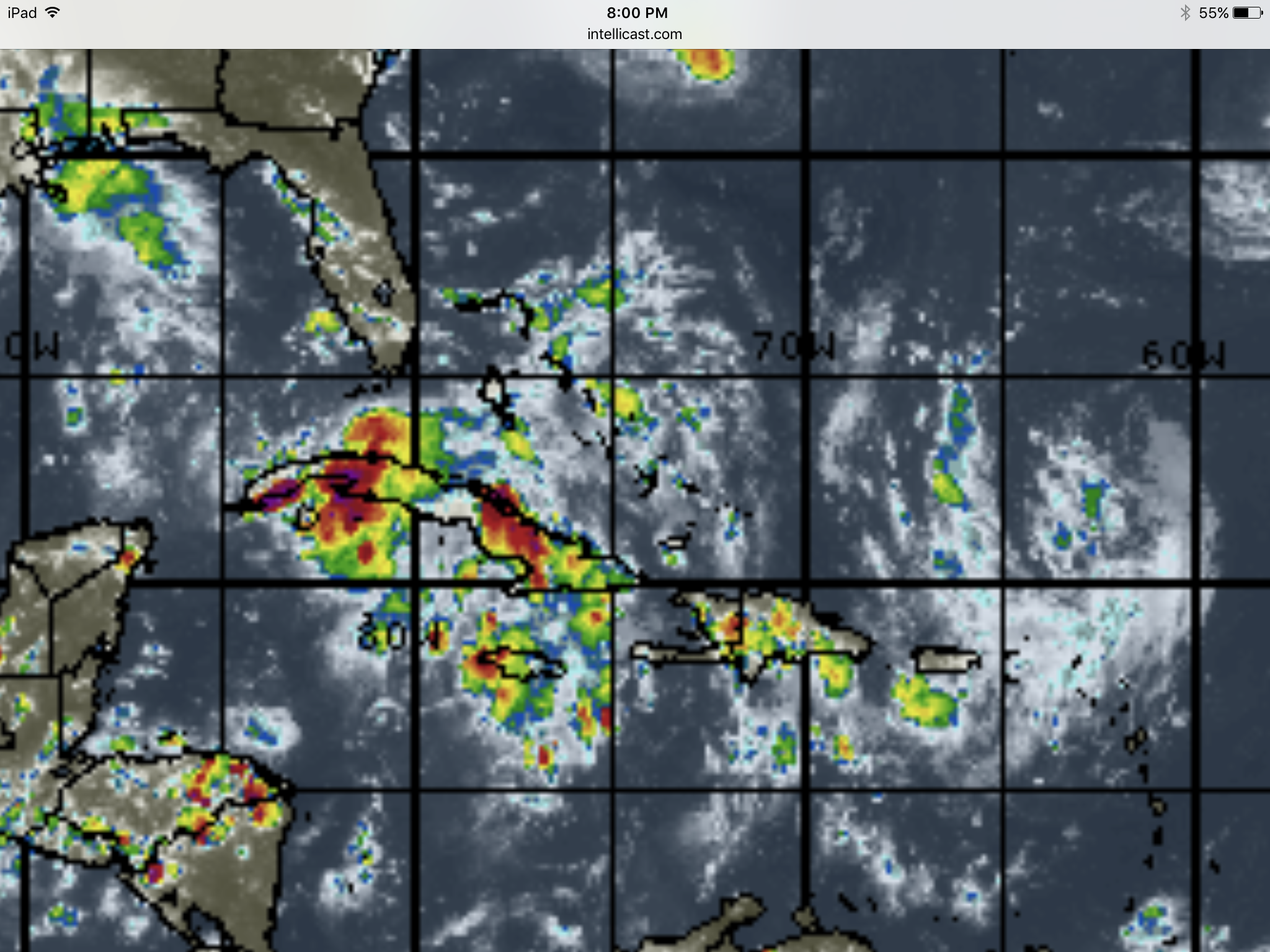

The images above show the amount of water that is contained within the high thunderstorm clouds associated with this low pressure. The brighter (reds and pinks) colors show higher amounts of rain and an increased amount of thunderstorm activity. Without a doubt this system is holding an immense amount of moisture so far, which is one sign of deterring a tropical system forming. The other important factor to look for is the low pressure center of the system. Barometric pressure can help us determine if a low pressure has formed but another way is to simply look at the clouds and the way they are moving. the third image above is an animated loop if you click on it. You can easily see that these thunderstorms are not moving in a straight line. Rather they are moving in a counterclockwise rotation. This can show you that a low pressure center has/is forming and could potentially become stronger (pressure drop).
It is easy to see that rain is the big trouble right now across extreme southern Florida and the island of Cuba. For the past few days the Caribbean Islands have been enjoying very wet weather due to this storm forming, but now that the storm is over warm waters and creating more thunderstorm activity (more evaporation rates due to the warm ocean waters), the rain is becoming heavier across Cuba and southern Florida.
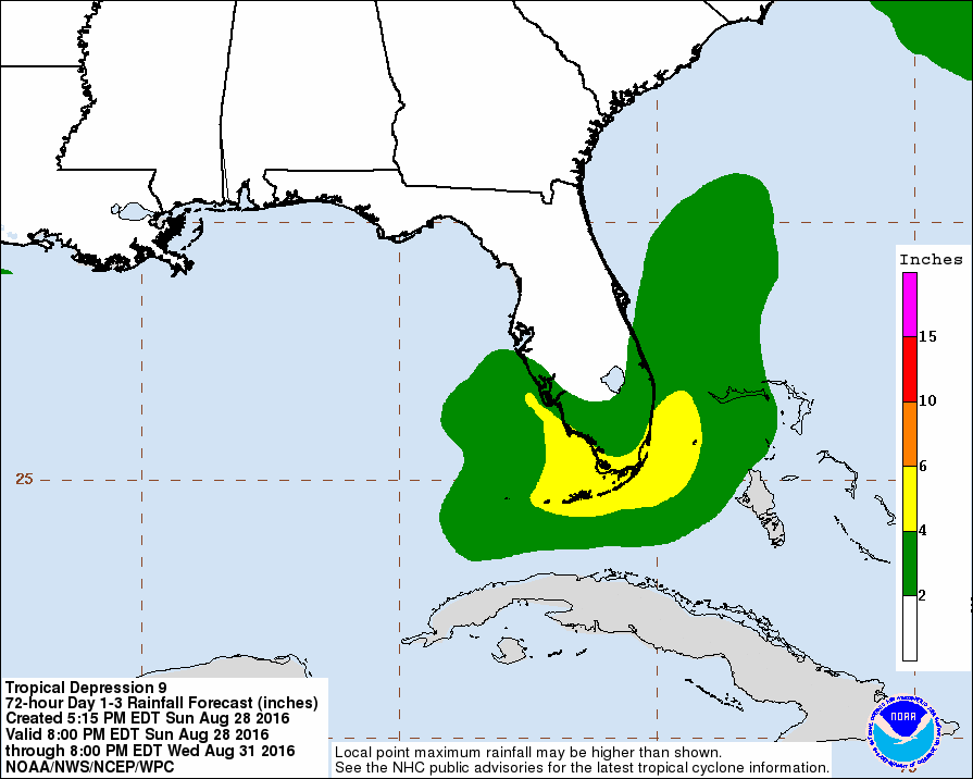
Southern Florida, including the Florida Keys is expected to receive rain amounts of up to 4-6 inches in some areas. Cuba will likely receive more with values closer to 8 inches in some areas.
This may sound like a lot of rain but I am sorry to say that the worst is yet to come. As a tropical storm forms, more thunderstorms form around the center of low pressure and therefore more rain is held in the system. Over the next few days this system will grow to be a Tropical Storm and become more organized as a system with rain extending further out from the center. What this means is that the west coast of Florida is going to be very wet for this next week.

Rain models are already showing that much of Florida will receive about 3 inches of rain. However, some areas (especially where the storm will come ashore) could receive upwards of 10 inches of rain. Now is this necessarily a bad thing? Yes and no. Let’s begin with the positives:
Many areas around Florida have had a very dry summer and a lot of this can be blamed on the El Niño which is currently weakening rapidly. Many counties along the east coast of Florida have experienced some abnormally dry months, which is very odd due to the fact that summer is typically seen as the rainy season.
East Florida desperately needs some rain. Yet, east Florida is unique compared to the western half of Florida. Along the west coast the Gulf of Mexico tends to be much warmer compared to the Atlantic. These very warm waters fuels storms and pushes them inland almost everyday. So because of the warm waters in the Gulf, the west coast tends to be more wet compared to the east. Along the east coast of Florida they usually have to rely on the interaction between the sea breeze and the land breeze in order to receive rain. In some cases a few thunderstorm will form over the Atlantic and push inland, but most of the time the cool sea breeze interacts with the very warm continental breeze and creates a battleground in some way. These two breezes of different temperatures create a line of thunderstorms, but the bad news is that they are mostly inland and away from the shore. So it is very difficult for the east coast to get lots of rain compared to the west coast of Florida. So the good news is that this system will bring beneficial rains to the drought stricken areas of eastern Florida.
The bad news is the western part of Florida. Although some of this rain will be helpful to some of the western counties the majority will be potentially deadly, especially areas around Tampa. Thanks to the many rivers and the housing developments close to these rivers and shorelines flooding is a huge problem each summer in western Florida and it is very serious when a tropical storm/hurricane forms. The main threat with this system will be the rain. This system is expected to be a large system which will carry heavy amounts of rain into western Florida for this coming week. Water will be the main killer and the main cause of damage for Floridians. Wind will currently not be the main issue.
In addition there is another topic that is catching everyone’s attention and it does not have to do with the weather: the Zika virus. Zika is carried by mosquitos, and for anyone who has been to Florida you know that mosquitos rule the land there. Health experts are warning that a wet summer could mean an increase in mosquitos and therefore and increase in Zika. Zika has been spreading for months from south Florida and traveling northward. Now with the threat of a potential tropical storm brewing Floridians will have to be on high alert after the storm for an increase in this deadly virus.
Now is the time that I can warn residents and visitors in the central western and northwestern Florida areas: this is the time to prepare. Many models are in agreement that this system will become a tropical storm and impact Florida Thursday evening. If you live in a flood prone area you should review your emergency procedures and your evacuation routes. You may also want to consider using sandbags and protecting your property, especially if you are close to the shore or along a river.
So here is the question you may be asking: How confident are we that this system will impact Florida? Pretty confident, and it all has to do with not only the models shown in the spaghetti plot below but also in the current direction this system is heading.
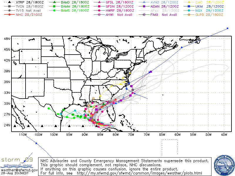
The majority of the meteorological and climatological models are showing northwestern Florida to be directly impacted by late next week with a Tropical Storm strength system. But there are a few that are showing the system heading off to Texas. Is this possible? Sure, but it likely won’t happen. If this system stays on a southern longitude course and slows down significantly it can potentially head westward and impact Texas or Mexico. However, this storm is moving relatively fast and turning on a more northern route. The higher up this system goes (higher longitudes) then the more likely the system will be picked up by the prevailing westerly winds and thrown back into Florida. This is what we expect will happen.
At this point meteorologists and the National Hurricane Center are watching the system very closely and we are expecting to see this system become a tropical storm by morning. The Hurricane Hunters are traveling into the system today (Sunday, August 28, 2016) to determine if there are any Tropical Storm winds within the system. If they find these tropical storm forced winds (starting at 39 mph/63kmh) then the National Hurricane Center will label the system as a Tropical Storm and the system will receive the name Hermine or Ian (sort of like wondering if the baby will be born a boy or a girl). But why the debate on the name? In my last blog/forecast we were only focusing on this one system. Well, a lot has changed in three days. We now have another Tropical Depression in the Atlantic spinning towards the Carolinas. Everyone meet “Tropical Depression Eight”:
Unlike Tropical Depression Nine this depression seems to be more of a joke (no offense to the little storm). The National Hurricane Center has been watching this tiny area for a couple of days and have determined a low pressure area forming with thunderstorm activity rotating around it. But we should laugh at this for a moment. The low pressure is located to the right of this tiny small system, so really most (if not all of the moisture) is located to the west of the low pressure system. For the moment we can call this a dry storm. Very little precipitation. Although a tropical depression is already fairly weak in wind strength (below 39 mph) this system is so far a wind storm and less of a water storm (compared to Tropical Depression Nine). This will likely change by tomorrow as the sun rises and evaporation occurs creating more thunderstorms for the system. Because right now it looks very sad. So we are all hoping for some more thunderstorm activity to at least make it look a tropical system to show all of you. Similar to Tropical Depression Nine we are expecting that this system will become Tropical Storm strength by tomorrow. But unlike Tropical Storm Nine the Carolinas might be spared by a direct impact. Similar to other systems that have formed in this area of the past few weeks this system is expected to be picked up by the western end of the Bermuda High pressure system and carried away from land and back out to sea. Even if this system makes a direct impact it is not likely that it will be a strong tropical storm. This system is rapidly approaching land and therefore has less time to grow and strengthen. If it does impact land it should be a fairly small and weak tropical storm.
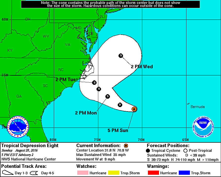
The Carolina will still experience some rainfall especially along the Outerbanks of North Carolina. At the moment this chance has a 40-50% chance of bringing tropical storm force winds to the Carolinas in the next 24-48 hours:
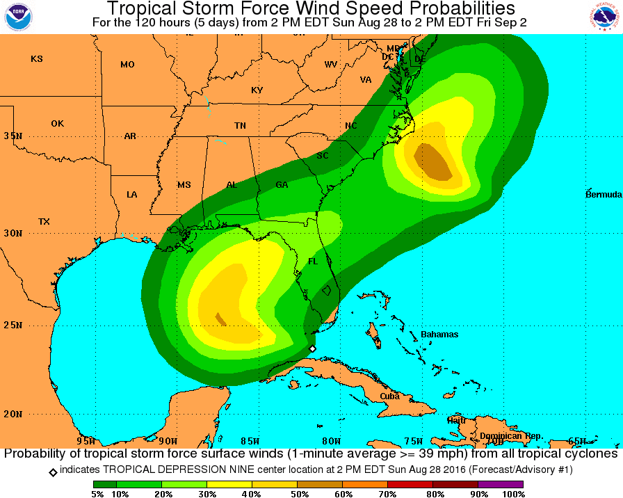
Finally, I have one more storm to discuss. Anyone remember Gaston? Well it is still surviving and the big news is that it is now the first major hurricane of the 2016 Atlantic Hurricane Season!
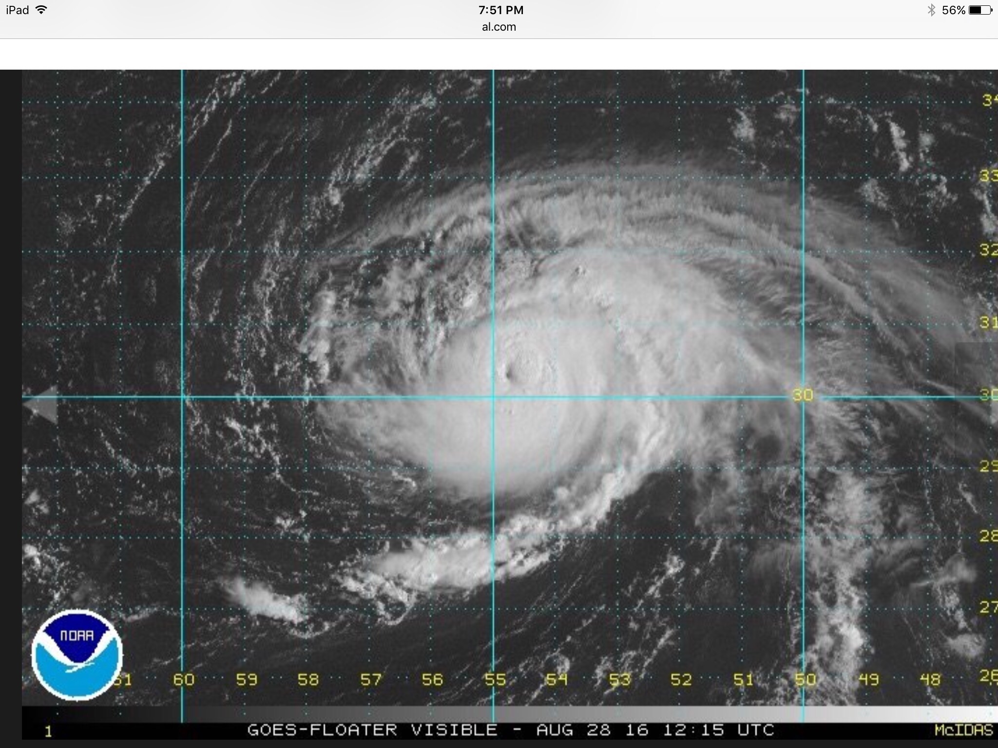
I personally had a feeling that this storm would become the first major hurricane of the season (see past blog below). This usually happens with Cape Verde systems since they have so much time over the warm waters of the tropical Atlantic to strengthen.
It is easily shown in the satellite image above that this system is a monster storm. Perfect circular shape and a well defined eye in the center. At the moment Gaston is expected to keep its Category 3 strength as it drifts off the east coast of Bermuda. But do not worry Bermuda! This storm is shifting its track very fast thanks to the Bermuda High.
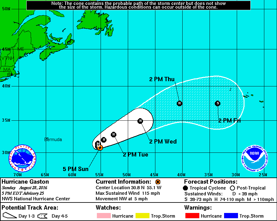
Gaston will enter an area with cooler sea surface temperatures and begin to loose its tropical characteristics pretty fast as it is carried back out to sea and towards the Azores Islands. If this storm survives, the Azores could receive some precipitation and possibly some tropical storm force winds by late this week. However, not to worry for both Bermuda and the Azores. This storm is moving far away from Bermuda and expected weaken rapidly before it approached the Azores. The only threat this system poses is to commercial shipping and possibly some large swells along the coasts of Bermuda.

So there you have it. Three potentially dangerous storms spinning in the Atlantic. We even have a small area off the east coast of Texas that meteorologists and I are keeping an eye on. At the moment this area has a 20-30% chance to develop over the next 24 to 48 hours. However, we have bigger problems to worry about. In particular Tropical Depression Eight and Nine heading towards the Carolinas and Florida, respectively. Gaston is heading out to sea and not bothering anyone. However, this is not the end! September is known as the peak season for hurricanes in the North Atlantic and already we are watching other areas this coming week for the possibility of more storms forming. Thanks to El Niño quickly dying and a La Niña beginning to form, our hurricane season will start to liven up considerably these next few months. In addition to the tropical depressions threatening the US the next main story will be off the west coast of Africa this week:
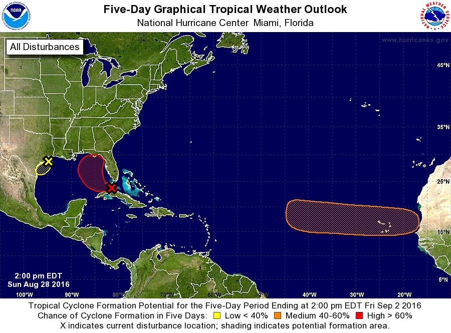
There is a between a 40 – 50% chance of tropical development around the Cape Verde region this week which could allow for more major hurricanes to form, just like Gaston.
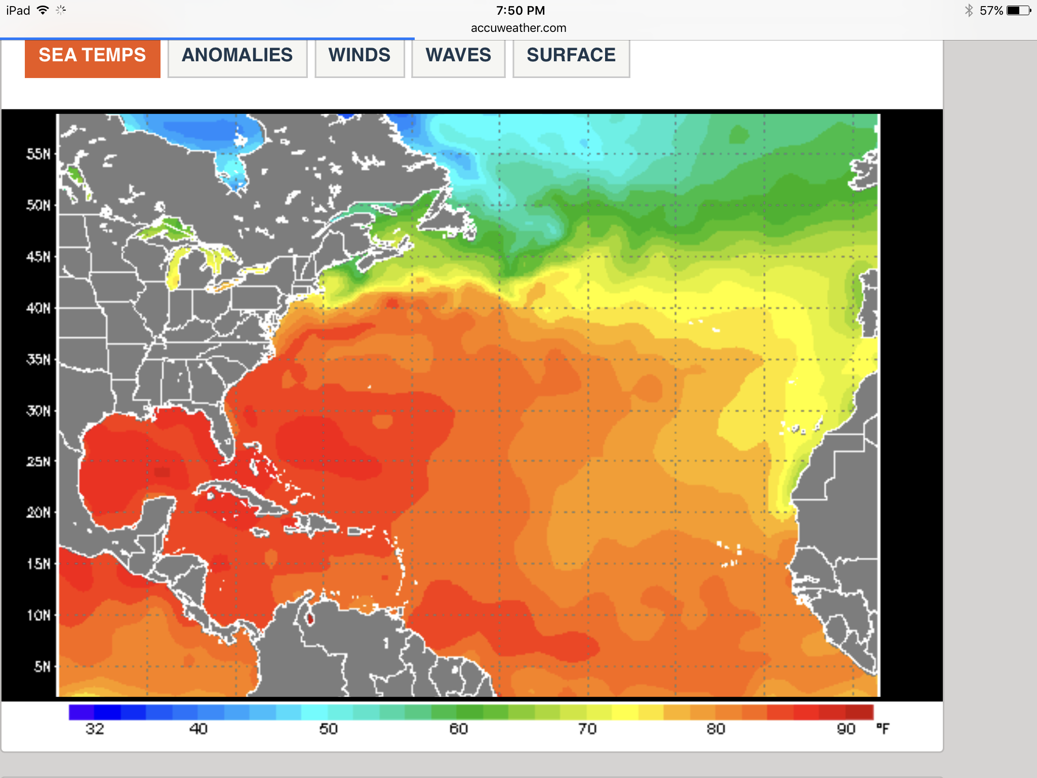
Also important to note are the sea surface temperatures across the whole Atlantic (red and orange = warm). The vast majority of the Atlantic is experiencing very warm temperatures which fuels these systems and causes them to strengthen.
This is still a few days off however and instead of focusing on this area the main story will be on the depressions for the next few days. By tomorrow (August 29, 2016) we should have two tropical storms with the names of “Hermine” and “Ian” formed and this will be the point when meteorological agencies, governments, and residents start to pay really close attention to the forecasts. Once more, this is the time to prepare. Do not wait until the last minute to prepare for an approaching storm. Another blog will be posted soon to discuss updated track information, strength, and preparation. Hurricane Season is reaching its peak in the North Atlantic, be ready now!
Gaston and Soon-To-Be Hermine. Which Poses a Greater Risk?
Updated August 25, 2016 @ 11:57 am EST
We all knew it was going to happen at some point and now it seems to have arrived: the peak of hurricane season. Typically the North Atlantic becomes active towards mid-Spetember (around the mark of September 10), but during the final weeks of August we usually start to see an increase in the amount of hurricane activity, especially around the Cape Verde Island region off the west coast of Africa. Well this is what we are experiencing now.
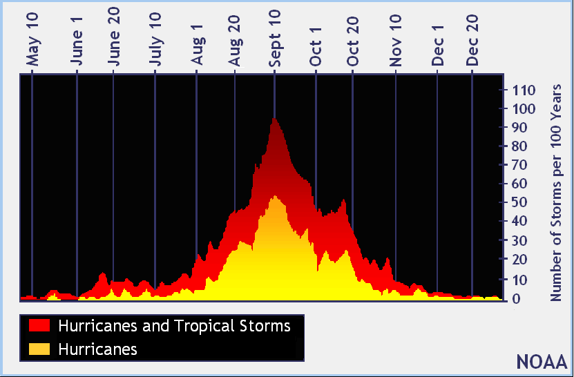
We just got rid of Tropical Storm Fiona as it moved towards Bermuda last week, and now we have Hurricane Gaston traveling across the Atlantic and another area of disturbance that we are keeping a very close eye on down by the Leeward Islands. So which one of these is making the media burst into “emergency mode” and therefore causing everyone to come cry to me asking if this is true? Well, it is the disturbance that hasn’t even formed into a tropical system yet. Before I get into this system, let’s discuss Gaston for a moment.
Gaston formed a couple days ago and models indicated days before that this system coming off the west coast of Africa would become a system. Gaston formed quickly off the Cape Verde Islands into a tropical storm and quickly grew into a hurricane. In the meteorological community it is fairly well known that systems forming close to the Cape Verde Islands usually grow to reach hurricane status, and in many cases these hurricanes have a better chance of becoming major hurricanes (Cat. 3 – 5) as they travel across the warm tropical waters of the Atlantic. The nice thing about hurricanes forming near the Cape Verde Islands is that depending on their latitude and longitude and proximity to the Cape Verde Islands we can forecast fairly well the path that a storm will typically take. <- everyone gasp
Typically if a tropical system forms to the far south of the Cape Verde Islands the storm will take a more westerly path and eventually make its way to the Caribbean Islands and possibly even the Gulf Of Mexico area. These are usually the storms that make us shake in our boots. If a tropical system forms in the similar longitude as the Cape Verde Islands it will travel westward possibly impacting Florida and Georgia but usually before this happens the storm will turn more northwest. The reason for this turn depends on the Bermuda High. This high pressure is constantly hanging out in the Atlantic and grows, shrinks and moves constantly. The more north of the Cape Verde Islands a storm forms the more likely it is to interact with this Bermuda High. Therefore, if a tropical system forms north of the Cape Verde Islands it will usually follow the Bermuda high in a clockwise direction which will make the storm travel first towards the west and then quickly move northward off the coast of New England and back out to sea. These are usually the best case scenarios. However, like everything else in life, there are always exceptions to the rule, most of which depend on the Bermuda High. So don’t follow this rule too closely.
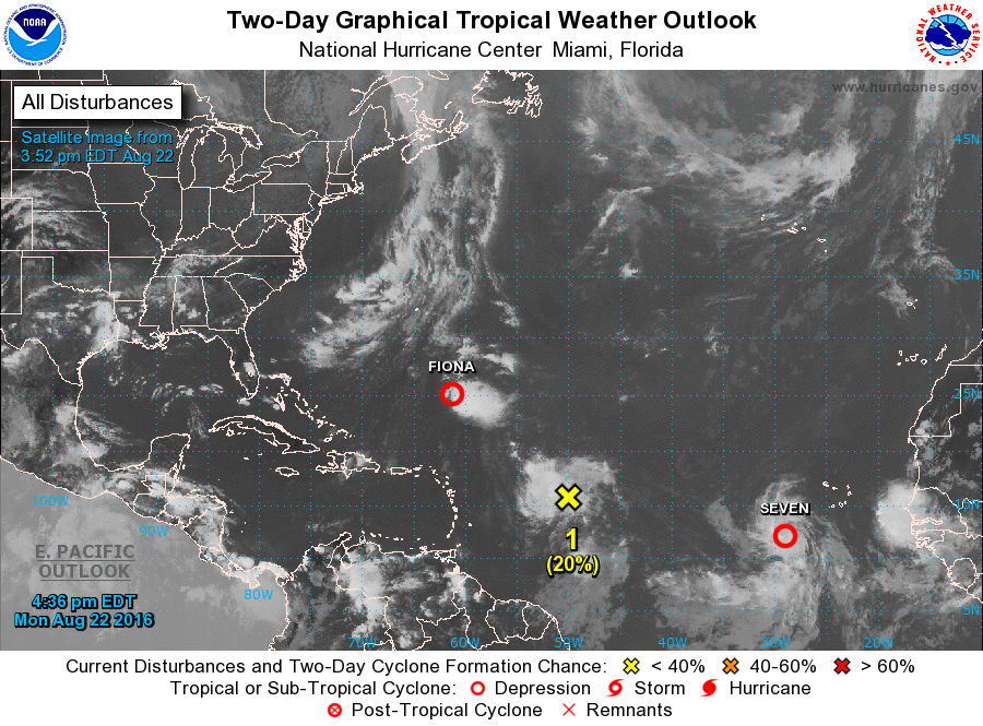
When Gaston was forming a few days ago it was fairly close in longitude to the Cape Verde Islands. Immediately many of us knew that because of the warm waters in this area that Gaston would likely grow into a hurricane very fast. We also knew that Gaston would likely travel a bit westward before turning to a more northerly direction as well, due to the Bermuda High being closer to Africa and Europe at the moment (note in the image above the large area with very few cloud formations just to the north of Gaston is the Bermuda High). This is what we have been seeing the past couple of days. Immediately after moving away from the Cape Verde Islands Gaston was picked up by the clockwise direction of the Bermuda High and taken on a more north-northwesterly path.

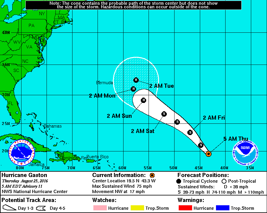
Gaston is not in a favorable area at the moment and is expected to weaken slightly back to a tropical storm for the next few days. However, it is likely that this system will regain some energy and evolve once more into a hurricane. But, before it can impact any land area Gaston will eventually turn directly north once it reaches the western most side of the Bermuda High. For the moment the island of Bermuda should be spared but they should expect some large swells and some rain from the outer bands by early next week.
So now let’s get to the storm that everyone is biting their nails over: Invest 99L… Yea, it doesn’t even have the name Hermine yet.
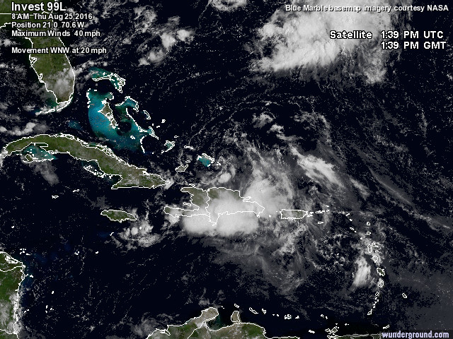
Everyone say hi to this messy area of thunderstorms. Many would probably think that there is nothing there and asking why meteorologists are so concerned about this area. It all has to do with the movement of these thunderstorms. Typical thunderstorm usually move in one direction. Over the continental United States they usually travel in a west to east direction and in a single line. The reason we are looking closely at this disturbance is that we are seeing the thunderstorms starting to rotate in a counterclockwise formation, indicating that a low pressure center is forming. This is the major warning sign that tropical development is taking place, when rotation occurs. At the moment most of the thunderstorm activity is secluded to the south and east side of the storm but this will soon change and it has a lot to do with the area this disturbance is in.
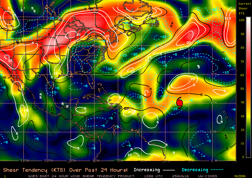
Due to a patch of fairly strong wind shear just north of the disturbance (high winds shear values are red and white in color above), the thunderstorms are instead moved to the south to keep the storm “alive”. However, as this system continues on west-northwest path it will move away from this small patch of wind shear and enter into an area with not only minimal wind shear, but very warm waters. Bad for us, good for the storm. At this point we will see the system undergo a rapid intensification process and likely receive the name “Hermine” as a reward for reaching tropical storm status. This is the point when all eyes turn towards the storm. Due to it’s current path we are now concerned that a US landfall is very likely. The important question remains though: how strong will it be? Like most hurricane models everyone is arguing the strength of this particular storm and it gets really bad when we have completely opposite forecasts:
The first model is the European, the second the American. Completely different right? One pretty much shows an “end of the world” scenario (European) the other shows a couple thunderstorms (American). So what is it going to be? Answer: we don’t know yet! <- typical response, sorry.
Right now the main concern is whether this system can evolve and survive the next few days because we have one last hope to keep this storm as weak as possible: the Caribbean Islands.
The only factor that is hindering development currently (besides the tiny patch of wind shear to the north) are the islands of Puerto Rico and the Dominican directly below the system. Hurricanes do not like land. It cuts the hurricane off from its source of energy which is the ocean. Puerto Rico and especially the Dominican are also mountainous which helps break down a tropical system further.
If some of you recal we had a similar threat last year with Tropical Storm Erika which traveled a similar route at about the same time as this disturbance. Check out the Erika (2015) blog here. Erika made the USA, especially Florida go over-the-top with broadcasts and state of emergencies and then a couple days later it just dissipated having never come close to Florida. It was sad and embarrassing to say the least.
Well, we are having a similar situation right now. Florida is on high alert and I can only pray that they wait a little while longer to sound the alarm. Right now this disturbance is busy trying to survive over the Caribbean Islands. These mountainous islands could help weaken the system and allow for this disturbance to only be a minor tropical storm if it hits land and not a major hurricane (as the European model is predicting). For the moment the National Hurricane Center is calling for a 50% chance of tropical development over the next 24 hours, and closer to a 70 – 80% chance over the next 48 hours. At the moment they are pretty much convinced this disturbance will grow into a tropical storm and receive the name Hermine very shortly.
One thing is certain. All models so far agree on the track of this system but where we all differ is the strength (usually this is the way it goes). Models are showing Florida as an area that should be on high alert (not state of emergency alert yet).
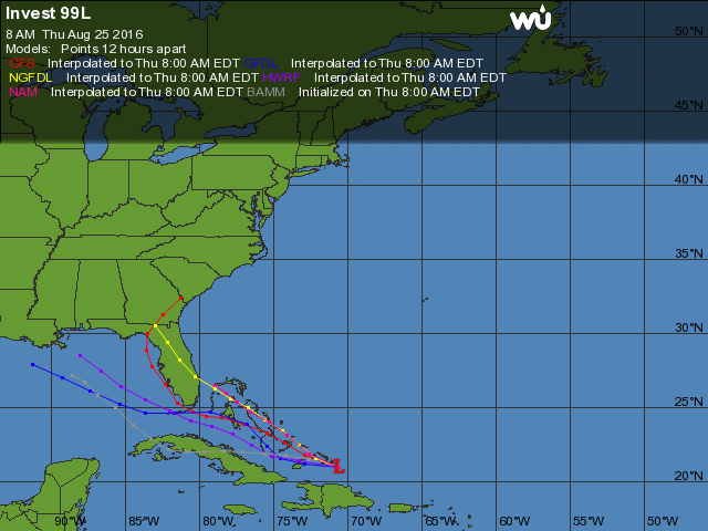
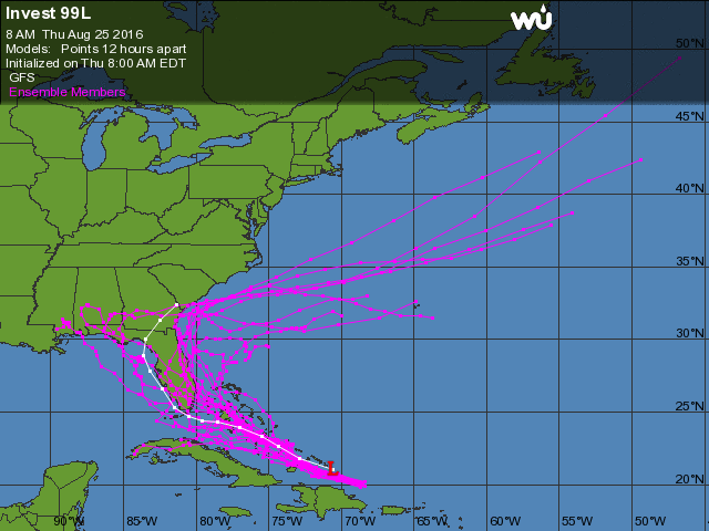
More than likely this system will bring most of the heavy rains to the west side of Florida as the system travels into the Gulf of Mexico region. Once more we cannot say anything about the strength of the system yet. I for one will not say it will be a major hurricane or a weak tropical storm until this system passes the islands of the Caribbean. An additional blog will be posted in the next 24-48 hours to discuss this system and the strength it will possibly reach. Until then we can watch and see if this system pushes past the islands and survives as it reaches an area of warm waters and low wind shear.
Is Earl Finally Coming Out to Play?
Updated August 2, 2016 @ 11:52 am EST
After a very active start to the Atlantic Hurricane Season all of a sudden everything goes dead quiet for over a month. This quiet period had a lot to do with Saharan dust coming off the west coast of Africa and traveling clear across the Atlantic Ocean to North America. Now this Saharan dust may have given North Americans beautiful sunsets, but it was literally killing off any tropical development in the Atlantic. Hurricanes act a lot like humans with the following example: when the wind picks up and dust is blown into our face we squint, we cough, we sneeze, etc. Hurricanes are the same way. Tropical development cannot take place in an area where dust is hanging in the atmosphere. Anything that tries to form is immediately choked by the fine particles hanging out in the atmosphere. So thanks to a dusty July we did not see much hurricane activity. However, now things are starting to heat up in the Atlantic. The dust has settled and we are nearing the peak of hurricane season (September 10). Sea surface temperatures are starting to warm up and wind shear levels are at a minimum across the tropical Atlantic, perfect time for tropical development. For the past few days meteorologists have been keeping an eye on a tropical disturbance in the Caribbean which has been bringing significant amounts of rain to the islands. The National Hurricane Center is certain that this disturbance will turn into Tropical Storm Earl in the next few hours.
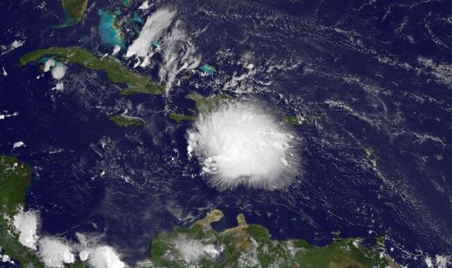
This system is already looking very organized and is undergoing rapid intensification. Notice how in the bottom image all of the solid white (high top thunderstorms) are being clustered close together. This is a sign of a very well organized system with almost no wind shear tearing this bundle of thunderstorms apart. In addition the warm waters in the Carribean are feeding this system and allowing it to become stronger and focus more on becoming a tropical storm by beginning to rotate around a low pressure area (AKA the eye).
Now we are fairly certain that this storm will continue to evolve and become Tropical Storm Earl very shortly. The reason we are so sure is because of the wind shear values in this area:
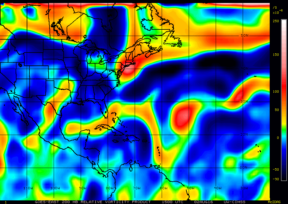
Now you may think of this as a “psychedelic” map but this figure above shows wind shear values at 200 mb (so way high up in the atmosphere). Going through different my heights in the atmosphere you can determine where the strongest winds are and if there is any chance a hurricane could be sheared apart by powerful winds in the different layers of the atmosphere (850 mb is wind speeds close to the surface – 200 mb is wind speeds high up in the Thermosphere). Going through and checking each my layer revealed that this disturbance is in the best possible place for development – the blue areas (this disturbance is currently located just to the south of the Dominican). Blue areas are very little wind shear, good for a hurricane, bad for anyone in the pathway.
These low wind shear values will continue for the next few days and help this system strengthen as it makes its way westward and possibly striking the Yucatan Peninsula.
Already six deaths and twelve injuries have been confirmed in the Dominican Republic thanks to this system. Officials in Jamaica and the Cayman Islands are warning residents to be prepared for heavy rains and strong winds as a tropical system slowly moves away further towards the west. killed at least six people in the Dominican Republic moves further west.
The Yucatan Peninsula is now preparing for the possibility of a tropical storm hitting the region starting tomorrow.
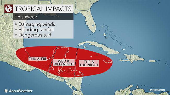
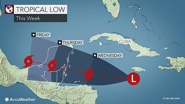
The system is expected to impact this area as a tropical storm and continue to maintain its strength as it impacts land and exits into the Gulf of Mexico. If “Earl” survives the crossing over the Yucatan it will very likely be a weak tropical storm as it crosses the short distance over the Gulf of Mexico waters in southern Mexico.
For now, tropical storm warnings will be posted shortly across the Yucatan Peninsula as this deadly storm churns closer to shore. Watch out everyone, the tropics are finally coming alive and Earl is coming out to play!
Tropical Depression 4 Forms, Likely to Recieve the Name “Danielle”
Updated June 19, 2016 @ 8:08 pm EST
We can all be in agreement: Hurricane Season is off to a busy start this year. We can mostly thank the rapid weakening of the El Niño over in the Pacific for this sudden increase. The question is, will it last into the more active hurricane months (August and September)?
Pin the meantime we have Tropical Depression 4 spinning in the Bay of Campeche, located in the south west Gulf of Mexico.

Meteorologists have been keeping a close eye on this area of disturbance for the past few days. When thunderstorms started to collect down off the coast of the Yucatan Peninsula a few days ago meteorology models were already fairly certain that this system would hold together and gather strength to evolve into a tropical system.
Tropical Depression 4 is expected to grow into a weak Tropical Storm overnight tonight as it slowly approaches the coast of Mexico. Currently, the Tropical Depression has maximum sustained winds of 35 miles per hour and is moving westward at 8 miles per hour, from the 8:00pm EDT advisory. This slow speed will allow this system to evolve into a Tropical Storm and be given the name “Danielle”.
Looking at the sea surface temperatures provided by NOAA in this area from June 18 at 8:43 pm this disturbance is in prime water temperatures for growing into a stronger system. Sea surface temperatures are hovering around 29-30 degrees Celcius (tropical development needs water temperatures of at least 26.5 celcius).
Finally, looking at the wind sheer values in this area: currently we are having slight wind shear in this area, however, these winds are not strong enough to disrupt the formation of a tropical system:
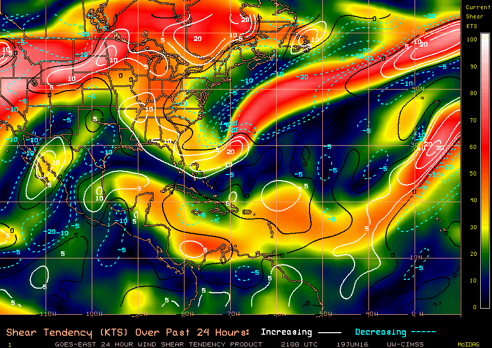
(Courtesy of the Louisianna Hurricane Center)
Current wind shear values are ranging between 20-30 kts (green and yellow depicted on the chart above). The crucial point comes tonight, when these winds push more to the south-southeast. Allowing for little to no wind shear to move into this area of the development for the next few days:
(Courtesy of the Louisianna Hurricane Center)
Tropical storm warnings have been issued for Laguna Verde to Rio Panuco in Mexico. Residents are being warned for the potential of flash floods.
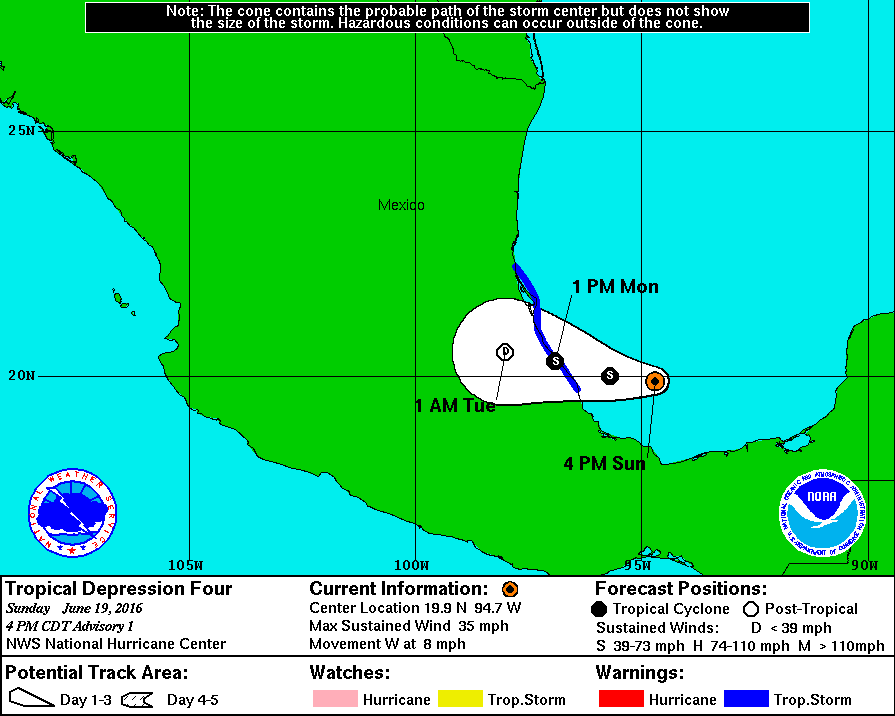
Tropical Depression 4/Tropical Storm Danielle will impact this area Monday early Monday afternoon but it won’t last long. Thanks to Mexico’s Sierra Madre Oriental mountain range this storm will dissipate fairly fast and will likely dissipate overnight Monday.
Colin Will be Impacting Florida Overnight Monday as a Tropical Storm
Updated June 6, 2016 @ 3:29 PM EST
First off, we get to celebrate a record that has been broken: Tropical Storm Colin has become the earliest third tropical storm to form on record in the Atlantic basin (everyone cheer).
It has been an unusual start to the hurricane season this year. Hurricane Alex was a strange storm which formed super early back in January. Bonnie then formed about a week before the official start of hurricane season. Now we have Colin. So far it is turning out to be an active start to hurricane season. Could a weakening El Niño have anything to do with this increase? Perhaps. It could be that we see an active start to this year’s hurricane season followed by a decrease in activity during the peak (Spetember/October). However, we could also see this season become more active as the months pass by.
Continuing with Tropical Storm Colin:
The Hurricane Hunter completed their investigation Sunday afternoon (June 5, 2016) and found tropical storm forced winds within the system. Based on this information the tropical system was given the name Colin yesterday and upgraded to tropical storm status. Colin has been picking up speed and is on a one-way course to hit the northwest coast of Florida overnight tonight and continue its impacts until tomorrow afternoon.
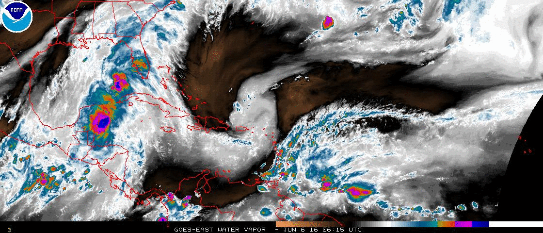
Florida is already under a state of emergency with the main threat being heavy rain. Winds are expected to be around 50 mph, making this a solid tropical storm system as it impacts land (relating to the Saffir-Simpson Scale). Colin is a fairly large system and most of its moisture is secluded to the eastern part of the storm. This is mostly due to the high levels of wind shear located west of the storm over by Texas and Louisianna.
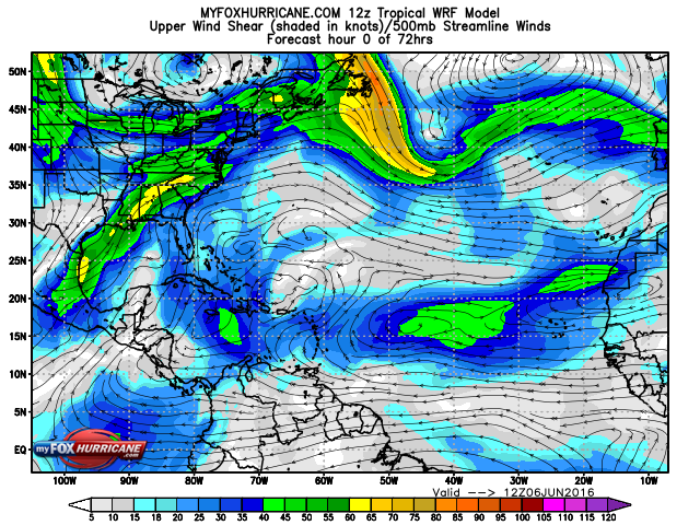
Higher wind shears are depicted in yellow and green.
Due to the higher wind levels to the west it is contributing to all of the moisture in Colin to be pushed eastwards, right into the state of Florida. Florida, especially the west coast has already been feeling the impact of Colin since yesterday morning with the outer bands of Colin brushing the coast lines. Today central and northern Florida will experience heavier rain bands and even the threat of some isolated tornadoes.
Most of these tornadoes will be hiding in the stronger outer bands as they move across Florida throughout the day today. 1st Lt. Kelsie Carpenter, 53rd Weather Recon even took a photo of a waterspout during their Hurricane Hunter mission yesterday:
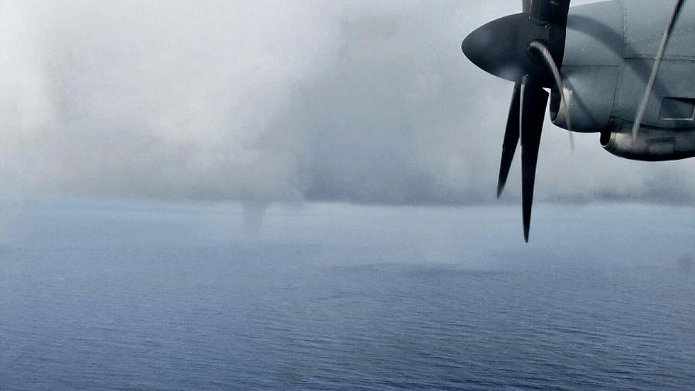
Residents along the Panhandle of Florida are preparing by filling sandbags and stocking up on food and water. Forecasts have changed slightly since yesterday with the “cone of uncertainty” moving slightly northward, placing the Pandle of Florida in the direct path of Colin, with southeastern Georgia being placed on alert once Colin moves through Florida.
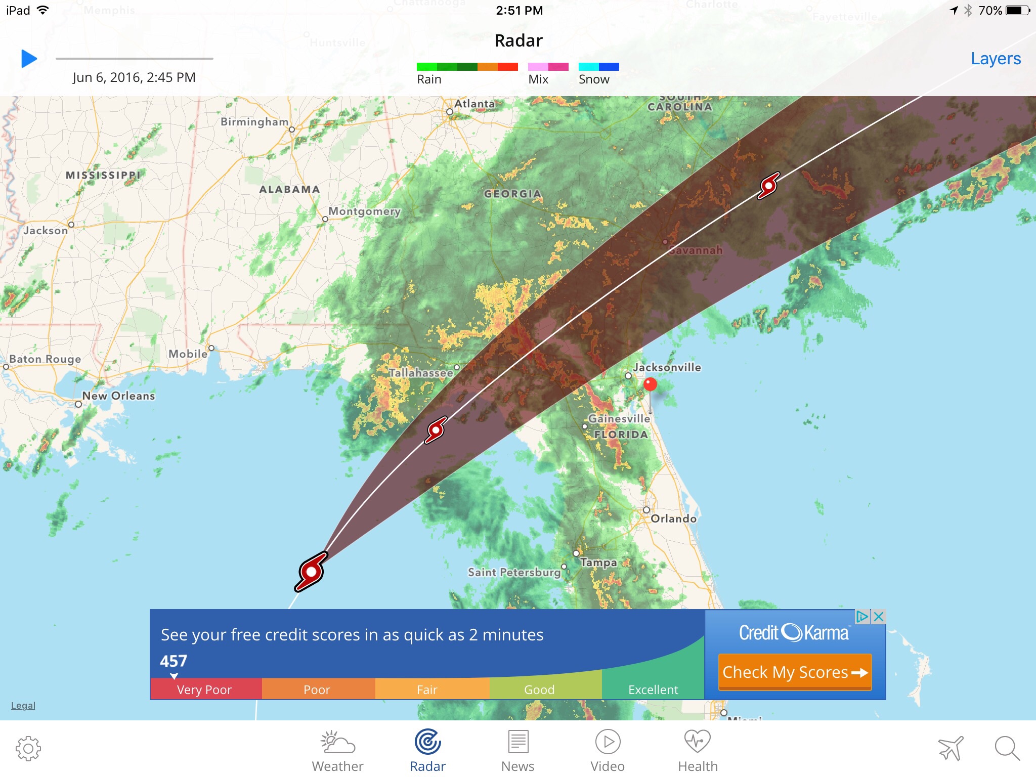
Colin is expected to hold together as it passes through Florida and Georgia and exit back out into Atlantic as a Tropical Storm. Due to Colin’s fast speed (about 16 mph moving NNE), the system will only bring rain to Florida for Monday and Tuesday morning.
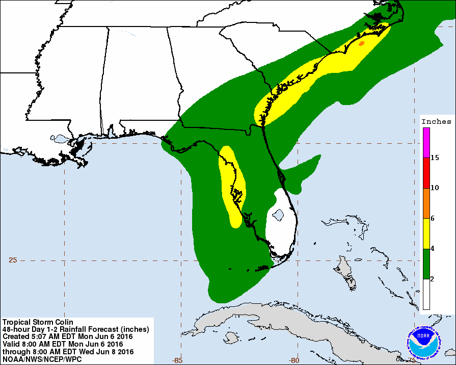
4-5 inches of rain is expected along the central western coast of Florida with similar amounts expected along the Carolinas and Georgia as Colin moves out to sea in the next 36-48 hours.
Colin is mostly a rain storm, and this is good for many parts of Florida and Georgia which are suffering some minor drought problems. The main concern tonight and tomorrow will be heavy rains which could overflow some lakes and streams across Florida and the threat of some overnight isolated tornadoes. Keep your NOAA weather radio handy for the next 24 hours and listen for any warnings your local weather agency issues. If you are in a low lying area that is prone to flooding you may want to consider evacuating to higher ground. Avoid swimming in the ocean and even streams for the next 2 days due to the threat of rip tides and strong currents from Colin. Bring your pets in and keep them calm and dry until the storm passes. Animals can sense large storms and danger and you do not want them to get spooked and end up running away. Make them feel safe and bring them in for the day/night.
Colin is moving swiftly and is expected to leave Florida and Georgia by early afternoon tomorrow (June 7, 2016). Colin will exit back out to sea and quickly make its way northeast towards Europe, most likely transitioning into a large extra tropical storm off the coast of Nova Scotia by Wednesday.
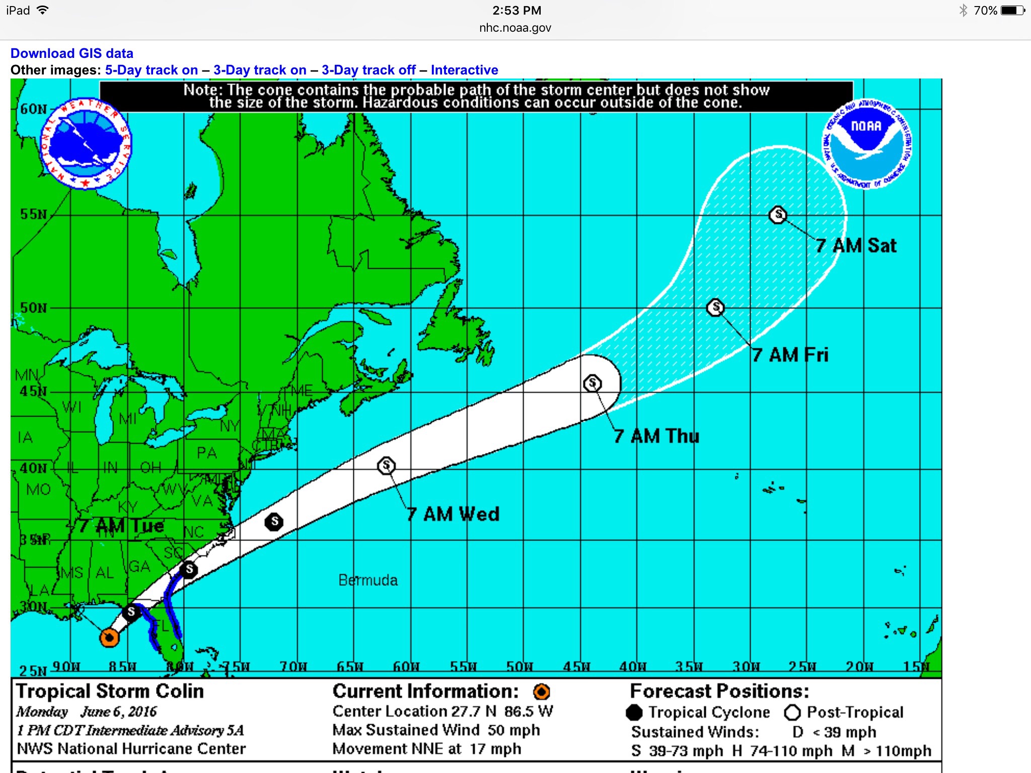
Lastely, I will post some warnings that were issued for my area regarding Colin. Always fun to get these advisories with your cell phone “dinging” every few minutes warning you of the storm 🙂
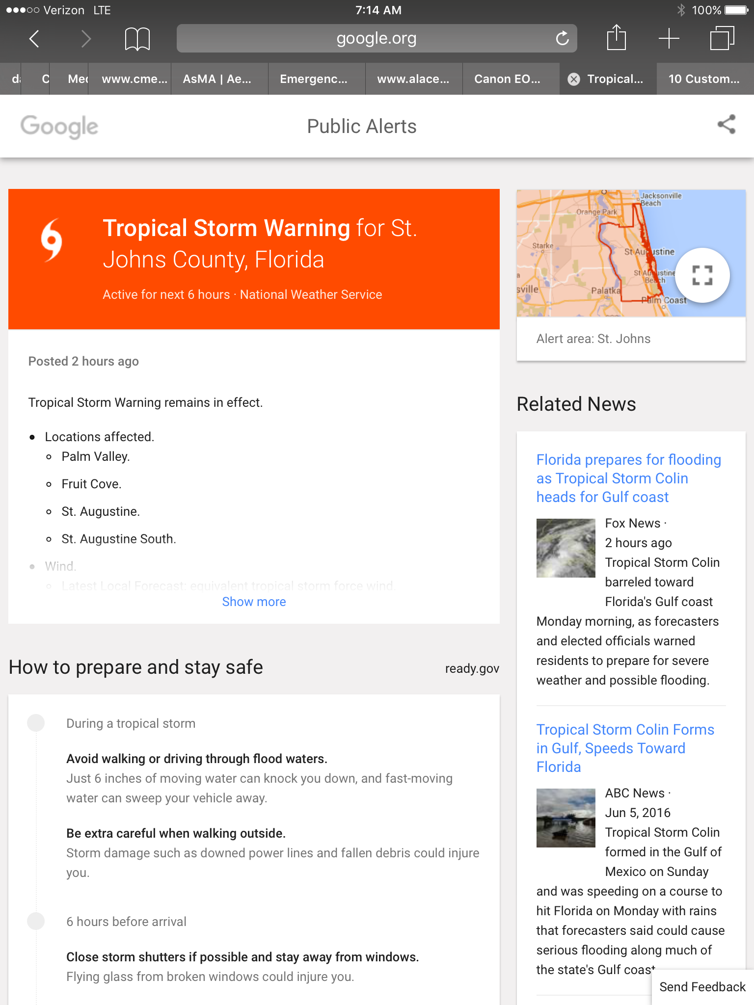

Florida is under a state of emergency and under high alert as Colin approaches the coast. Be smart and stay out of the ocean and keep your weather radio handy in case a tornado is approaching. Stay dry and safe everyone 🙂
Colin Will Soon be Here and Florida is Already Under a Tropical Storm Warning
Updated June 5, 2016 @ 1:39 pm EST
Hurricane Season is officially here and we have been having an active couple of weeks so far. Bonnie formed of the east Florida coast during the last week in May and hung around the Carolinas bringing heavy rain along the coast before moving back out to sea. Now we have another system to look out for. The National Weather Service has upgraded a disturbance in the Gulf of Mexico to “Tropical Depression 3”.
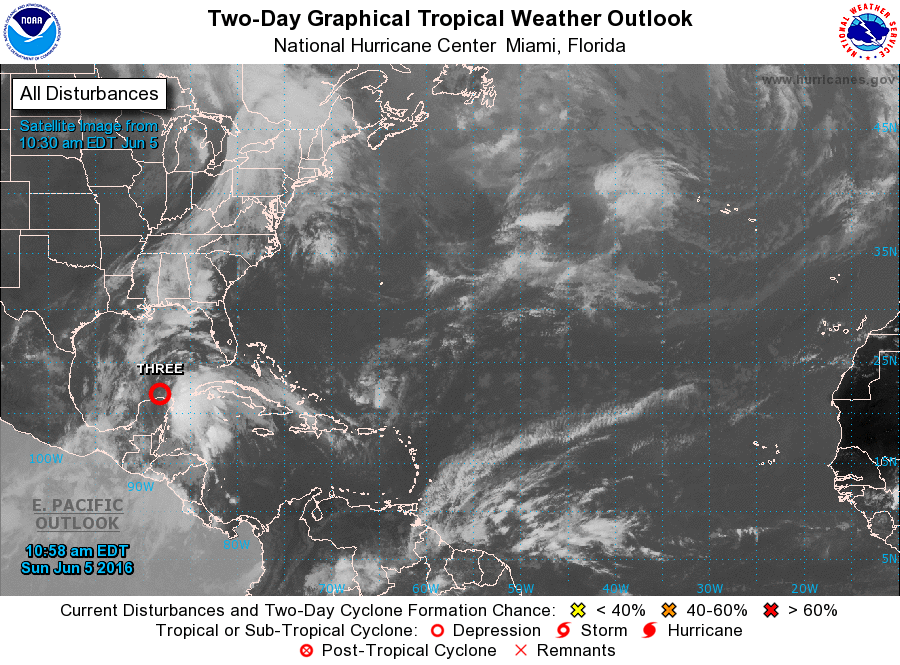
This disturbance is currently hanging out right off the Yucatan Peninsula in Mexico and is expected to move NNE for the next couple of days. The bad news is that meteorologists are certain that this system will intensify in the next few hours to become Tropical Storm Colin. The reason why we are so sure that this system will intensify is due to the environment it is currently in.
During the month of June storms have a higher chance to form in the Gulf of Mexico compared to the Atlantic Ocean. This is because the Gulf of Mexico can be seen sort of like a small lagoon. A small body of water will heat up much faster compared to a larger one. The Atlantic Ocean takes a longer time to heat up compared to the Gulf of Mexico. At the moment the Gulf of Mexico is warm and prime for storm development. Here are the current sea surface temperature readings for June 5, 2016 from NOAA:
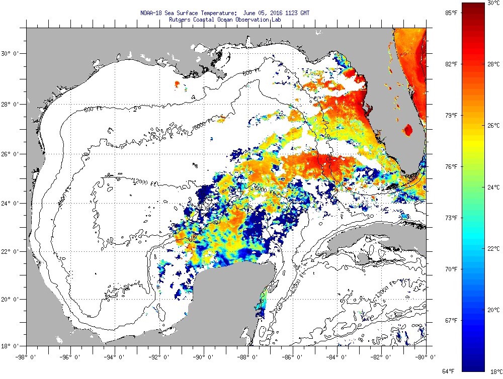
Red areas are warm and helpful to the development of tropical systems. A disturbance needs to have a temperature of around 26.5 – 27 degrees Celsius in order to form typically. Although there are some cooler waters surrounding the system currently (which is being caused by the system itself – mixing of waters) Tropical Depression 3 will be heading NNE into prime water temperatures of close to 28 degrees Celcius. This will benefit the storm and transform it into a powerful Tropical Storm.
Finally, the wind shear values:
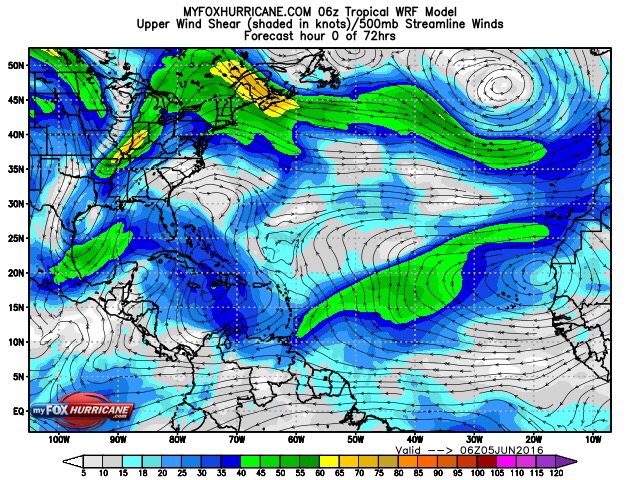
Wind shear is realtivily light for the eastern Gulf of Mexico with the majority of the high wind shear secluded to the western half of the Gulf. With very little wind shear in this area where Tropical Depression 3 is currently spinning there is a greater chance of the depression evolving into a tropical storm in the next 12 – 24 hours. Possibly sooner. Hurricane Hunters are scheduled to fly into the system today and make the final call on if this system has reached the tropical storm threshold (39 mph minimum winds).
However, this storm is heading right towards Florida and forecasts have been excellent the past few days with very few deviations in the models. Forecasters have been keeping an eye on this area for the past few days and knew that tropical activity would increase and bring rain to the north-western part of the Sunshine State.

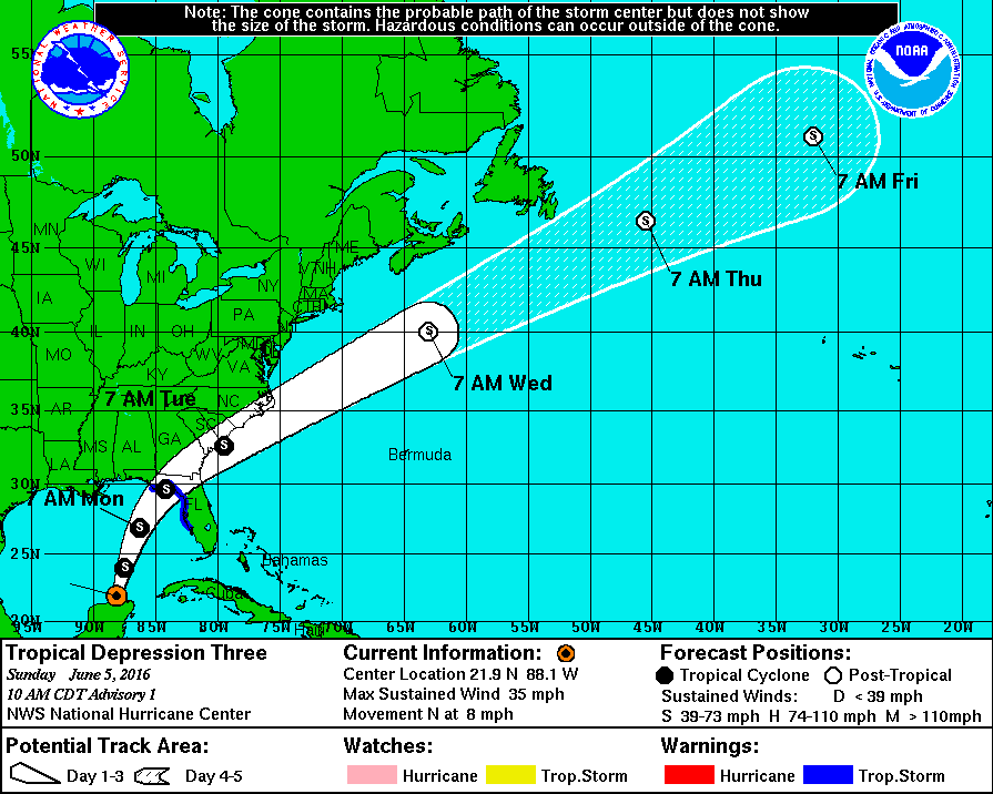
Impact is currently set for Monday afternoon and Tropical Storm Warnings are currently up for the northern part of Florida. A strong Tropical Storm with winds as high as 73 mph is expected. There is a possibility of this system reaching Category 1 status. However, due to the small size of the Gulf of Mexico this will be difficult for a storm. When a storm is impacting land (even the outer bands), it disrupts the wind motion and the energy absorption gained from the warm ocean. More than likely this system will stay as a tropical storm especially since the size of the depression is fairly large at the moment. Smaller storms in a smaller ocean have a better chance of gaining energy since their out ands don’t reach land <- little tip.
The big news this year is Florida’s “Hurricane Amnesia”. The last time Florida experiences a Hurricane was back in October of 2005 when powerful Category 3 Hurricane Wilma came through. Therefore, it has been over 10 years since Florida has experienced a hurricane (tropical storms don’t count). This is fairly uncommon and dangerous. Florida’s population has increased substantially since this time and many have forgotten how dangerous a hurricane can be. Florida’s luck will run out, sooner than later. When it does it will most likely be disaster ours on a number of levels. People need to be reminded that hurricanes are normal and part of “Florida’s life”. By living in this state you should understand the risks surrounding it, and hurricanes are a major part of it. So, now we play the waiting game. Florida will get hit by a Hurricance, that much is obvious. However, will it be this year?
The good news is that this system will bring some much needed rain to the west coast of Florida and help areas that are currently in a drought. I will post an update soon regarding the change in status once the Hurricane Hunters investigate the system further. The next time I report we could have Tropical Storm Colin!
Hurricane Season is Approaching and a weakening el Niño Could be Trouble
Updated March 26, 2016 at 10:31 pm EST
66 more days until the start of Atlantic Hurricane Season 2016! While others may dread the season, I personally can’t wait for the start of it. This year will be a little unique with regards to the weakening el Niño. NOAA has been keeping a close eye on the el Niño event off the west coast of South America and has determined that the sea surface temperatures have been decreasing steadily over the past few weeks as shown from the timeline below (darker reds are disappearing and fading):
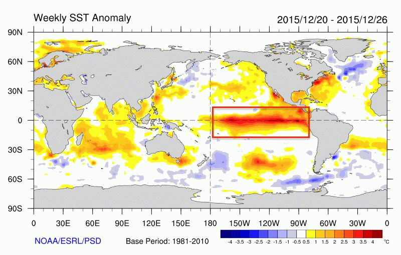
What this may turn into is a la Niña, which shifts the warmer waters closer to Asia and the waters off the coast of South America become cooler than normal. For more information on the dynamics of a la Niña event head on over to the Climate Blog.
So what does this mean for the 2016 Atlantic Hurricane season? In 2015 forecasters were able to determine very quickly that the hurricane season would be very quiet and below average. This was true. It was a very quiet and boring season with very little activity and only a few little scares (cough, Tropical Storm Erika, cough). We did receive one catastrophic storm: Hurricane Joaquin. Joaquin devastated the Caribbean Islands for days as the system nearly stalled right over the islands causing extensive damage, 34 deaths, and the sinking of the SS el Faro ship.
The reason for this inactive season was the el Niño event which caused a decrease in Atlantic sea surface temperatures and even contributed to higher wind shear values. This prevented few storms to evolve into hurricanes. While the Atlantic was quiet however, the Pacific was lively! Very lively. Several records were broken including the monstrous Hurricane Patricia which became the strongest hurricane (with regards to wind speed: 215 mph – 345km/h) in the eastern Pacific. Cyclone Winston also became the most devastating and most powerful hurricane to hit the small island nation of Fiji, an island that rarely sees a cyclone. Even the Indian Ocean received their fair share of hurricane formation, with two cyclones hitting Yemen (an area that has never received a hurricane in recorded history) mere days apart from one another. Both considered to be major cyclones (Cyclone Chapala – Category 4 and Cyclone Megh – Category 3). In conclusion, the Pacific and Indian Oceans were have a very busy time in 2015.
However, it appears that the pattern is now shifting and a la Niña event is breathing down our necks. This will shift everything. If a la Niña forms warm waters will emerge in the Atlantic giving way to an increased chance of hurricane development. The Pacific on the other hand will become cooler, surprising hurricane formation. In other words the Atlantic will become the hot spot for hurricane activity. Check out a simple diagram I made for your reference:
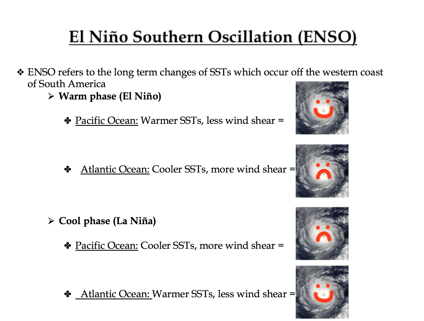 -> yes, hurricanes smile and frown like the rest of us
Now, how likely is this? At the moment, not very likely. True, a la Niña event is underway, but this type of event does not take place over night. The el Niño event is currently weakening and will continue to do so. However, this event will continue to deteriorate into the summer months (aka hurricane season). A la Niña event will not start to take shape until the Autumn time, where I expect we will get our first warnings. Therefore, hurricane season will be in a weakening el Niño state or even a la Nada (nothing/normal) state. Temperatures in the Atlantic Ocean will not be warm enough yet to have a “super hurricane season”, like the one the Pacific Ocean saw in 2015. However, I am expecting it to be more active than the Atlantic Hurricane Season of 2015. What does this mean? It is likely that we will see more hurricane formations with most being tropical storm status. I personally (100% Weather Goddess forecasting) am predicting about 3-4 major hurricanes (category 3 or higher). Now, if the la Niña event did form in time for hurricane season, I would then say we would have to worry about a highly active hurricane season. This does not appear to be happening. We might see an increase in storm formation in the Autumn season since this is the time I am expecting la Niña warnings to be blaring all around the world. This is normal though as hurricane formation picks up in September.
Weather Goddess Forecast for the Atlantic: In conclusion, the Atlantic won’t recieve a season like the Pacific Ocean had in 2015. The Atlantic will be more active compared to the 2015 Atlantic Hurricane Season. With a weakening el Niño, storms will have an easier time forming and evolving into hurricanes due to waters in the Atlantic slowly increasing in temperature. Therefore, the Atlantic could experience an increase in the frequency and the intensity of hurricanes this 2016 season.
Weather Goddess Forecast for the Pacific: As for the Pacific Ocean: the hurricane apocalypse season is gone. However, with the weakening el Niño still leaves behind some warm sea surface temperatures which some storms will use to their advantage while the warm waters last. Pacific Hurricane Season starts May 15 (Happy Birthday to the Weather Goddess), a little earlier than the Atlantic season. It will not be surprising to see a few storms form into hurricanes earlier in the season due to the lingering warm waters. However, with cooler waters replacing these warm waters hurricane formation will start to become suppressed closer to the Autumn season.
Looks like January is the New June
Updated January 14, 2016; 1:55 pm EST
Subtropical Storm Alex is now a full fledged Hurricane in the east Atlantic. It seems like this storm took advantage of the low wind shear values and the slightly warm ocean temperatures because overnight Alex developed an eye with strong thunderstorms rotating around the center of circulation: a typical trait of a tropical storm.
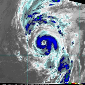
(Courtesy of NOAA)
Looking at the satellite image on the right you can clearly tell though that this is not a very circular storm (like a typical hurricane would have). It is fairly large and developing a tail to the north (a sign that a front is forming). The National Hurricane Center designated this as a hurricane because of two main reasons:
- An eye appeared with heavy thunderstorm activity rotating around the eye.
- winds exceed 74 mph (Category 1 status).
Although this storm still has tropical characteristics associated with it, it also has extratropical characteristics starting to form. The frontal area to the north is a major sign of this. This hurricane is already a mixture of warm (tropical) and cold (extratropical) air.
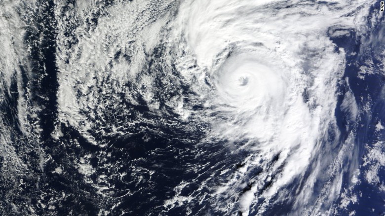
Although I do agree (looking at the image above) that towards the eye there is more tropical (warm) air which allows an eye to form and create a circular network of thunderstorms. So really the cold extratropical air is hanging out in the north part of the hurricane and will eventually work its way down toward the center of circulation. However, as to not confuse the public (and to make life more interesting) the National Hurricane Center is referring to Alex as a full blown hurricane (tropical storm) for now. This will probably change as the eye closes off and the thunderstorm activity pushes off and remains secluded to only one side of the circulation. I encourage you all to think of Alex as a hurricane though as it still maintains the winds speeds of a category 1. I am just sharing with you all of these little “nit-picky” facts for your enjoyment.
At 10 am EST Hurricane Alex had estimated winds of 85 mph which exceeded the Category 1 status of 74 mph (according to the Saffir-Simpson Scale). Alex is now a solid Category 1 hurricane and has made history. Alex is the the first named storm to form in the month of January since 1978 and the first hurricane for this month since 1938. So congrats to Alex.
The Azores Islands are under a hurricane warning and rain and gale force winds are expected to impact the islands Thursday and Friday as Alex moves over/close to them. 3 to 7 inches of rain is expected for the islands along with dangerous storm surge. At the moment Alex is 490 miles (790 km) south of the islands.
The track of Alex has changed very little over the past 24 hours:
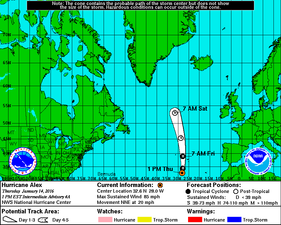
The Azores islands may avoid a direct hit as the storm is now moving further west, away from the islands. Alex could maintain it’s hurricane strength for another 24 hours but eventually it will be heading into a harsh atmospheric environment where the low atmospheric and sea surface temperatures will suck the energy right out of the storm. Wind shear values are high north of the Azores and this will weaken Alex considerably. However, for the moment the environment is treating Alex well and this allowed for convection to take place overnight and create heavy thunderstorms close to the center of the low pressure, thereby forming the “eye”.
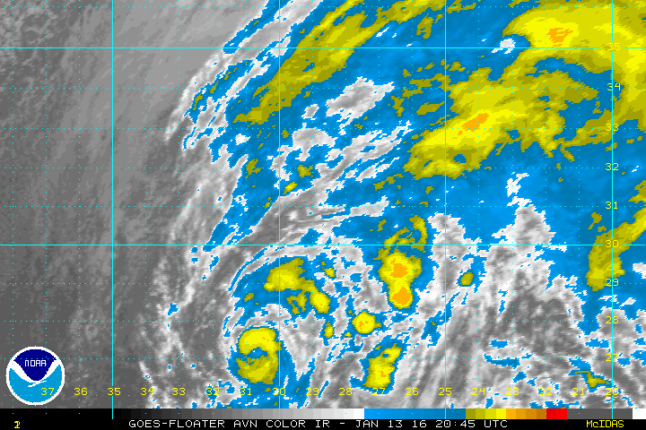
(Click picture for animation – provided by NOAA)
Alex is not expected to impact North America or Europe. However in the next 48 hours, as the storm weakens and transitions into a cold-core system, Greenland will feel some impacts mostly consisting of heavy rains and gail force winds.
Don’t we have another 6 months until Hurricane Season?
Updated January 13, 2016; 6:00 EST
Surprise surprise everyone! We have a very rare and unusual event this year. It is only the beginning of January and we already have our first named storm! Everyone meet the VERY early Alex:
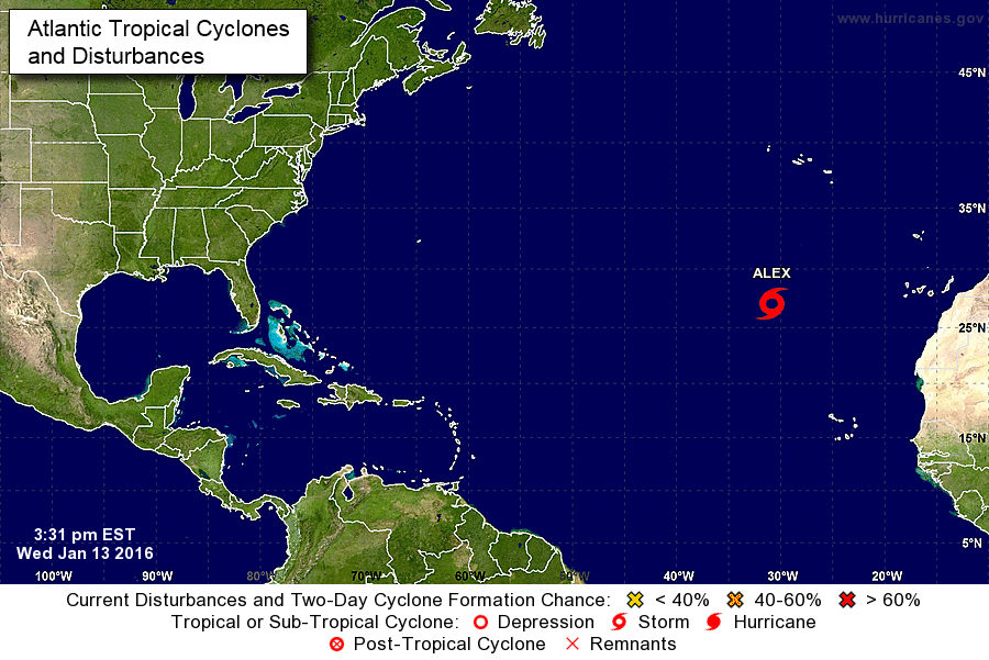
(Photo Courtesy of the National Hurricane Center)
Crazy right? Could this possibly be a sign of what is to come this year? I have mentioned this before in my 2015 blog but I was expecting 2016 to be very active, especially compared to 2015. This is because of the famous el Niño that continues to impact our winter. Typically after an el Niño a la Niña follows which switches the whole process. Instead of the Pacific Ocean being active with higher frequencies of hurricanes, the Atlantic gets more active. So far we are expecting this el Niño to lose energy and start switching to a la Niña in the next few months. However, why do we have Alex forming in the middle of winter? Seriously, I woke up to -15°C this morning. Let’s first take a look at sea surface temperatures:

(Photo Courtesy of Weather Underground)
Alex is not in a particularly warm area at the moment, the sea temperature in this area is currently hovering around 78°F. Typically for a tropical storm to form there needs to be a sea surface temperature of 79°F. 1 degree is not a big difference so it is possible for a storm to form. However, even with sea surface temperatures being warm we still have to look at the atmosphere and the wind sheer values. The main reason why tropical systems don’t form during the winter months is because upper level wind shear values are intense which tear the storm apart. As summer approaches the atmosphere settles down and wind shear becomes less. However, let’s look at the current wind shear levels in the Atlantic Basin:

(Photo Courtesy of CIMSS)
Upon first glance you see a lot of whites, reds and oranges. These symbolize very high wind shear values which prevent any type of tropical formation. However, take a look directly east… see that nice bluish-green blob? That tiny area is where Alex is located. That tiny area is keeping this storm alive.
Finally, we look at one more factor: air temperature. Let’s face it, this week has been freezing for all of us in North America. So how can the Atlantic give birth to Alex? The closest landmass to Alex are the Azores Islands. Currently the islands are experiencing a decent temperature of 13°C:
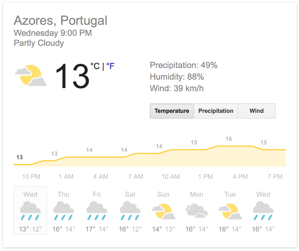
Not a great temperature for thunderstorm activity (basically what a hurricane is, a large cluster of thunderstorms). However, take a look at Thursday and Friday’s forecast. 16 and 17°C, respectively. That is impressive given the fact that the typical temperature for the islands during this time of the year is around 14°C.
However, it is possible for the islands to receive max temperatures up to 17°C for this time of the year, sometimes higher. As Alex slowly approaches the islands it is definitely the cause for the temperature to rise to 17°C. It may be a bit chilly on the islands today but thanks to the warm sea surface temperatures and the minimal wind shear, convection has taken place allowing for Alex to form.
So what do we have to worry about? Well, for all of us living in North America we have nothing to worry about. The dominant winds during this time of the year move systems that form from west to east. Due to the fact that Alex is on the other side of the Atlantic, he will stay on that side and travel northward for the next couple of days and weaken considerably.
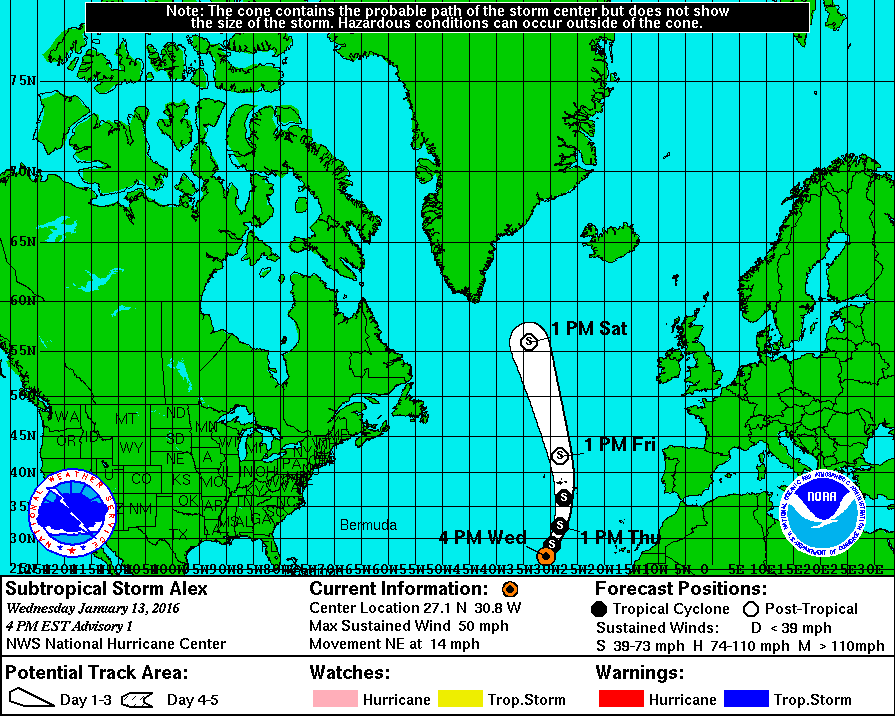
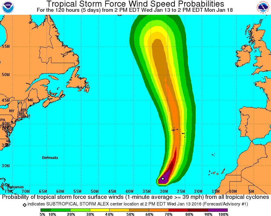
(Photos courtesy of NOAA)
Forecasts are taking the storm northward and turning slightly towards Greenland. At the moment Alex is moving very slow and is expected to maintain its subtropical storm status. The term “subtropical”is basically stating that the storm formed in a subtropical-latitude area and does not have the typical perfect tropical shape that typical hurricanes have in tropical latitudes. Subtropical storms are basically tropical storms just that they formed in subtropical latitudes (annoying right?).
Alex is likely to take advantage of the low wind shear area but this small area won’t last long and soon wind shear will return to the area which will tear the storm apart. As Alex progresses northward he will run into cooler ocean temperatures and this will inevitably be the death of the storm. The Azores Islands have been informed that there is a good chance that they will experience tropical storm force winds in the next 48 hours, with Friday being the day that Alex will pass over/close to the islands. During this time Alex will likely be undergoing extratropical transition and bring heavy rains to the islands.
Looking at the current satellite imagery of Alex it does not look healthy at all. In fact it looks disorganized.
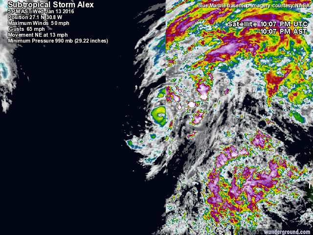
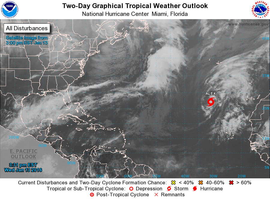
(Photos Courtesy of NOAA)
Most of the thunderstorm activity is away from the center and towards the north. However, the National Hurricane Center has been keeping a close watch on this storm for a few days. Due to the fact thunderstorms were increasing and beginning to spin around an area of low pressure they decided to call it a subtropical storm. However, once again this storm is not organized very well and will probably not become more organized. This is a good sign for the Azores as the storm may dissipate quickly. More than likely, Alex will transition into an extratropical system and bring a couple days of rain to the the islands before quickly pushing away.
Danger-wise, we do not have to worry about this system causing widespread damage and deaths. Yet, Alex does hold the record for being the earliest subtropical named storm of any hurricane season (in my opinion “subtropical” ruins a lot of the excitement). The good news about this storm is that I can start my 2016 Atlantic Hurricane Season blog early!
So in closing, should we take Alex as a warning for what is to come for the 2016 Hurricane Season? Many people might think this is a bad sign for the summer. Really we cannot say until hurricane season arrives. Sad but true but meteorologists cannot see into the future… just forecast a bit. I for one believe that 2016 will be active just from past statistical analyses on el Niño and la Niña years. For now enjoy watching Alex turn in the Atlantic and we will wait for Tropical Storm Bonnie to form next!